This item has been sold, but you can get on the Waitlist to be notified if another example becomes available, or purchase a digital scan.
1859 Gaston Wall Map of New Jersey
NewJersey-gaston-1859$1,250.00

Title
A New Map of the State of New Jersey.
1859 (dated) 46.5 x 27 in (118.11 x 68.58 cm) 1 : 253440
1859 (dated) 46.5 x 27 in (118.11 x 68.58 cm) 1 : 253440
Description
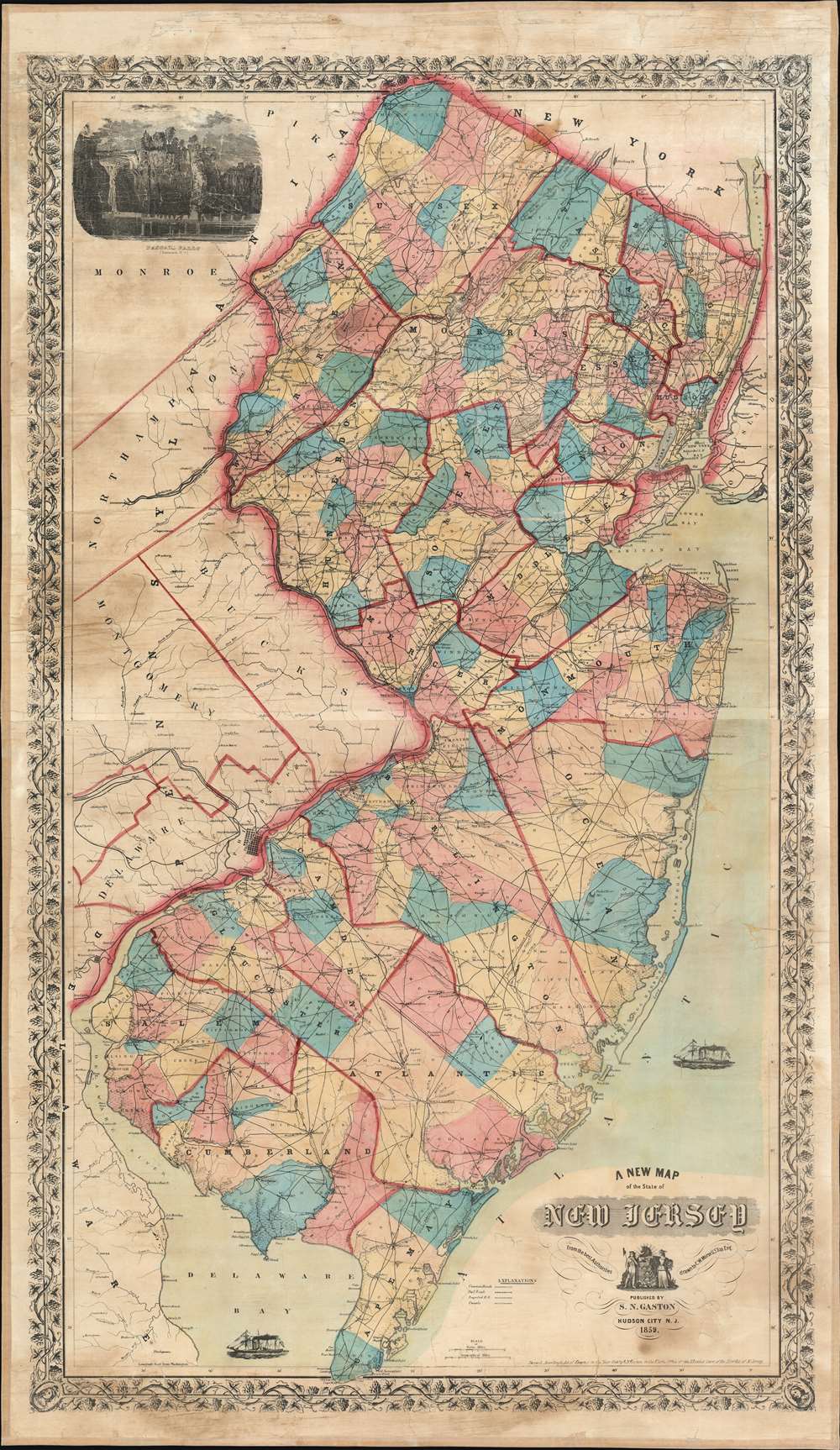
A previously uncatalogued and impressively detailed 1859 Samuel N. Gaston wall map of New Jersey. Covering the entirety of New Jersey along with parts of New York, Pennsylvania, and Delaware, Gaston's map fills an essential gap in New Jersey cartography between the Squire map of 1836 and the Kitchell map of 1860. Black lines representing the state's growing road and railroad network stand in stark contrast against this patchwork of brilliant color. Railroads, a relatively new phenomenon, cross the state in every direction, with the Camden and Atlantic Railroad, New Jersey Railroad, and New Jersey Central Railroad among them. The proposed New York and Norfolk Railroad stands as it is illustrated by a surprisingly straight line through a large portion of eastern New Jersey.
Wall Map of New Jersey
When compared with other large-format maps of New Jersey, Gaston's map holds its own. While not as comprehensive or detailed as Kitchell's 1860 work, changes in southern New Jersey, particularly with respect to roads, transportation networks, and other areas of development, are striking in contrast to earlier maps, such as the 1836 Bela S. Squire, Squire's Map of New Jersey. Despite its obvious advances, within a year, Gaston's map would become obsolete, eclipsed by Kitchell's seminal work. This fact also may explain the Gaston map's exceptional rarity.Publication History and Census
This map was drawn by Charles W. Morse and published by Samuel M. Gaston in 1859. This is the only known surviving example.Cartographer
Samuel N. Gaston (March 9, 1824 - June 21, 1863) was an American map and book publisher based in New York. During his career as a publisher, Gaston worked with several important cartographers, including A.J. Johnson and Charles W. Morse. Gaston enlisted in the Union Army on August 9, 1862, and was mustered into Company D, 20th Regiment, Connecticut Volunteer Infantry on September 8 as a corporal. Promoted to the rank of sergeant on January 18, 1863, Gaston was wounded at the Battle of Chancellorsville on May 3, 1863. His wounds proved to be fatal, and he died on June 21 of that year. He is buried in Middletown, Connecticut. Gaston married Rosalia Welton, and the couple had four children, one of whom died in 1861, and another that was born on July 17, 1863, less than a month after Samuel Gaston died. More by this mapmaker...
Condition
Very good. Full professional restoration with linen refreshed. Exhibits some staining to margin areas.
References
Not in Nova Caesarea by John Delaney. Not cataloged in OCLC.