This item has been sold, but you can get on the Waitlist to be notified if another example becomes available, or purchase a digital scan.
1945 Army Information Branch Newsmap Overseas Edition Map of East Asia
NewsmapVolIVNo12FOverseas-army-1945$175.00


Title
Newsmap for the Armed Forces Overseas Edition. V-E Day + 9 Weeks-186th Week of U.S. Participation in the War.
1945 (dated) 17 x 23 in (43.18 x 58.42 cm)
1945 (dated) 17 x 23 in (43.18 x 58.42 cm)
Description
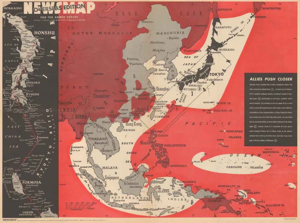
This is a visually striking 1945 'Army Information Branch Newsmap' map of East Asia. The map highlights the pre-atomic firebombing of the Japanese Home Islands - a largely forgotten napalm campaign that destroyed 6 major Japanese cities and multiple smaller cities.
A Closer Look
Coverage embraces from western China to the Marshall Islands and from the Soviet Union to New Guinea and the Solomon Islands. Allied Territory is shaded red and highlights the constant pressure being put on the Japanese. The Japanese Home Islands, colored black, are at the center of a shrinking sphere. A textbox situated along the right highlights actions by the Allies as they 'push closer' to Tokyo. Some are territorial moves, such as the invasion of Kume, the Australian landing at Balikpapan on Borneo, and offensives by Chiang Kai-shek's Chinese nationalists in French Indochina and along the Chinese coast. The last is the firebombing of four Japanese cities by American B-29 Superfortresses.The Firebombing of Japan
While history remembers atomic bombings of Hiroshima and Nagasaki, popular memory has largely forgotten multiple earlier devastating bombings by the U.S. Army Air Forces well before Hiroshima and Nagasaki. On the night of March 9, 1945, the American napalm firebombing campaign against Japan began. More than 270 B-29s rained fire on the Japanese capital, dropping over 1,600 tons of bombs. The raid destroyed sixteen square miles of downtown Tokyo, killed an estimated 100,000 civilians, and left over one million people homeless. After a month of strategic bombings in support of the invasion of Okinawa, the firebombing campaign against Japan's other largest cities commenced in earnest in mid-April and continued through June. In those two months, the Army Air Force destroyed Japan's six largest cities, killed between 112,000 and 127,000 people, and left millions homeless. Incendiary raids against smaller Japanese cities began in mid-June and continued through the end of the war in August - many of the smaller targeted cities have never recovered.Publication History and Census
This map was created by the U.S. Army's Information Branch and distributed to army and navy posts overseas. The Overseas Edition of U.S. Army Newsmaps are smaller and have a much higher attrition rate than the larger domestic edition, making this example a rare find. We have been unable to locate any other surviving examples of the Overseas Edition of this Newsmap.Source
NEWSMAP Series.
Newsmaps were published weekly between April 1942 and March 1946. Their content usually featured world maps, short summaries of the week’s military action, and photographs of troops and materiel. Early Newsmaps were printed on one side only, but, later in the war, they were printed on both sides, with the reverse bearing large-format maps, photographs, or other visual information. Several different versions of Newsmaps were produced: a large domestic version, a smaller overseas version, and an industrial version, which included more information about war production efforts. Two other editions appear in the United States Government Publications Monthly Catalogs, a 'Newsmap Special Edition' and a 'Newsmap Special Supplement for Special Training Units'.
Per the National Archives and Records Administration, ‘NEWSMAPS were not issued for general distribution. The posters were distributed to military installations, government and civilian groups working on War Department projects, and certain depository libraries, as designate by Congress, and one copy to Congressmen, if requested.’ The importance of the Newsmaps to the Army is related in the 1944 Basic Field Manual for The Special Service Company. The Manual states that as soon as the company reaches its destination ‘the company commander should contact the Special Service Branch in theater of operations headquarters, for copies of the weekly Newsmap.’ Also per the Manual
Per the National Archives and Records Administration, ‘NEWSMAPS were not issued for general distribution. The posters were distributed to military installations, government and civilian groups working on War Department projects, and certain depository libraries, as designate by Congress, and one copy to Congressmen, if requested.’ The importance of the Newsmaps to the Army is related in the 1944 Basic Field Manual for The Special Service Company. The Manual states that as soon as the company reaches its destination ‘the company commander should contact the Special Service Branch in theater of operations headquarters, for copies of the weekly Newsmap.’ Also per the Manual
The librarian should check the weekly Newsmap as soon as it is made available and should post it in a conspicuous place. He should take steps to see that the place where the Newsmap is posted is made known to all troops of the area in which the company or platoon is operating. This can be done effectively through notices in soldier newspapers, verbal announcements by those directly in charge of troops, and by posting announcements on bulletin boards.
Condition
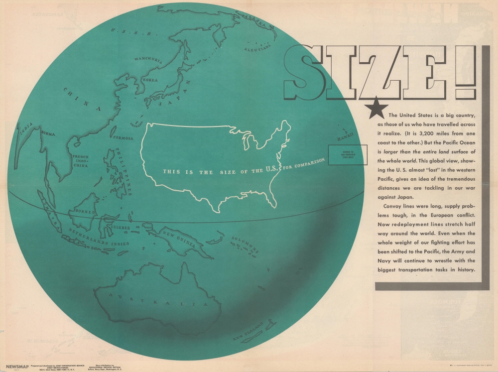
Very good. Light wear along original fold lines. Verso repairs to fold separations. Slight loss to lower right margin. Map comparing the size of the continental United States to the Pacific Ocean on verso.