This item has been sold, but you can get on the Waitlist to be notified if another example becomes available, or purchase a digital scan.
1910 Map of New York City and Vicinity
NewYork-anon-1910$50.00

Title
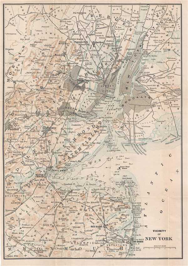
Vicinity of New York.
1910 (undated) 14 x 10 in (35.56 x 25.4 cm) 1 : 217000
1910 (undated) 14 x 10 in (35.56 x 25.4 cm) 1 : 217000
Description
This is a c. 1910 map of New York City and its vicinity. The map depicts the region from Plainfield, New Jersey to Jamaica, New York and from Bergen County, New Jersey and Westchester County, New York to Monmouth County, New Jersey. Highly detailed, counties and townships throughout the region are labeled, including New Utrecht, Flatbush, Gravesend, Flatlands, and Flushing on Long Island. New York, Brooklyn, Long Island City, and Greenpoint in New York are all illustrated with their street grid, along with Jersey City, Newark, and Elizabeth in New Jersey. Myriad towns and villages are also labeled, including Passaic, Orange, Rahway, and South Amboy. The regional rail network is depicted using solid black lines all of which are labeled, such as the Staten Island Railroad, the Long Island Railroad, the New York and New Hampshire Railroad, and the Central Railroad of New Jersey. Buoys, beacons, and depth soundings are labeled in New York Bay, Raritan Bay, and Sandy Hook Bay. The Narrows are also labeled.
Condition
Very good. Light wear along original fold lines. Close left margin. Blank on verso.