
1902 National Publishing Company Map of New York State

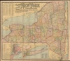

The National Publishing Company's New Railroad, Post Office, Township and County Map of New York.
Regal Map of the Empire State.
- Digital Map Information
- Suitable for large format printing
- File Size: 136.29 MB
- File Type: ZIP / TIFF
- ICC color profile embedded
- Delivered instantly via download link
Regal Map of the Empire State.
An impressive, large-format 1902 indexed folding map of New York State by the National Publishing Company highlighting the state's rail network at the start of the 20th century.A Closer Look
The map's grand size allows for granular detail, demarcating counties and towns. The main map focuses on the mainland portion of the state, from New York City and points north. Inset maps detail the five boroughs of New York City, and a separate map details Long Island. An alphanumeric grid surrounds the map, corresponding to indices of the state's counties, county seats, and railroads. Separate tables indicate mileage between railroad stations and the travel distances between New York's larger cities. The state's demographics as of the 1900 census are given both for cities and the state. A further list names the steamship lines available from New York, New Jersey, and Hoboken.Publication History and Census
This map was produced and published by the National Publishing Company in 1902 (it is sometimes also cataloged with the Scarborough Company as an author, given the close relationship between the two companies; the Scarborough edition was published in 1903). It is listed among the holdings of 6 institutions in OCLC, while an 1899 edition is held by one institution.Cartographer
National Publishing Company (1897 - 1902) was an American map publishing firm founded in Portland, Maine in 1897. The founders, brothers Walter C. Scarborough (June 4, 1862 - May 9, 1904) and Howard G. Scarborough (December 23, 1867 - June 10, 1905), were also proprietors of the Scarborough Company and the Dominion Publishing Company. The National Publishing Company was intended to be managed by Howard, with Walter serving as treasurer. By 1901, the firm had relocated to Boston, where it published and sold large scale brilliantly printed road maps. In 1902, the Scarborough brothers merged their three concerns into the Boston based Scarborough Company and opened an office in Indianapolis, Indiana. Walter and Howard died in 1904 and 1905, both from tuberculous, but the Scarborough Company continued, transferring its offices to Indianapolis. In 1913 it became the Scarborough Motor Guide Company (c. 1913 - c. 1933). It does not appear to be related to the more prominent general publisher of the same name based out of Philadelphia. Further Details...
Source
Petrini, P., Atlante Partenopeo, (Naples: Stamperiào San Biagio) 1700 - 17.
Condition
Very good. Bright and clean. Mounted on linen. Some wear at folds with minimal loss.
References
OCLC 2023130.