
National Publishing Company

National Publishing Company (1897 - 1902) was an American map publishing firm founded in Portland, Maine in 1897. The founders, brothers Walter C. Scarborough (June 4, 1862 - May 9, 1904) and Howard G. Scarborough (December 23, 1867 - June 10, 1905), were also proprietors of the Scarborough Company and the Dominion Publishing Company. The National Publishing Company was intended to be managed by Howard, with Walter serving as treasurer. By 1901, the firm had relocated to Boston, where it published and sold large scale brilliantly printed road maps. In 1902, the Scarborough brothers merged their three concerns into the Boston based Scarborough Company and opened an office in Indianapolis, Indiana. Walter and Howard died in 1904 and 1905, both from tuberculous, but the Scarborough Company continued, transferring its offices to Indianapolis. In 1913 it became the Scarborough Motor Guide Company (c. 1913 - c. 1933). It does not appear to be related to the more prominent general publisher of the same name based out of Philadelphia.
Regal Map of the Empire State.
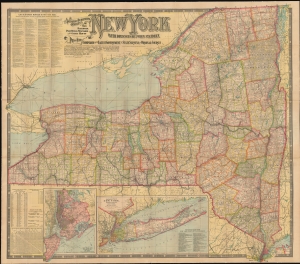
The National Publishing Company's New Railroad, Post Office, Township and County Map of New York.
$360.00
Acquire
- Digital Map Information
- Suitable for large format printing
- File Size: 136.29 MB
- File Type: ZIP / TIFF
- ICC color profile embedded
- Delivered instantly via download link
An impressive, large-format 1902 indexed folding map of New York State by the National Publishing Company highlighting the state's rail network at the start of the 20th century. (more details)
Green Mountain State.
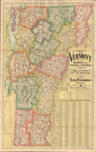
Complete map of Vermont showing highways and natural features…
$400.00
Acquire
- Digital Map Information
- Suitable for large format printing
- File Size: 221.22 MB
- File Type: ZIP / TIFF
- ICC color profile embedded
- Delivered instantly via download link
An impressive, large-format 1902 indexed folding map of Vermont by the National Publishing Company highlighting the state's rail network at the start of the 20th century. (more details)