This item has been sold, but you can get on the Waitlist to be notified if another example becomes available, or purchase a digital scan.
1867 Beers Map of New York City and Vicinity ( Westchester, Long Island, Newark, Bergen )
NewYorkArea-beers-1867$200.00

Title
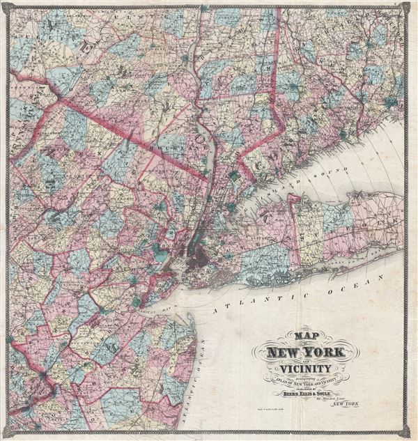
Map of New York and Vicinity.
1867 (undated) 28 x 31 in (71.12 x 78.74 cm) 1 : 253440
1867 (undated) 28 x 31 in (71.12 x 78.74 cm) 1 : 253440
Description
An uncommon large format 1867 F. W. Beers map of New York and Vicinity. Centered on New York City, the map covers from Poughkeepsie to Barnegat Bay and from the Pennsylvania border east to Suffolk County, Long Island, and New Haven Connecticut. Parts of northern New Jersey, Long Island, and Westchester are included. Overall the map is presented in exceptional detail with streets, roadways, rail lines, counties, and towns noted. Surrounded by a decorative border. Prepared by F. W. Beers from original survey work for inclusion in his 1867 Atlas of New York and Vicinity.
Cartographer
The Beers family (Fredrick, Silas, James and Daniel) (fl. c. 1850 - 1886), along with Charles and Augustus Warner, were prominent map publishers working from the 1850s to the late 1880s. Often publishing under the Warner & Beers designation, the combined firms produced a series of important state and county atlases and map of much of the northeastern United States. Many of their regional maps are among the most detailed and well laid out maps ever produced of their respective regions. Because Warner & Beers county maps were often detailed down to the individual homes and landowners, they have become highly sought after by general and family historians. In additional to producing maps of surpassing detail, Warner & Beers also maintained an earlier generation's attention to detail and quality while publishing in an era ever increasingly dominated by the low cost printing methods used by the publishing empires of Rand McNally and George Cram. More by this mapmaker...
Source
Beers, F. W., Atlas of New York and vicinity from actual surveys, (New York) 1867.
Condition
Very good condition. Professionally flattened and backed with archival tissue.
References
Rumsey 0065.001. Haskell, D., Manhattan Maps A Co-operative List, 1177.