This item has been sold, but you can get on the Waitlist to be notified if another example becomes available, or purchase a digital scan.
1939 U.S. Army Topo Engineers Map of West Point and Vicinity, New York
NewYorkWestPoint-topoengin-1939$75.00

Title
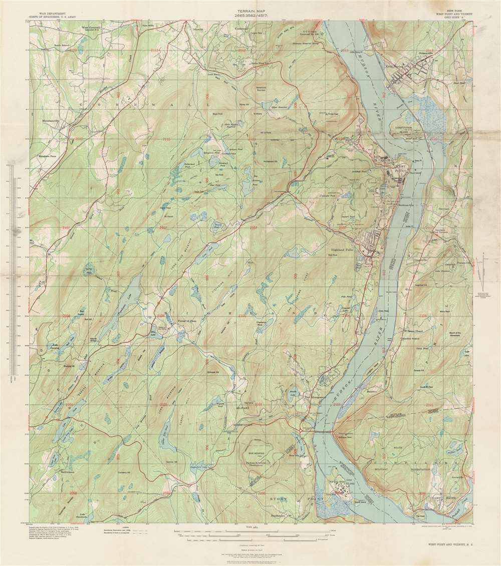
Terrain Map. New York West Point and Vicinity.
1939 (dated) 36 x 31 in (91.44 x 78.74 cm) 1 : 20000
1939 (dated) 36 x 31 in (91.44 x 78.74 cm) 1 : 20000
Description
This is a 1939 U.S. Army Corps of Engineers’ terrain or topographical map of West Point and vicinity, New York. The map depicts the area from Storm King Mountain in Cornwall, along the Hudson River, south as far as Iona Island near Stony Point, and from Houghton Farm east to Forsonville. Details pertaining to the region's terrain, including important roads, camps, military reservations, hills, lakes, and a host of additional features, appear throughout.
Publication History
Originally prepared in 1938, this map was published in 1939. This chart was compiled under the direction of the Chief of Engineers, U.S. Army, and issued by Engineer Reproduction Plant, Corps of Engineers, U.S. Army.Cartographer
Army Corps of Topographical Engineers (fl.1838 - 1863) refers to the an elite branch of the U.S. Army created on July 4, 1838 to perform civil mapping and survey work throughout the United States. The origins of the Corps of Topographical Engineers can be traced back to the American Revolutionary War, where General George Washington recognized the need for accurate surveys pursuant to military action. Shortly following the war, in 1779, a civilian engineering corps was created by act of Congress. Identified in 1802 by Thomas Jefferson, the "Corps of Engineers," which was based at West Point, the group participated in the War of 1812 and in later in the fortification of New Orleans. It was not until 1838, however, that a separate group of "Topographical Engineers" was formally recognized. This elite group, consisting only of officers, most of whom were trained in surveying and engineering by the esteemed Andrew Ellicott at West Point, never numbered more than 36 individuals - the best and brightest. This small but determined group played a central role in the mapping and exploration of the American West. Few branches of the military can boast such a distinguished alumni. Their names resonate throughout the map of the west and include John Charles Fremont, Zebulon Pike, George Meade, Kemble Warren, William Amiel Weeks, A. B. Gray, Randolph B. Marcy, James H. Simpson, Howard Stansbury, John W. Gunnison, William Ludlow, and Robert S. Williamson. The onset of the American Civil War brought an abrupt end to the surveying activity of the Topographical Engineers. Many of the most prominent engineers went on to distinguished military careers on both sides of the War Between the States. The Army Corps of Topographical Engineers itself was folded into the Corps of Engineers on March 31, 1863. Though the Army Corps of Engineers continues to do military and civil survey work to this day, the elite club of adventures that formed the Topographical Engineers were no more. More by this mapmaker...
Condition
Very good. Minor wear along original fold lines. Minor toning and spotting. Closed margin tear professionally repaired on verso. Blank on verso.