1938 Fairmap Pictorial City Map or Plan of New York City
NewYorkWorldsFair-fairmap-1938$500.00

Title
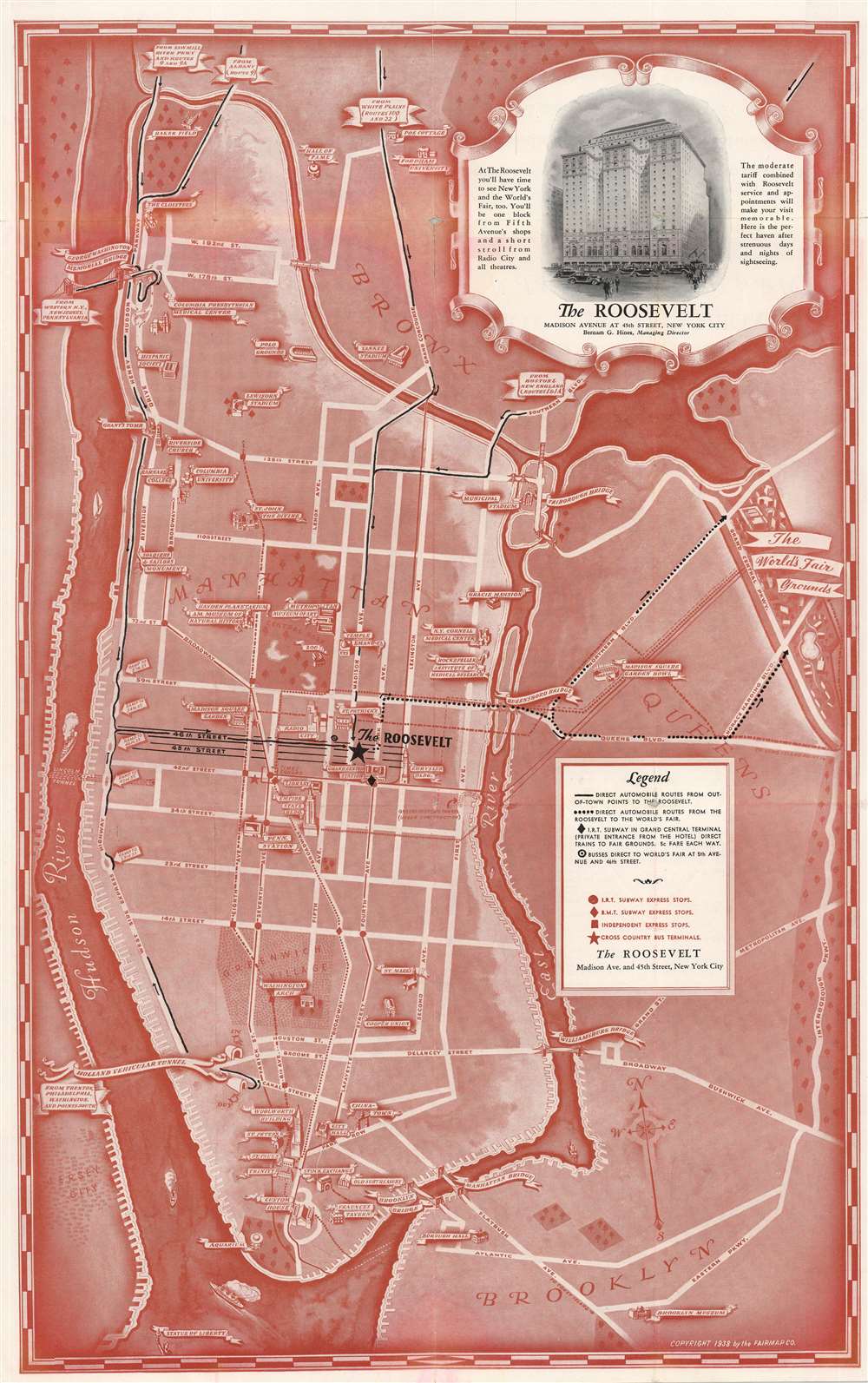
(Map of New York City Showing Direct Routes to the World's Fair Grounds With a Complete Listing of the Hundreds of Points of Interest Which Every Visitor Should See. Presented With The Compliments of The Roosevelt.)
1938 (dated) 21.75 x 13.75 in (55.245 x 34.925 cm) 1 : 43000
1938 (dated) 21.75 x 13.75 in (55.245 x 34.925 cm) 1 : 43000
Description
This is a 1938 Fairmap Company pictorial map of New York City. The map depicts the city from the Hudson River to the Interborough Parkway between Brooklyn and Queens and from the Bronx to the Statue of Liberty. Created as a promotional advertisement for The Roosevelt Hotel, located on Madison Avenue and 45th Street near Grand Central Station, numerous tourist attractions and New York City landmarks are illustrated in profile and identified. Some of these include the Metropolitan Museum of Art, the American Museum of Natural History, the Empire State Building, the Chrysler Building, Radio City Music Hall, and Grand Central. Other New York City institutions, such as Barnard College, Columbia University, the Cooper Union, and the Fraunces Tavern are also noted. The Manhattan Bridge, Brooklyn Bridge, Williamsburg Bridge, and Triborough Bridge are all illustrated. In anticipation of the 1939 World's Fair, the map shows the fairgrounds in Queens and marks the best automobile routes to them from Manhattan. Routes to the fair, and auto routes to the island of Manhattan from New Jersey and Upstate New York are shown with their ultimate terminus at The Roosevelt. Major streets throughout Manhattan are illustrated and labeled, including Fifth Avenue, Park Avenue, and 14th, 34th, and 42nd Streets. Express subway stops are also noted on the I.R.T., B.M.T., and Independent lines, although local stops are ignored.
Publication History and Census
This map was created and published by the Fairmap Company as a promotional brochure for the Roosevelt Hotel.Condition
Good. Wear along original fold lines. Slight loss at fold intersections. Text on verso.