This item has been sold, but you can get on the Waitlist to be notified if another example becomes available, or purchase a digital scan.
1935 General Drafting Map of New Hampshire Ski Trails
NHSkiTrails-generaldrafting-1935$125.00

Title
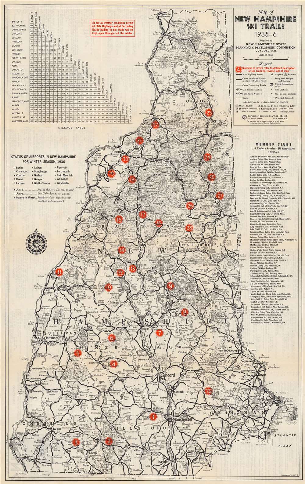
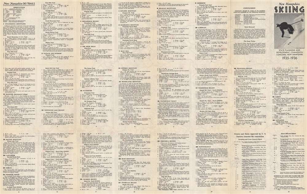
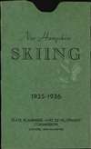
Map of New Hampshire Ski Trails 1935-6.
1935 (dated) 25.5 x 16 in (64.77 x 40.64 cm) 1 : 380160
1935 (dated) 25.5 x 16 in (64.77 x 40.64 cm) 1 : 380160
Description
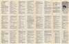
This is a 1935 New Hampshire State Planning and Development Commission and General Drafting map of New Hampshire ski trails. Numbered red dots mark twenty-nine ski trails across the state. Each corresponds with an index on the verso. New Hampshire's highway network is illustrated with a milage table in the upper left. New Hampshire's airports are also listed with their 'winter status' noted (open with plowed runways, open without plowed runways so skis are required, and closed during the winter). A list of amateur ski clubs in the eastern United States appears along the right border.
Publication History and Census
This map was prepared by the New Hampshire State Planning and Development Commission and published by the General Drafting Corporation in 1935. We note a single cataloged example, which is part of the collection at the University of Wisconsin - Milwaukee.Cartographer
General Drafting Corporation (1909 - 1992) was one of the 'Big Three' publishers of road maps between 1930 and 1970, along with H. M. Gousha and Rand McNally. Founded in 1909, Otto G. Lindberg, an immigrant from Finland and the company's founder, began his business with a borrowed drafting board and a $500 loan from his father. At the time only twenty-three years old, Lindberg advertised his business as 'any and all general drafting' and was based out of 170 Broadway in New York City. Only two years later, in 1911, the firm secured its first contract from the American Automobile Association to make 'road maps'. Lindberg incorporated his business in 1914 and became its first Chairman of the Board, a position he held until his death in 1968. Lindberg persuaded Standard Oil of New Jersey to let him draw the 'best' road map of the state that they had ever seen, and Standard Oil would distribute it for free. Sufficiently impressed with the finished product, Standard contracted General Drafting to make all their road maps - a relationship that lasted another six decades. This relationship allowed General Drafting to work exclusively for Standard Oil, but when oil companies stopped providing free maps, General Drafting was in a bind. The company tried to expand into the retail map market, and it of course continued creating maps for Exxon (the new name for Standard Oil) to sell, but its returns continued to decline. The firm was purchased in 1992 by Langenscheidt and subsequently absorbed into the American Map Company. General Drafting's state maps became this company's 'Travelvision' lineup. More by this mapmaker...
Condition
Very good. Closed tear extending one (1) inch from right border below list of member clubs no effecting printed map professionally repaired on verso. Information about New Hampshire Ski Trails printed on verso.
References
OCLC 32178089.