
General Drafting Corporation

General Drafting Corporation (1909 - 1992) was one of the 'Big Three' publishers of road maps between 1930 and 1970, along with H. M. Gousha and Rand McNally. Founded in 1909, Otto G. Lindberg, an immigrant from Finland and the company's founder, began his business with a borrowed drafting board and a $500 loan from his father. At the time only twenty-three years old, Lindberg advertised his business as 'any and all general drafting' and was based out of 170 Broadway in New York City. Only two years later, in 1911, the firm secured its first contract from the American Automobile Association to make 'road maps'. Lindberg incorporated his business in 1914 and became its first Chairman of the Board, a position he held until his death in 1968. Lindberg persuaded Standard Oil of New Jersey to let him draw the 'best' road map of the state that they had ever seen, and Standard Oil would distribute it for free. Sufficiently impressed with the finished product, Standard contracted General Drafting to make all their road maps - a relationship that lasted another six decades. This relationship allowed General Drafting to work exclusively for Standard Oil, but when oil companies stopped providing free maps, General Drafting was in a bind. The company tried to expand into the retail map market, and it of course continued creating maps for Exxon (the new name for Standard Oil) to sell, but its returns continued to decline. The firm was purchased in 1992 by Langenscheidt and subsequently absorbed into the American Map Company. General Drafting's state maps became this company's 'Travelvision' lineup.
American Airlines at the dawn of the Jet Age.
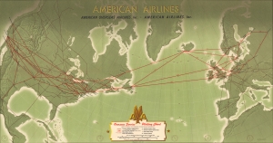
American Airlines Overseas Service Plotting Chart.
$225.00
Acquire
- Digital Map Information
- Suitable for large format printing
- Full resolution TIFF file
- ICC color profile embedded
- Delivered instantly via download link
This is a 1950 Antonio Petruccelli American Airlines route map of the United States and Europe. Published at the dawn of the Jet Age (although jet airliners would not be introduced to the U.S. until later in the decade), this map is part of the legacy of increased civilian airline travel in the years after World War II (1939 - 1945) and the advent of relatively easy global travel. (more details)
Cheerful Cold War propaganda.
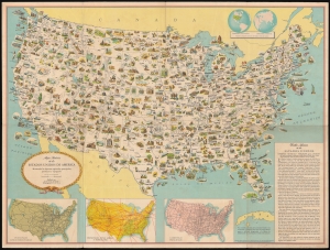
Mapa pictórico de los Estados Unidos de América: mostrando las riquezas regionales principales, productos y topografía.
$700.00
Acquire
- Digital Map Information
- Suitable for large format printing
- File Size: 118.41 MB
- File Type: ZIP / TIFF
- ICC color profile embedded
- Delivered instantly via download link
This is a c. 1952 Spanish language pictorial map of the continental United States published by the U.S. Department of State and distributed by the U.S. Information Agency (U.S.I.A.). Versions of this map were produced in many languages for international publication. Its innocuous presentation belies its role in the United States' worldwide propaganda campaign during the Cold War. (more details)
Visit Florida's amazing sites!
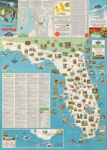
Standard Oil Pictorial Guide to Florida.
$375.00
Acquire
- Digital Map Information
- Suitable for large format printing
- Full resolution TIFF file
- ICC color profile embedded
- Delivered instantly via download link
This is a charming 1953 General Drafting pictorial tourist map of Florida. Pictorial vignettes populate the map from southern Georgia to Key West and highlight tourist attractions, state parks, and numerous other locations. Among these are the University of Florida, Florida State University, Silver Springs, the New Smyrna Ruins, Highlands Hammock State Park, the Ringling Museum of Art, and, of course, Everglades National Park. An inset map situated in the lower left corner focuses on the Overseas Highway, while a large text box in the Gulf of Mexico provides sightseers with information about sites throughout the state. An inset of St. Augustine appears along the top border, along with temperature maps of Florida in July and January. (more details)
Two leashed cheetahs - enough said!
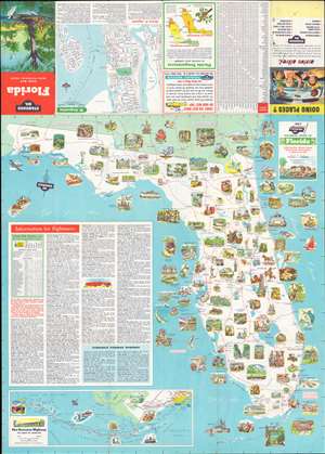
This is a 1956 General Drafting Corporation pictorial map of Florida. Wonderfully colored vignettes promote tourist attractions, such as Silver Springs, the McKee Jungle Gardens, the Ringling Museum of Art, the South Florida Museum, and the Bok Singing Tower. Tourist activities, including deep-sea fishing and waterskiing, are also highlighted. The most-eye-catching (and head-scratching) of these promotes Africa U.S.A., a defunct safari-themed park outside Boca Raton, presenting a young woman with two leashed cheetahs. Other vignettes illustrate Florida's universities, its beaches, and wildlife. Sightseeing information dominates the lower left and includes short summaries of attractions and other activities. An inset focusing on the Overseas Highway from Miami to Key West is situated in the lower-left. (more details)
Highlighting Tampa and St. Petersburg.
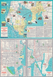
This is a 1961 General Drafting Company pictorial map of Tampa and St. Petersburg and vicinity. (more details)
A selective history of Standard Oil of Kentucky.
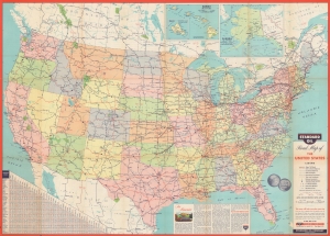
Standard Oil Road Map of the United States / Standard Oil Souvenir Map: 75 Years of Oil Progress.
$250.00
Acquire
A large-format double-sided map of the United States produced in 1961 by the General Drafting Corporation for Standard Oil of Kentucky (also known as Kyso). Together, they highlight the rapid expansion of highways and interstates across the country, as well as the impact of the development of the oil industry on daily life. (more details)
Dining on the road - American Highway Culture.
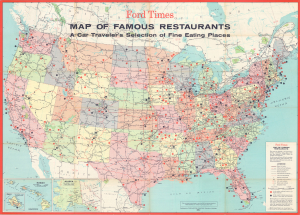
Ford Times Map of Famous Restaurants A Car Traveler's Selection of Fine Eating Places.
$550.00
Acquire
This is a large-format 1964 General Drafting map of the United States produced for Ford Times. Focusing on the country's highway infrastructure at the height of the era of interstate construction, the map highlights 'famous' restaurants adjacent to the growing American interstate system. (more details)