This item has been sold, but you can get on the Waitlist to be notified if another example becomes available, or purchase a digital scan.
1889 Kellner Wall Map of North America
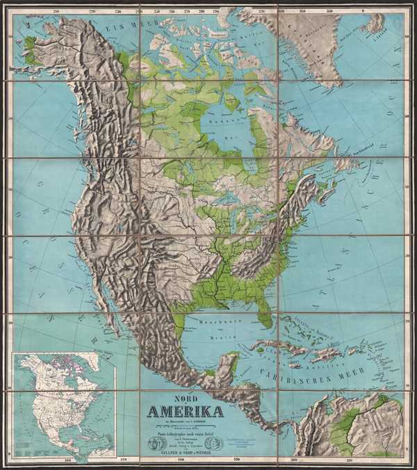
NordAmerika-kellner-1889$375.00

Title
Nord-Amerika.
1889 (undated) 44 x 39 in (111.76 x 99.06 cm) 1 : 8060000
1889 (undated) 44 x 39 in (111.76 x 99.06 cm) 1 : 8060000
Description
This is a large c.1889 color photo-lithograph wall map of North America. The map covers the whole of North America from the Bering Strait south to Panama. Important cities, lakes, rivers, mountains, islands, and a host of other topographical features are identified. Relief is beautifully rendered. An inset map in the lower left shows North America color coded to depict British, Dutch, Danish, Spanish, French and Swedish possessions. Beautiful large map. Printed and published by Kellner and Company of Weimar, Germany.
Cartographer
Kellner and Company (fl. c. 1870 – 1900) was a Weimar, Germany, based publishing house active in the late 19th century. Kellner was known for its novel use of photo-lithographic printing techniques to produce high quality relief maps. This freed them from the use of a professional draughtsman and thus enabled them to issue high quality relief maps at a low price. More by this mapmaker...
Condition
Very good. Dissected and mounted on linen in 18 panels. Original linen in good condition. Some foxing and former collection stamp at bottom of map.
References
OCLC: 493930560.