
This item below is out of stock, but another example (left) is available. To view the available item, click "Details."
Details
1948 Randolph and Storm Pictorial Map of Texas Dominating North America
1948 (dated) $800.00
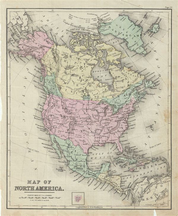
1879 Warren Map of North America
NorthAmerica-warren-1879$35.00

Title
Map of North America.
1879 (undated) 11.5 x 9.5 in (29.21 x 24.13 cm)
1879 (undated) 11.5 x 9.5 in (29.21 x 24.13 cm)
Description
This is an example of David M. Warren's 1879 map of North America. Centered on the United States, it covers from the Arctic Ocean to Panama, including Greenland, Iceland and parts of South American and the West Indies. Throughout, the map identifies various railroads, cities, towns, rivers, islands, mountain passes and an assortment of additional topographical details. The map is color coded according to regional and political boundaries; however state lines are not shown. elevation is rendered by hachure. Issued as page 25 in the 1879 edition of Warren's Common-School Geography.
Source
Warren, D. M., Common School Geography, 1879.
Condition
Very good. Even overall toning. Text on verso. Verso repair at few places near margins.