This item has been sold, but you can get on the Waitlist to be notified if another example becomes available, or purchase a digital scan.
1823 Tanner Map of North Carolina and South Carolina (1st Edition)
NorthCarolinaSouthCarolina-tanner-1823$1,000.00

Title
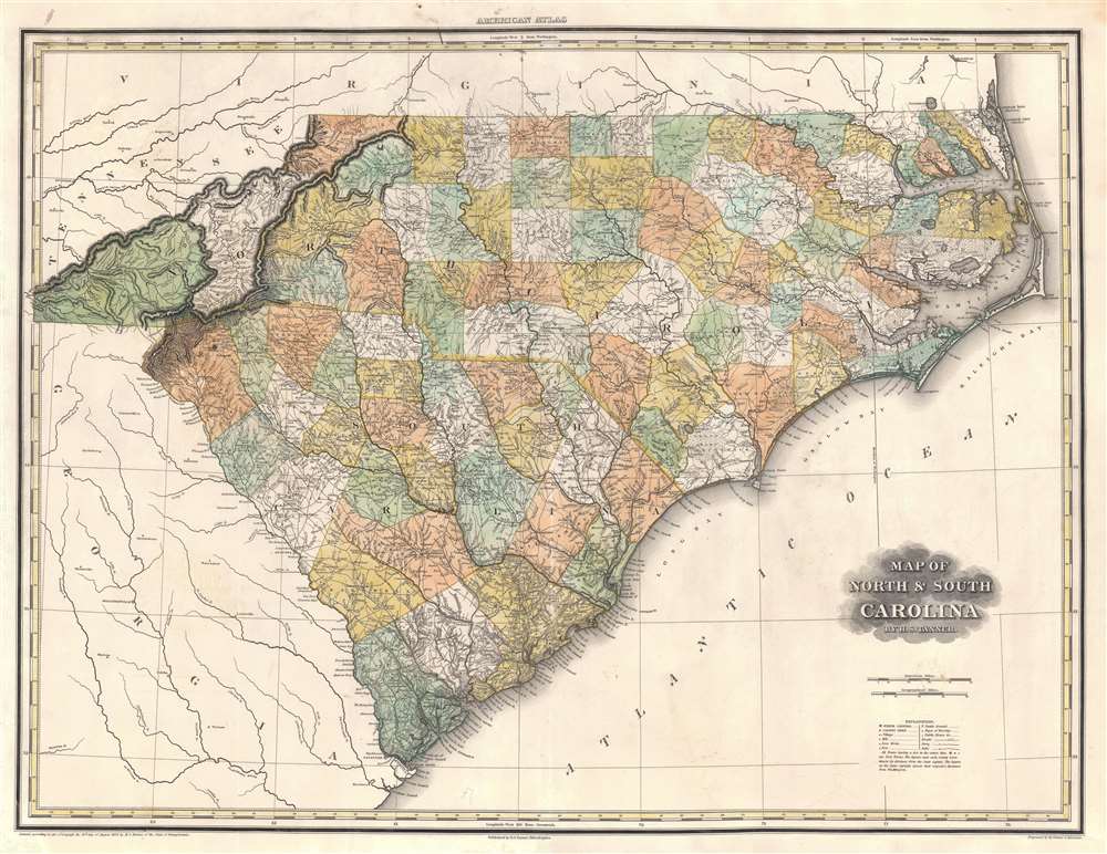
Map of North and South Carolina.
1823 (dated) 23 x 29.5 in (58.42 x 74.93 cm) 1 : 1100000
1823 (dated) 23 x 29.5 in (58.42 x 74.93 cm) 1 : 1100000
Description
An uncommon 1823 first edition Henry Schenck Tanner map of North Carolina and South Carolina. When this map was illustrated, it represented the finest atlas map of these states then obtainable, featuring a wealth of important cartographic firsts, such as the addition of Haywood County (founded in 1808). The map remained definitive until new more detailed maps were produced after the American Civil War.
A Closer Look
The map covers all of North and South Carolina, as well as adjacent parts of Georgia, Tennessee, and Virginia. In addition, it features an impressive richness of detail, naming mills, iron works, forts, battle grounds, places of worship, public houses, roads, ferries, and falls.Publication History and Census
This map was published by Tanner in 1823 edition of his iconic New American Atlas. A second edition was produced in 1825. This map, like all maps from the New American Atlas, is today rare to the market but is well represented in institutional collections.Cartographer
Henry Schenck Tanner (1786 - May 18, 1858) was one of the preeminent American map engravers and publishers of the early 19th century - what is considered to be the "Golden Age of American Map Publishing". Born in New York City but based in Philadelphia, Tanner's forty plus year career was almost entirely focused on cartographic work. His earliest map work appears in conjunction with another important map publisher, John Melish. Early in his career, Tanner partnered with his brother Benjamin, to engrave extensively for Melish as well as other Philadelphia publishers including Lucas Fielding (Baltimore), A. Bourne, Jason Torey, Samuel Harrison, and Samuel Lewis, among others. In 1818 Tanner convinced his fellow publishers and partners to finance the compilation of a New American Atlas. The atlas was sold by subscription and slowly emerged between 1819 and 1823. The New American Atlas, possibly the pinnacle of 19th century American cartography and was commended in its day as "one of the most splendid works of the kind ever executed in this country". It was subsequently republished in several updated editions until about 1839. Tanner had by this time become the most active and influential map publisher in the United States. Around 1832, recognizing the market for a less cost prohibitive atlas, Tanner began work on the smaller format New Universal Atlas. This popular and important atlas went through numerous editions before being bought out by Carey and Hart, and then, in 1846, by S. A. Mitchell, who would rise to become the preeminent publisher of the next generation. In addition to these important atlases, Tanner also issued numerous extremely important and influential travelers guides, state maps, wall maps, and pocket maps. He should not be confused with his brother, also an America map engraver, the New Yorker Benjamin Tanner. More by this mapmaker...
Source
Tanner, H.S., A New American Atlas, (Philadelphia: Tanner) 1823.
Tanner's New American Atlas is regarding as the largest and most beautiful early American atlas, truly a landmark achievement from the Golden Age of American Cartography. The atlas was initially published in five parts between 1819 and 1823, after which collected editions were issued in 1823, 1825, 1833, and 1839. It terms of size, format, printing quality, paper quality, cartographic accuracy, and elegance of engraving, the New American Atlas was unparalleled. As noted by map historian Walter Ristow, 'Tanner's atlas raised U.S. commercial map production to a new level of excellence.' His contemporaries were also duly impressed. The American educator and historian Jared Sparks, as quoted by Ristow, describes the atlas as thus:
on the whole as an American Atlas, we believe Mr. Tanner’s work to hold a rank far above any other, which has been published. The authentic documents, to which he had access, the abundance of his materials, the apparent fidelity, with which they are compiled, the accurate construction of his maps, and the elegance with which they are executed, all these afford ample proofs of the high character of the work, of its usefulness as a means of extending the geographic knowledge of our own country, and of its claims to public patronage. (Ristow, p. 197)
Condition
Very good. Exhibits light soiling. Verso repair to centerfold separation. Old color faded.
References
Rumsey 5388.020. OCLC 47699264.