1965 Vietnam War Era Vietnamese Map of North Vietnam
NorthVietnam-thang-1965$350.00

Title
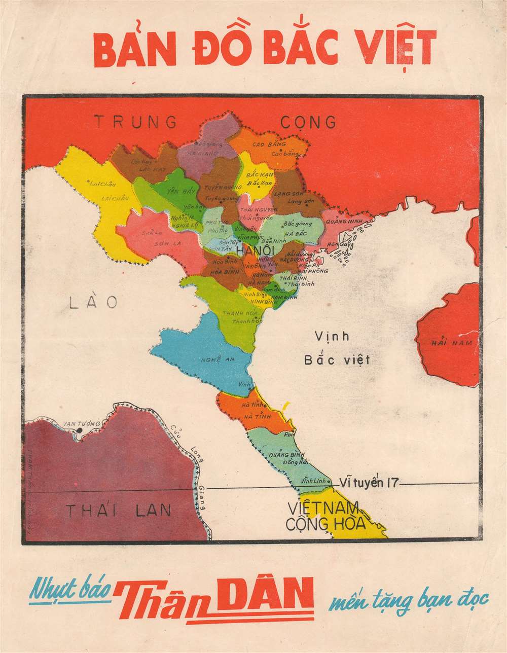
Bản Đồ Bắc Việt.
1965 (undated) 11.75 x 9.25 in (29.845 x 23.495 cm) 1 : 4000000
1965 (undated) 11.75 x 9.25 in (29.845 x 23.495 cm) 1 : 4000000
Description
This is a c. 1965 Phạm Thăng Vietnamese map of North Vietnam, published Vietnam during the Vietnam War (1955 - 1975). Created by the South Vietnamese cartographer, Phạm Thăng, the map illustrates Communist North Vietnam from the border with China to the border with South Vietnam (17° N). North Vietnamese provinces are color coded and labeled, with the provincial capital named in each. The 17th parallel separates North and South Vietnam. South Vietnam is labeled merely as Cộng Hòa, which translates to 'Republic.'
The Vietnam War
The Vietnam War, known in Vietnam as the Resistance War Against America or simply the American War, raged from November 1, 1955 to April 30, 1975. A complicated conflict with an even more complicated legacy, the Vietnam War pitted the communist North Vietnamese, led by Ho Chi Minh, against the republican South Vietnamese. The South Vietnamese were supported by the United States, and the North Vietnamese by the Soviet Union and China. Anti-communist dogma the fear that 'if one country fell to Communism, then more would fall,' drove American interest in the war. Eventually, as the conflict between the North and South grew, American involvement intensified. Finally, American ground troops were sent into combat against the North Vietnamese (Viet Cong). 1968, three years after the map was published, proved to be pivotal in the Vietnam War. That year, U.S. troop strength reached its maximum, with 549,500 soldiers present. 1968 also saw the Tet Offensive, the most successful Viet Cong campaign, and a waning of American support for the war. U.S. forces withdrew in January 1973, and Saigon fell to the North Vietnamese on April 30, 1975.Publication History
This map was created by Phạm Thăng and published in the Thân Dân newspaper c. 1965.Cartographer
Phạm Thăng (fl. c. 1965 - 1967) was a Vietnamese mapmaker and graphic artist active in Saigon during the mid-1960s. There are several city plans and infographic maps from the Vietnam War Era attributed to this figure, although it remains unclear who he was. There is a well known artist by this name, however, it is uncertain if they are related in any way. More by this mapmaker...
Condition
Good. Exhibits some soiling and creasing. Closed tear extending one half (.5) inch into printed area from right margin professionally repaired on verso. Closed margin tears professionally repaired on verso. Blank on verso.