This item has been sold, but you can get on the Waitlist to be notified if another example becomes available, or purchase a digital scan.
1863 Fisk and Russell Map of New York City
NYC-fiskrussell-1863$175.00

Title
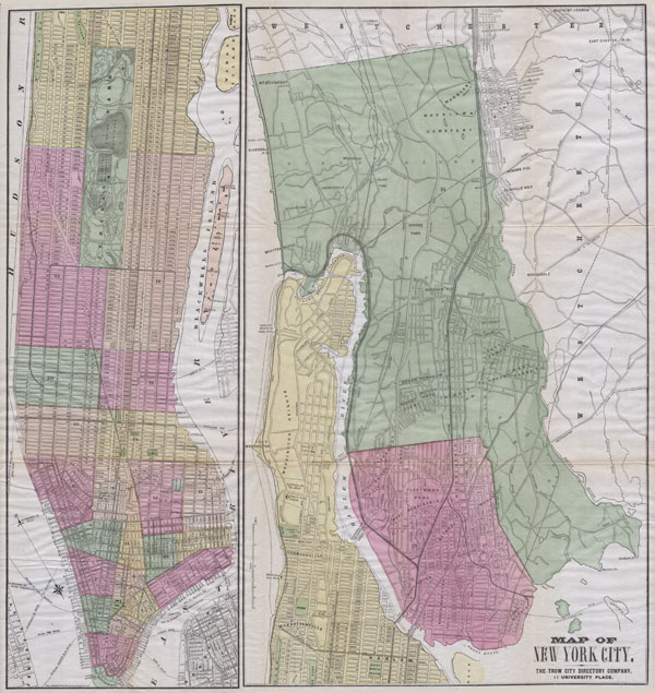
Map of New York City. The Trow City Directory Company, 11 University Place.
1863 20.5 x 21.5 in (52.07 x 54.61 cm)
1863 20.5 x 21.5 in (52.07 x 54.61 cm)
Description
A large and rare hand colored map of New York City prepared by Fisk & Russell for the Trow City Directory Company. Covers all of Manhattan Island and in a very unusual variation on most maps of the period, the whole of the Bronx. Most streets are labeled as are public squares, ferries, docks, and even important individual buildings. Interesting features include the Lunatic Asylum where Columbia University now stands, the Croton Aqueduct, trolley lines running throughout lower Manhattan, and considerable detail within Central Park.
Condition
Very good condition. Minor repairs where the map was originally bound into the book, else fine. The whole is bright and clean without any other notable discoloration or damage. Good margins. Blank on verso.