This item has been sold, but you can get on the Waitlist to be notified if another example becomes available, or purchase a digital scan.
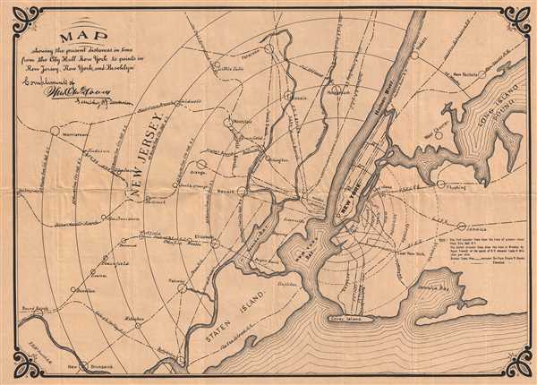
1890 McDowell Map of New York City and Vicinity
NYDistances-mcdowell-1890$62.50

Title
Map showing the present distances in time from the City Hall New York to points in New Jersey, New York, and Brooklyn.
1890 (undated) 16.5 x 23 in (41.91 x 58.42 cm)
1890 (undated) 16.5 x 23 in (41.91 x 58.42 cm)
Description
This is an 1890 F.H. McDowell map of New York City and its vicinity. The map depicts from Bound Brook and Morristown, New Jersey to Long Island Sound, New Rochelle, and Jaimaca New York and from Paterson New to Staten Island. Manhattan Island slightly right of center, with concentric rings emanating from Lower Manhattan, meant to show the amount of time it takes to get to the locations noted on the map. Coney Island is noted, as well as Flushing. Other cities labeled in New Jersey include Hakensack, Passaic, and New Brunswick. Yonkers, New York is depicted along the Hudson. Several railroads are noted, including the Hudson River Railroad and the Long Island Railroad. The entire map is encased by an attractive border.
This map was produced by F. H. McDowell, Engineer of Mines in 1890.
This map was produced by F. H. McDowell, Engineer of Mines in 1890.
Condition
Very good. Even overall toning. Blank on verso.