This item has been sold, but you can get on the Waitlist to be notified if another example becomes available.
1959 Ocean Hiway Association Map of Florida, the U.S. East Coast, and the Ocean Highway
OceanHiway-oceanhiwayassn-1959$50.00

Title
Official 1959 Map of the Ocean Hiway Safest - Fastest - Smoothest New York to Florida.
1959 (dated) 18.5 x 16.875 in (46.99 x 42.8625 cm) 1 : 2100000
1959 (dated) 18.5 x 16.875 in (46.99 x 42.8625 cm) 1 : 2100000
Description
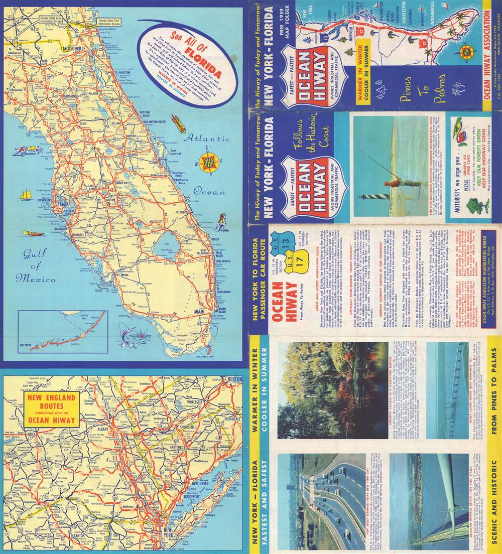
This is a 1959 Ocean Hiway Association map of Florida, the U.S. east coast, and the Ocean Highway. Cities and towns throughout Florida are identified, with solid red lines tracing the state's highway network. Pictorial elements off Florida's coastlines reinforce its image as a tropical paradise ready to welcome visitors all year. An inset in the lower-left illustrates the Overseas Highway from Tavernier to Key West. A second, smaller map, details the highway network in New England from Boston to New York and shows how it connects with the Ocean Highway. To the right of the map, short texts and color photographs promote the Ocean Highway as the ideal route for any vacation south from New England, particularly for those traveling to Florida.
Verso Content
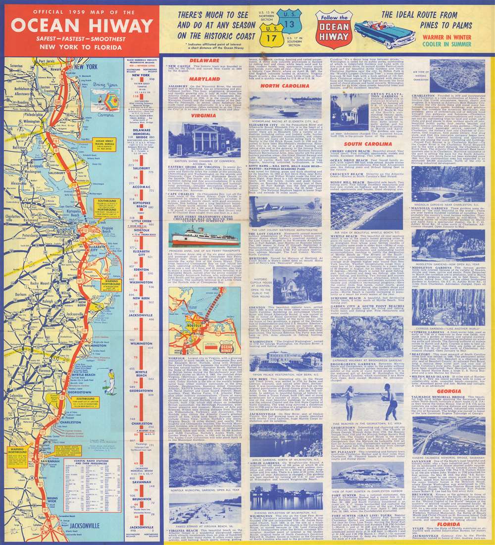
A map of the entire Ocean Highway from New York to Jacksonville occupies the left portion of the verso. In addition, yellow text boxes provide essential travel tips. A strip map / diagram next to the more conventional map provides distances between major waypoints, along with driving instructions. Information on places of interest dominates the rest of the sheet, with locations arranged by state.The Ocean Highway
Officially running from Jacksonville, Florida, north along the Atlantic coast to North Brunswick, New Jersey, the Ocean Highway tried to appeal to a different crowd than the other named highways. Those earlier highways, such as the Lincoln Highway and the Dixie Highway, were marketed as fast and efficient ways of getting from one place to another, while the Ocean Highway was promoted as a leisure route. Beginning in the 1930s, representatives from eight states helped operate the Ocean Hiway Association, which promoted the route along U.S. Route 17 and U.S. Route 13.Publication History and Census
This map was created for and published by the Ocean Hiway Association in 1959. We note nine examples cataloged in OCLC which are part of the collections at the Pennsylvania State Library, Cornell University, the Library of Congress, Pennsylvania State University, the University of Georgia, the University of Illinois at Urbana Champaign, the Jacksonville Public Library, Brigham Young University, and the University of Arizona.Cartographer
The Ocean Hiway Association (1935 - at least 1982) was an American highway promotion organization active during the 20th century. Founded in 1935 in Myrtle Beach, South Carolina, representatives from seven states collaborated to promote travel along the Ocean Hiway which connected New York City with Florida and ran along the U.S. east coast. More by this mapmaker...
Condition
Good. Exhibits wear and toning along original fold lines. Minor fold separations along left margin. Two small areas of loss at two fold intersections.
References
OCLC 52180413.