This item has been sold, but you can get on the Waitlist to be notified if another example becomes available, or purchase a digital scan.
1814 Brue Wall Map of the Pacific w/ Australia, North America, East Asia
Oceanie-brue-1814$1,750.00


Title
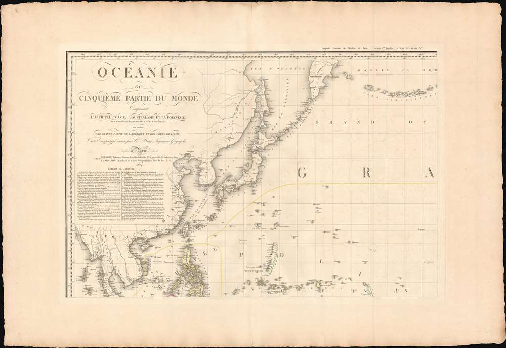
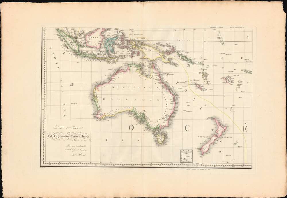
Océanie ou Cinquième Partie du Monde Comprenant L'Archipel d'Asie, L'Australasie et la Polynésie (ou le Continent de la Nouvelle-Hollande et les Îles du Grand Ocean.) en outre Une Grande Partie de L'Amérique et des Còtes de L'Asie.
1814 (dated) 40 x 60 in (101.6 x 152.4 cm) 1 : 29000000
1814 (dated) 40 x 60 in (101.6 x 152.4 cm) 1 : 29000000
Description
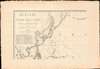
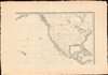
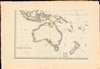
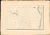
A striking large scale 1814 map of the Pacific by Adrian-Hubert Brué. This is one of the earliest general maps of the Pacific to be offered commercially - partially responsible for introducing the vastness of Oceania to the general European public. It is moreover the first map to coin the term Océanie for the Pacific Islands - previously it was known as Océanique.
In the early 19th century, following the discoveries of James Cook (1728 - 1779), Jean-François de Galaup, comte de Lapérouse (1741 - 1788), and George Vancouver (1757 - 1798) Europeans were at last confronted with the vastness and complexity of the Pacific. In the early 19th century, scholars and geographers introduced the concept of the Pacific, or specifically Oceania, as the 'Fifth Part of the World'. The notion was particularly popular in France, where it was embraced by geographers such as Edme Mentelle (1730 - 1815), Conrad Malte-Brun (1775 - 1826), and as here Adrien-Hubert Brué (1786 - 1832).
Moreover, while Brué did not coin the phrase Cinquème Partie du Monde, he did coin the term Océanie for the Pacific Islands - previously it was known as Océanique - and it appears as such here for the first time in print. Later, in 1836, the French geographer Grégoire Louis Domeny de Rienzi (1789 - 1843) popularized the term in his highly derivative, but widely-read encyclopedia, Océanie ou cinquième partie du monde.
Scope and Focus
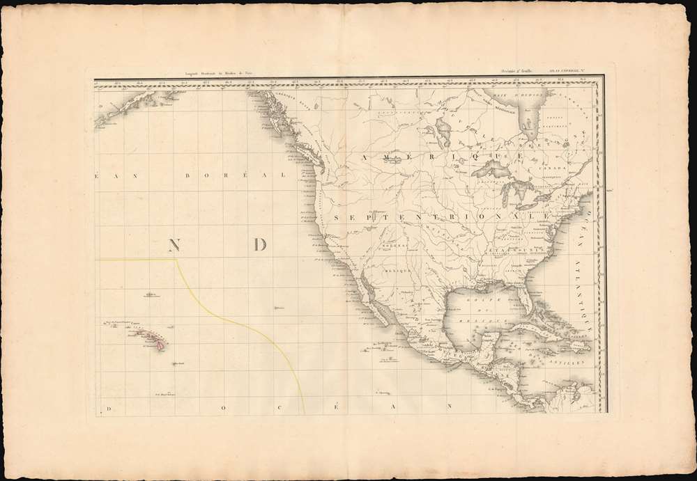
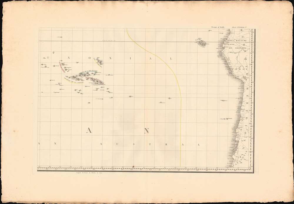
The map is generally focused on the Pacific with Hawaii (Sandwich Isles) appearing not far from center in the upper right sheet. It extends eastward to embrace most of North America, and westward to include East and Southeast Asia. Despite broad coverage, the map's focus is Polynesia, Australia, Micronesia, and the East Indies - these areas feature the greatest detail and richest color. Polynesia is loosely outlined in yellow.Océanie: The Fifth Part of the World
The map bears the curious title Cinquème Partie du Monde or 'Fifth Part of the World'. The reference hails from the conventions of medieval-style T-O maps. Such maps, predating the age of discovery, established a three-part world model centered on Jerusalem: Europa, Asia, and Africa. After the discovery of America and the general understanding that it was not Asia, but rather a separate continent, Martin Waldseemüller (c. 1470 - 1520) and others added America as the 'Fourth Part of the World'.In the early 19th century, following the discoveries of James Cook (1728 - 1779), Jean-François de Galaup, comte de Lapérouse (1741 - 1788), and George Vancouver (1757 - 1798) Europeans were at last confronted with the vastness and complexity of the Pacific. In the early 19th century, scholars and geographers introduced the concept of the Pacific, or specifically Oceania, as the 'Fifth Part of the World'. The notion was particularly popular in France, where it was embraced by geographers such as Edme Mentelle (1730 - 1815), Conrad Malte-Brun (1775 - 1826), and as here Adrien-Hubert Brué (1786 - 1832).
Moreover, while Brué did not coin the phrase Cinquème Partie du Monde, he did coin the term Océanie for the Pacific Islands - previously it was known as Océanique - and it appears as such here for the first time in print. Later, in 1836, the French geographer Grégoire Louis Domeny de Rienzi (1789 - 1843) popularized the term in his highly derivative, but widely-read encyclopedia, Océanie ou cinquième partie du monde.
Royalist Tendencies
The map was issued in the early days of the Bourbon Restoration (1814 - 1830), and is thus dedicated to the Comte d'Artois. This title was abolished in 1793 during the French Revolution (1789 - 1799) but reinstated with the abdication of Napoleon Bonaparte. In this case, the dedication specifically refers to Charles Philippe (1757 - 1836). Charles returned to France shortly before Napoleon's abdication, taking control of France as Lieutenant General of the realm. When this map was printed, Charles was the de facto ruler of France until 1815, when his uncle Louis XVIII arrived from England to assume the throne. He succeeded Louis XVIII as King of France in 1825 as Charles X. Brué dedicated many of his maps to the Comte d'Artois, suggesting that he was angling for royal patronage.Publication History and Census
This map was first published, as here, in 1814, by Adrien Hubert Brué in partnership with the Paris map publishers Jacques Desray and Jean Goujon. It was issued both separately and bound in sections into the rare Brué Atlas Universel. The map went through numerous subsequent editions to about 1847. We note examples at the Newberry Library, the Württembergische Landesbibliothek, the State library of Victoria, and TU Darmstadt, Universitäts- und Landesbibliothek.CartographerS
Adrien-Hubert Brué (1786 – July 16, 1832) was a French cartographer active in the late 18th and early 19th centuries. Brué served on various ships from age 12. At 14 he was commissioned to the crew of the Naturalist, one of the two ships in Baudin Expedition (1800 – 1804) to the South Pacific. Later in life, Brué turned to cartography where his work was known for remarkable clarity and accuracy. Brué eventually acquired the prestigious office of Geographe du Roi and often signed his maps as such. In this position Brué contributed to thousands of maps and numerous atlases. Like most cartographers, many of his maps were published posthumously. His widow published several maps in 1834, before selling out to Brué's erstwhile partner, Charles Picquet's son and heir, Pierre-Jacques Picquet. Brue's maps were still being updated and republished decades after his death. More by this mapmaker...
Jean Goujon (fl. c. 1785 - 1825) was a French publisher and mapseller based in Paris. Goujon's work begins appearing shortly before the French Revolution (1789 - 1799) and continues well into the Napoleonic Era (1799 - 1815). He was based out of no. 6, Rue du Bac, Paris. In 1825, Goujon's daughter married Eugène Andriveau. Andriveau soon took over Goujon's shop and took the name, Andriveau-Goujon. The family dynasty that followed became the most prominent geographic publishers in France in the 19th century. Learn More...
Condition
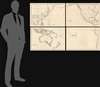
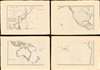
Very good. Four sheets, unjoined. Wide margins with original deckled edges. Slight centerfold wear.
References
OCLC 1028991901. Phillips (Atlases) 726.