1830 Tanner Pocket Map of Ohio
OhioPocketMap-tanner-1830$1,200.00


Title
The Travellers Pocket Map of Ohio with its canals, roads and distances. / Ohio Traveller.
1830 (dated) 13 x 10.5 in (33.02 x 26.67 cm) 1 : 1430000
1830 (dated) 13 x 10.5 in (33.02 x 26.67 cm) 1 : 1430000
Description
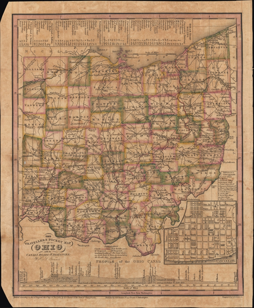
This is a scarce 1830 pocket map of Ohio by Henry Schenck Tanner and engraved by Edward B. Dawson. It presents the state during a period of rapid growth after the War of 1812, as settlers arrived in large numbers to settle the pacified frontier.
In addition to the main map, an inset map of Cincinnatti appears at the bottom-right with its own legend. At the bottom is a profile of the Ohio (and Erie) Canal, demonstrating the rise in elevation between Lake Erie and the canal's high point at Akron, with travel achieved by a series of locks. At the top is a series of tables of steamboat routes, noting the distance of each leg of the given journey and the cumulative distance of the journey from its starting point.
Another canal in the planning stages was partially completed at the time of publication: the Miami Canal running north of Cincinnati. This became the southern part of the Miami and Erie Canal, which was completed in 1845. The unbuilt portion extending northwards from Dayton is marked as 'Proposed Can.,' reaching all the way to Toledo. (Here, as Port Lawrence and part of Michigan, it sat on disputed territory that would later be awarded by Congress to Ohio after the brief 'Toledo War' between the two states.) The area around the canal was dubbed the 'Ohio Rhineland' by the large number of German immigrants who settled there. However, since the canal was completed just as railroads were becoming widespread, it was operational for only a few years. It soon fell into disuse, with much of the original canal ceded to the railroads. Other sections were converted into highways.
But the largest, most important, and most complete canal seen here is the Ohio and Erie Canal, which is displayed as completed but, in fact, only began operations along its full route two years after this map was published. The canal connected Portsmouth on the Ohio River with the Cuyahoga River near its mouth on Lake Erie in Cleveland. First proposed in the 1780s, engineers spent years surveying the route before construction began in 1825. The canal only carried freight until 1861, after which railroads superseded canals. After 1879, when the canal reopened following severe flooding, it became apparent that it had been poorly maintained, and many sections were filled in and replaced with railroad tracks over its right-of-way. Today, some of the sections of the former canal serve as state and national recreation areas.
This map is quite scarce, noted in the OCLC among the holdings of six institutions: the Wisconsin Historical Society, Ohio History Connection, Oberlin College, the New York Public Library, Dartmouth College, and Harvard University. We are unaware of any instances of this map coming to the market in recent years.
A Closer Look
The map presents the state of Ohio with counties color-shaded for distinction. Cities and towns, forts, waterways (including canals), and roads (with distances between settlements) are noted throughout. Many early and unusual spellings and placenames appear. For example, just in northeast Ohio, Cleveland (Cleaveland), Chagrin (Chagrine), Mentor (Menter), and Strongville (Strongsville) have spellings that were later rendered non-standard. Other placenames changed entirely (Granger became Lakewood) or were incorporated into other cities (such as Newburg, now Newburgh Heights in Cleveland).In addition to the main map, an inset map of Cincinnatti appears at the bottom-right with its own legend. At the bottom is a profile of the Ohio (and Erie) Canal, demonstrating the rise in elevation between Lake Erie and the canal's high point at Akron, with travel achieved by a series of locks. At the top is a series of tables of steamboat routes, noting the distance of each leg of the given journey and the cumulative distance of the journey from its starting point.
The Pacified Frontier
The presence of forts in the western part of the state is a reminder that Ohio was a frontline of the War of 1812 and conflicts with Native Americans preceding and overlapping with that conflict. The 1817 Treaty of Fort Meigs had provided for three reservations for the Shawnee and some Seneca originally from New York in central-western Ohio, at Wapaughkonetta, Hog Creek, and Lewistown (here as 'Lewis T.'). In the 1825 Treaty of Lewistown, these peoples agreed to leave Ohio if provided land west of the Mississippi River, and by the time this map was published, the relocation process was already well underway. A large group of several hundred Shawnee led by Black Hoof (Catecahassa) refused to be displaced, but after his death in 1831, they also moved westward to what would later become Kansas.Canals
This map is notable for the prominence of several canals, which were the main conduits of commerce in the years before railroads became widespread. (Tanner mentions railroads in the legend, but this was a template used on other maps; no railroad was built in Ohio until the mid-1830s.) The Pennsylvania and Ohio Canal traced in northeast Ohio was only in the earliest stages of conception at this point. It was designed to link the Ohio and Erie Canal with the Beaver and Erie Canal in western Pennsylvania; construction began in 1833 and was completed in 1840.Another canal in the planning stages was partially completed at the time of publication: the Miami Canal running north of Cincinnati. This became the southern part of the Miami and Erie Canal, which was completed in 1845. The unbuilt portion extending northwards from Dayton is marked as 'Proposed Can.,' reaching all the way to Toledo. (Here, as Port Lawrence and part of Michigan, it sat on disputed territory that would later be awarded by Congress to Ohio after the brief 'Toledo War' between the two states.) The area around the canal was dubbed the 'Ohio Rhineland' by the large number of German immigrants who settled there. However, since the canal was completed just as railroads were becoming widespread, it was operational for only a few years. It soon fell into disuse, with much of the original canal ceded to the railroads. Other sections were converted into highways.
But the largest, most important, and most complete canal seen here is the Ohio and Erie Canal, which is displayed as completed but, in fact, only began operations along its full route two years after this map was published. The canal connected Portsmouth on the Ohio River with the Cuyahoga River near its mouth on Lake Erie in Cleveland. First proposed in the 1780s, engineers spent years surveying the route before construction began in 1825. The canal only carried freight until 1861, after which railroads superseded canals. After 1879, when the canal reopened following severe flooding, it became apparent that it had been poorly maintained, and many sections were filled in and replaced with railroad tracks over its right-of-way. Today, some of the sections of the former canal serve as state and national recreation areas.
The National Road
The National Road, begun in 1811 and completed in 1837, was the first major improved highway in the United States. The road, illustrated here running through Zanesville, Columbus, and Springfield, connected the Ohio and Potomac Rivers and stretched from Cumberland, Maryland, to Vandalia, Illinois, the Illinois state capital at the time. Construction of the road came to an end when federal funding dried up due to the Panic of 1837. The road became the major overland means of travel between the eastern and western portions of the American Republic, facilitating the transportation of goods and people and contributing to the growth of many new cities and towns along its route. However, like the canals, it would later be rendered obsolete by railroads.Publication History and Census
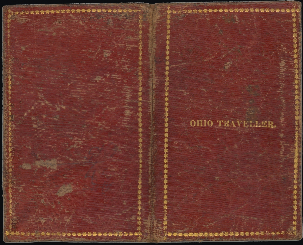
This map was prepared by Henry Schenck Tanner, engraved by Edward B. Dawson, and published in 1830. The inside cover provides insight into the map's provenance, appearing to include the name Stephen Madgin, the date June 15, 1831, and the location of 'Pitsburg.' Census and other historical records do note a Pennsylvania farmer born in 1797 (d. 1878) by that name, resident in Delaware County near Philadelphia.This map is quite scarce, noted in the OCLC among the holdings of six institutions: the Wisconsin Historical Society, Ohio History Connection, Oberlin College, the New York Public Library, Dartmouth College, and Harvard University. We are unaware of any instances of this map coming to the market in recent years.
CartographerS
Henry Schenck Tanner (1786 - May 18, 1858) was one of the preeminent American map engravers and publishers of the early 19th century - what is considered to be the "Golden Age of American Map Publishing". Born in New York City but based in Philadelphia, Tanner's forty plus year career was almost entirely focused on cartographic work. His earliest map work appears in conjunction with another important map publisher, John Melish. Early in his career, Tanner partnered with his brother Benjamin, to engrave extensively for Melish as well as other Philadelphia publishers including Lucas Fielding (Baltimore), A. Bourne, Jason Torey, Samuel Harrison, and Samuel Lewis, among others. In 1818 Tanner convinced his fellow publishers and partners to finance the compilation of a New American Atlas. The atlas was sold by subscription and slowly emerged between 1819 and 1823. The New American Atlas, possibly the pinnacle of 19th century American cartography and was commended in its day as "one of the most splendid works of the kind ever executed in this country". It was subsequently republished in several updated editions until about 1839. Tanner had by this time become the most active and influential map publisher in the United States. Around 1832, recognizing the market for a less cost prohibitive atlas, Tanner began work on the smaller format New Universal Atlas. This popular and important atlas went through numerous editions before being bought out by Carey and Hart, and then, in 1846, by S. A. Mitchell, who would rise to become the preeminent publisher of the next generation. In addition to these important atlases, Tanner also issued numerous extremely important and influential travelers guides, state maps, wall maps, and pocket maps. He should not be confused with his brother, also an America map engraver, the New Yorker Benjamin Tanner. More by this mapmaker...
Edward B. Dawson (fl. c. 1820 - 1830) was an American engraver active in Philadelphia during the middle part of the 19th century. Dawson engraved extensively for the mapmaking firm of Henry Schenck Tanner (1786 - 1858). Learn More...
Condition
Very good. Light wear along original fold lines. Creasing. Verso repairs at fold intersections. Closed edge tears professionally repaired on verso. Accompanied by original binder.
References
OCLC 26484602.