This item has been sold, but you can get on the Waitlist to be notified if another example becomes available, or purchase a digital scan.
1920 Arabic Blueprint Plan and Map of Damascus, Syria
OldDamascus-unknown-1920$1,000.00

Title
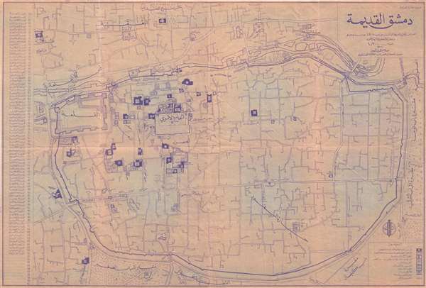
دمشق القديمةOld Damascus. /
1920 (undated) 26 x 38.5 in (66.04 x 97.79 cm) 1 : 2000
1920 (undated) 26 x 38.5 in (66.04 x 97.79 cm) 1 : 2000
Description
An unusual c. 1920 blueprint plan or map of Old Damascus, Syria. The blueprint is centered on the Mausoleum of Saladin and the Al Azm Palace. It extends to include that areas confined to the old walled city center and the area just north of the Barada River as far as the Attaouba Mosque. The map identifies some 80 historical sites within the old city numerically and with an associated table to the left of the map proper. All text is in Arabic. The purpose of the map is unclear, but it was mostly likely intended for city planning and historical preservation purposes.
Condition
Good. Overall age toning. Some minor water damage. Backed on archival tissue. Wear and minor repairs along original fold lines.