This item has been sold, but you can get on the Waitlist to be notified if another example becomes available, or purchase a digital scan.
1873 Gray Map of California, Nevada, and Oregon
OregonCaliforniaNevada-gray-1873$100.00

Title
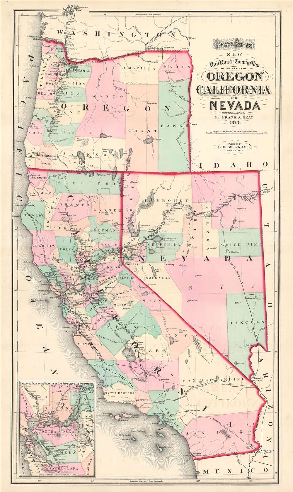
Gray's Atlas New Railroad and County Map of the States of Oregon California and Nevada.
1873 (dated) 26.5 x 15.5 in (67.31 x 39.37 cm) 1 : 2534400
1873 (dated) 26.5 x 15.5 in (67.31 x 39.37 cm) 1 : 2534400
Description
This is an 1873 Ormando Gray Map of California, Nevada, and Oregon. The map depicts the region from the Pacific Ocean to Idaho, Utah, and Arizona, and from Washington to Mexico. Published near the height of railroad expansion, the rail lines take center stage. The routes of the Central Pacific, Eastern Nevada, Southern Pacific, Atlantic and Pacific, Texas and Pacific, San Francisco and Northern Pacific, Napa Valley, Oregon and California, Oregon Central, and Northern Pacific Railroads are all illustrated and labeled. The Central Pacific Railroad, begun in 1862, constructed the western portion of the first transcontinental railroad, when it met the Union Pacific at Promontory Summit in the Utah Territory in 1869. Thus, rail travel at the forefront of the popular imagination when this map was published. Stops along all the routes are identified and distances between then are provided. Counties in California, Nevada, and Oregon are illustrated and labeled as well. They are also shaded different colors to allow for easy differentiation. An inset map of the vicinity of San Francisco and Sacramento is situated in the lower left corner. Much like the larger map, the inset map highlights the rail network in the area, complete with a most, if not all, of the stops along each route and the distances between them.
Publication History and Census
This map was drawn by Frank A. Gray and published by Ormando W. Gray, his father, in 1873. We are aware of only two examples in institutional collections. One is at the University of Nevada, Reno and the other is part of the David Rumsey Map Collection.Cartographer
Ormando Wyllis Gray (March 3, 1829 – July 6, 1912) was a mid to late 19th century map publisher with offices in New York City, Philadelphia, PA, and Danielsonville, Connecticut. Born in Townshend, Vermont, he attended Norwich College where he studied civil engineering and became a civil engineer and surveyor. Gray's first commercial atlas was an 1869 survey of Windhamd and Toland counties, Connecticut. His most important work seems to have been done in conjunction with other, more prominent map publishers, including Henry Walling and G.W. and C.B. Colton. Gray is best known for his state and county atlases, though did, with his sons, also independently issue at least two national atlases in the late 1870s. He retired from the map publishing business in 1890. He died at home in Bernardston, Massachusetts. He married Roxcena L. Arnold in 1851, with whom he had three daughters and one son. More by this mapmaker...
Source
Gray, O.W., Gray's Atlas of the United States with General Maps of the World Accompanied by Descriptions Geographical, Historical, Scientific, and Statistical. (Philadelphia: Stedman, Brown, and Lyon) 1873.
Condition
Very good. Even overall toning. Light wear along original centerfold. Verso repair to centerfold separation. Closed margin tears professionally repaired on verso. Blank on verso.
References
Rumsey 0310.081. OCLC 37899847.