This item has been sold, but you can get on the Waitlist to be notified if another example becomes available.
1976 U.S. Geological Survey Map of Kennedy Space Center, Florida
OrsinoFlorida-usgs-1976$150.00

Title
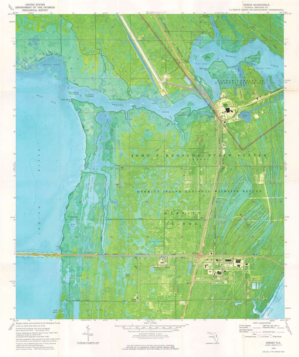
Orsino Quadrangle. Florida - Brevard Co. 7.5 Minute Series Orthophotomap.
1976 (dated) 26.5 x 22.25 in (67.31 x 56.515 cm) 1 : 24000
1976 (dated) 26.5 x 22.25 in (67.31 x 56.515 cm) 1 : 24000
Description
This is a 1976 U.S. Geological Survey topographic 'orthophotomap' map of John F. Kennedy Space Center in Florida. Sites around Kennedy Space Center are illustrated, including the Vehicle Assembly Building and the runway later used by the Space Shuttle. Launch Complex 39 is identified, along with the Crawler Causeway, but none of the launch pads themselves are within the depicted area. The visitor's center appears just below NASA Parkway West. Information concerning the map's creation is included below the bottom border.
What is an Orthophotomap?
An orthophotomap is an image made by compiling orthophotos. An orthophoto, also referred to as an orthophotograph or an orthoimage, is an aerial photograph or satellite image that has been geometrically corrected to a uniform scale. Orthophotos have been corrected for topographic relief, camera tilt, and lens distortion, making it possible to use orthophotos to measure true distances, unlike true aerial photographs. Orthophotomosaics are made by combining orthophotos, making it appear that every part of the image was taken from directly above, much like Google Earth. An orthophotomap is an orthophotomosaic complemented with additional data, such as a title, scale bar, direction, and other cartographic content.Publication History and Census
This map was created by the U.S. Geological Survey from 'aerial photograph taken January 18, 1976' and published in 1976. This map is not cataloged in OCLC and we note no other cataloged examples.Cartographer
The United States Geological Survey (1878 - Present), aka the U.S.G.S., is a scientific agency of the United States government, which was founded in 1879. USGS scientists study the landscape of the United States, its natural resources, and the natural hazards that threaten it. The organization has four major science disciplines: biology, geography, geology, and hydrology. It is a bureau of the United States Department of the Interior and is the department's only scientific agency. More by this mapmaker...
Condition
Very good. Light wear along original fold lines.