This item has been sold, but you can get on the Waitlist to be notified if another example becomes available, or purchase a digital scan.
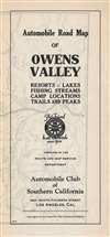
1930 Auto Club of Southern California Strip Map, Owens Valley
OwensValley-autoclubsocal-1930-2$100.00

Title
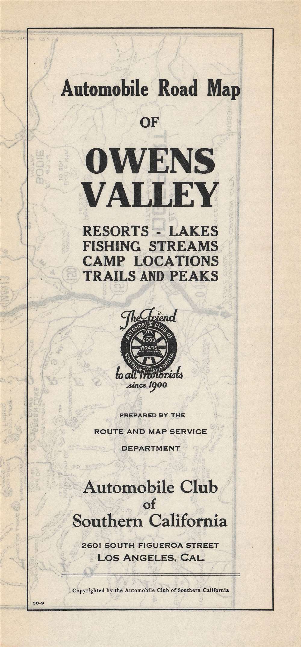
Automobile road map of Owens Valley : resort, lakes, fishing streams, camp locations, trails and peaks.
1930 (undated) 38 x 9.5 in (96.52 x 24.13 cm) 1 : 250000
1930 (undated) 38 x 9.5 in (96.52 x 24.13 cm) 1 : 250000
Description
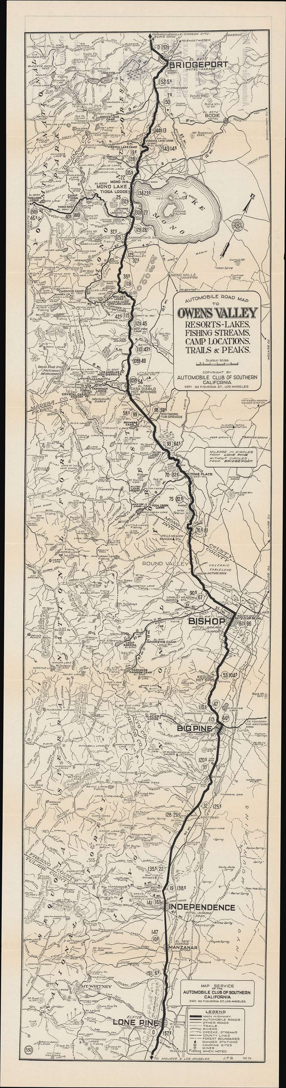
This is a rare c. 1930 Automobile Club of Southern California (ACSC) 'strip map' of the Owens Valley and nearby areas between Mono Lake and the Mojave Desert. It illustrates the route to the beautiful scenery of the Sierra Nevada Mountains, which were then becoming an increasingly popular and accessible tourist destination.
The route shown here follows the historic El Camino Sierra, later called the 'Sierra Highway' (today mostly S.R. 14 and U.S. Route 395). The previously little-known route was promoted as a scenic tourist highway in the early 20th century, but travel would still have been difficult when this map was published; not all roads were paved and travelers passed through rugged, even dangerous, terrains and climates.
Among the settlements that the road passes through is Manzanar, the site of the first internment camp for Japanese-Americans during World War II, which housed more than 10,000 people at its peak, mostly from the Los Angeles area. The camp's intense summertime heat and frigid nighttime winds were seared in the memories of former detainees, who worked tirelessly after the war to have the former camp designated a National Historic Site, which it was in 1992.
A Closer Look
This route depicted on this map skirts along the eastern edge of the Sierra Nevadas in Inyo and Mono Counties, passing near a series of famous lakes and mountains, as well as National Forests and Parks, including Sequoia, Sierra, and Yosemite. The numbers in circles along the route indicate distances from Lone Pine heading north, while the numbers not encircled denote distances heading south from Bridgeport. Lone Pine, Big Pine, and other towns along the route were and remain ideal for tourism purposes given their proximity to the natural wonders nearby.The route shown here follows the historic El Camino Sierra, later called the 'Sierra Highway' (today mostly S.R. 14 and U.S. Route 395). The previously little-known route was promoted as a scenic tourist highway in the early 20th century, but travel would still have been difficult when this map was published; not all roads were paved and travelers passed through rugged, even dangerous, terrains and climates.
Among the settlements that the road passes through is Manzanar, the site of the first internment camp for Japanese-Americans during World War II, which housed more than 10,000 people at its peak, mostly from the Los Angeles area. The camp's intense summertime heat and frigid nighttime winds were seared in the memories of former detainees, who worked tirelessly after the war to have the former camp designated a National Historic Site, which it was in 1992.
California Water Wars
The promotion of tourism to this region by the ACSC, based in Los Angeles, was unwittingly rather callous, as these areas had recently been dried out by the great thirst of the growing metropolis to the south. In the early 20th century, the rapidly expanding city of Los Angeles began to acquire land and water rights to build a long aqueduct across the Mojave Desert, which proved instrumental in the city's continued growth. Often using underhanded methods, the city diverted so much water from the Owens River and Owens Lake that the economy and ecosystem of Owens Valley was destroyed in a matter of years, causing farmers in the region to physically attack the aqueduct, including with dynamite. By 1926, Owens Lake had dried up completely and by the early 1940s Los Angeles also started to divert water that fed Mono Lake, setting it on the same course as Owens Lake before an 11th-hour conservation effort halted the lake's depletion. The 'California Water Wars,' fictionalized and immortalized in Roman Polanski's 1974 film Chinatown, set Los Angeles and Southern California on a path towards unsustainable suburban sprawl and water usage, which has also consumed much of the Colorado River.Publication History and Census
This map was made by 'J.F.B.' and 'W.N.,' the latter likely being W. A. Neely, of the ACSC around the year 1930. The ACSC produced dozens if not hundreds of these distinctive 'strip maps' or sectional road maps in the 1920s-1940s, but each was seemingly printed in a small run, and they are difficult to find today. This map is held by five universities in the United States and is scarce to the market. It appears to be very similar if not identical to a contemporaneous and equally rare map by the ACSC attributed to 'W.T.'Cartographer
The Automobile Club of Southern California (1900 - Present) is an auto club based in Los Angeles, California and an affiliate of the American Automobile Association (AAA). Founded in 1900, it was one of the first auto clubs in the United States and was dedicated to proposing traffic laws, improving road conditions, and the overall improvement of driving conditions. The Auto Club began producing its own maps in 1910, when it sent out its own team of cartographers to survey the state's roads. Its main office at the corner of Figueroa Street and Adams Boulevard was completed in 1923. Numbering nearly 8 million members in its home territory alone, today it is the largest single member of the AAA federation More by this mapmaker...
Condition
Very good.
References
OCLC 24445979.