This item has been sold, but you can get on the Waitlist to be notified if another example becomes available, or purchase a digital scan.
1943 Richard Edes Harrison Map of the Pacific From Three Perspectives
PacificOcean-harrison-1943$125.00

Title
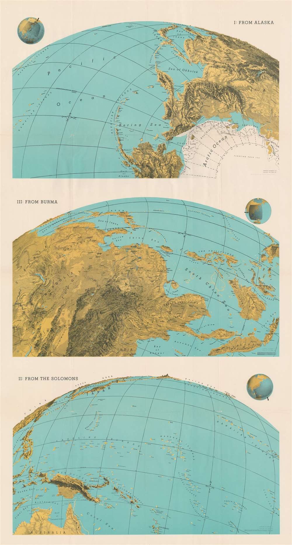
I: From Alaska. III: From Burma. II: From the Solomons.
1943 (dated) 46.5 x 25 in (118.11 x 63.5 cm)
1943 (dated) 46.5 x 25 in (118.11 x 63.5 cm)
Description
This 1943 Richard Edes Harrison map of the Pacific exemplifies his innovative spherical projection - successfully employed in countless WWII maps. Harrison uses the Pacific Ocean, an important World War II theater, to present his new cartographic paradigm. Here, Harisson exaggerates vertical topography to stand out prominently on land spherically projected to imitate a relief globe. The result leads the reader to interpret the often localized events on which he is focusing, from a global perspective. Today Google Earth and other mapping apps adopt a similar approach. Harrison's audience in 1943, obsessed with every detail about the global war, responded enthusiastically to his approach.
The Maps Themselves
Harrison divides the Pacific Ocean into three different views: from Alaska, from Burma, and from the Solomon Islands. Astute readers in 1943 would have recognized all three as critical World War II battlegrounds. By employing his spherical projection, Harrison conveys with more immediate visual accuracy and force the vastness of the Pacific. He labels many important locations in the Pacific War but does not clutter the map itself with notes about the war.Publication History and Census
This map was created in 1943 and published by FORTUNE Magazine. One example is cataloged in OCLC and is part of the collection at Pennsylvania State University. A collection stamp from the Ashtabula Public Library in Ohio appears on the verso. We have contacted the library and confirmed that it was legally deaccessioned in the 1990s.Cartographer
Richard Edes Harrison (1902 - January 5, 1994) was an American cartographer and cartoonist active in the middle part of the 20th century. Harrison is credited with redefining cartography, especially journalistic cartography, by employing spherical perspective, bold shading, and graphic design to both make maps more publicly accessible and give them an artistic dimension. Harrison was born in Baltimore and studied design at Yale, graduating in 1923, before relocating to New York City at the height of the Great Depression. He made ends meet through industrial design work, creating everything from bottles to ashtrays. His first foray into the cartographic world was a fill-in job at Fortune magazine. The editors at Fortune must have admired his work for it launched a long-standing collaboration. His work, doubtless inspired by the age of air travel, became exceptionally popular during World War II, where his unique approach and political charged subject matter illustrated the seats of war with exceptional poignancy and clarity. After the war, Harrison continued to produce maps from his base in New York City. In his spare time he was an avid ornithologist and was commonly seen in Central Park in search of rare bird sightings. More by this mapmaker...
Condition
Very good. Exhibits slight wear along original fold lines. Blank on verso.
References
OCLC 45886353.