This item has been sold, but you can get on the Waitlist to be notified if another example becomes available, or purchase a digital scan.
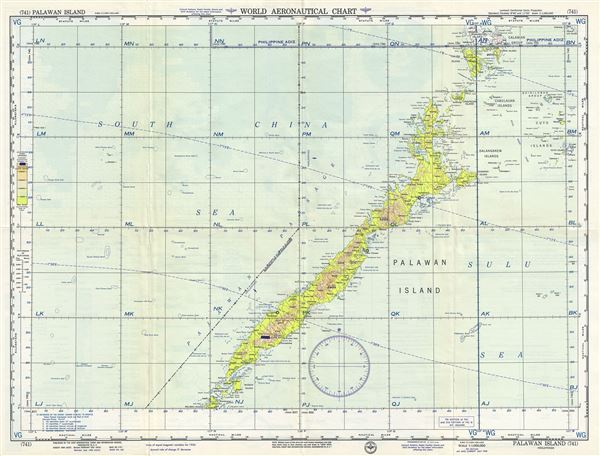
1958 U.S. Air Force Aeronautical Chart or Map of Palawan Island, Philippines
PalawanIsland-usaf-1958$50.00

Title
Palawan Island Philippines.
1958 (dated) 22 x 29 in (55.88 x 73.66 cm) 1 : 1000000
1958 (dated) 22 x 29 in (55.88 x 73.66 cm) 1 : 1000000
Description
This is a fine 1958 U.S. Air Force aeronautical chart or map of Palawan Island of the Philippines. It covers the islands in the Palawan Province from Balabac Island north as far as Busuanga Island. The chart notes cities, rivers, islands, topography and other data essential to the air pilot. Verso features legends and a world aeronautical chart index. This chart was published by the USAF Aeronautical Chart and Information Service, Washington 25, DC, and issued as chart no. 741. First issued in 1948, this is the eight edition revised to July 1958.
Condition
Very good. Minor wear and toning along original fold lines. Minor spotting.