This item has been sold, but you can get on the Waitlist to be notified if another example becomes available, or purchase a digital scan.
1942 G. Frederick Owen Bird's Eye View Map of Palestine
Palestine-owen-1942$900.00


Title
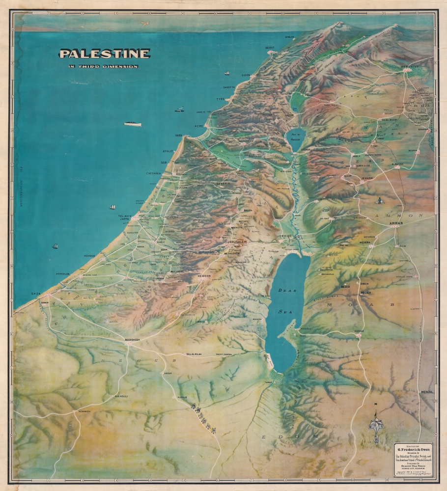
Palestine In Third Dimension.
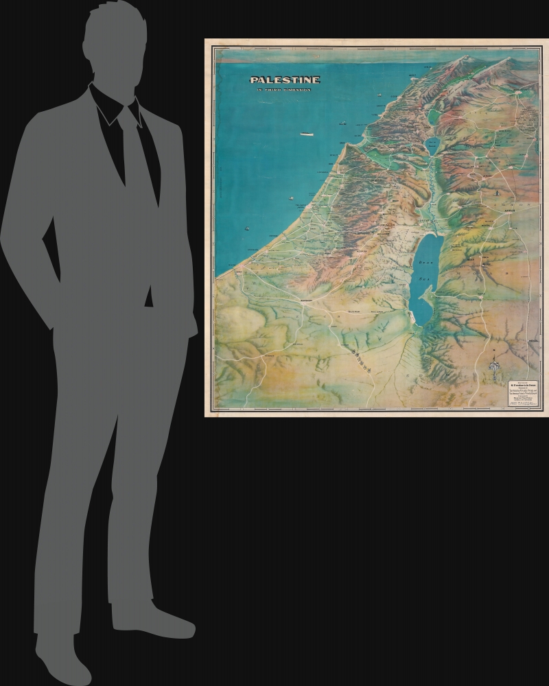
1942 (dated) 41.25 x 37.5 in (104.775 x 95.25 cm)
1942 (dated) 41.25 x 37.5 in (104.775 x 95.25 cm)
Description
This is a 1942 G. Frederick Owen bird's-eye view map of British Mandatory Palestine. It was published six years before the creation of modern Israel during a period of academic renaissance in 'Holy Land Studies' and a Zionist resurgence.
At the same time the British Palestine Mandate also allowed for a resurgence of Zionism. Jewish immigration to the Holy Land, as well as Zionist land purchases, were no longer restricted. Moreover, Jewish persecution in Europe inspired the call for a 'Jewish National Home'. Under the Mandate, Zionist activity grew to such a degree that it was one of the primary motivations for the Arab Revolt (1936 - 1939).
Historical Context: Academic Renaissance - and Zionism
The map coincides with an emerging scientific and historical fascination with the Holy Land following its takeover by the British. Under the Ottomans, foreign, particularly Christian and Jewish visits to the Holy Land were restricted, but under the British Mandate, the borders opened. Scholars flooded to Jerusalem and other Palestinian cities, where a kind of academic renaissance led to a wealth of archeological and historical studies. Owen, the map's maker was member or two such organizations that were leading forces behind much of this research, the Palestine Oriental Society and the American School of Oriental Research.At the same time the British Palestine Mandate also allowed for a resurgence of Zionism. Jewish immigration to the Holy Land, as well as Zionist land purchases, were no longer restricted. Moreover, Jewish persecution in Europe inspired the call for a 'Jewish National Home'. Under the Mandate, Zionist activity grew to such a degree that it was one of the primary motivations for the Arab Revolt (1936 - 1939).
A Closer Look
The view looks north, the Dead Sea and Gaza appear in the foreground, while in the distance Qurnat as Sawdā (Kornet-es-Sandra) and Mount Hermon are recognizable. Jerusalem, Tel Aviv, Jaffa, Bethlehem, Nazareth, Jericho, Haifa, Acre, Tyre, Beirut, Sidon, Damascus, and Amman are identified. The Sea of Galilee and the River Jordan are illustrated. Topography is represented pictorially.British Mandatory Palestine in 1942
Mandatory Palestine was established in 1920, following World War I (1914 - 1918). During the First World, an Arab uprising against Ottoman rule and the British Empire's Egyptian Expeditionary Force drove the Ottoman Turks out of the Levant. The British initially agreed to honor Palestinian independence, but ultimately took full control of the region. The Mandate had mixed results. It led to a American and European academic and religious activity, unchecked Zionist land purchases and immigration, and a rise in Arab nationalism. Three years after the beginning of World War II (1939 - 1945) and the end of the Arab Revolt (1936 - 1939), Mandatory Palestine was in tumult. The Arab Revolt called for the end of British administration and Arab independence in Palestine, as well as a cessation of open-ended Jewish immigration. Although the revolt was suppressed, Arab resentment towards both Western powers and Zionists only increased, contributing to many of the issues that plague Israel today.A Divided Land
Arabs in Palestine generally held conflicting sympathies. The British had, only a few years before, violently put down the revolt, but Nazi racial theories did not hold Arabs in particularly high regard. Palestinian Jews supported the British war effort even as they fought against them for the establishment of a Jewish state.Publication History and Census
This map was edited by G. Frederick Owen and published by Beacon Hill Press of Kansas City in 1942. An empty OCLC record exists for this map, suggesting that a former OCLC member institution created the entry. We note only a handful of instances when this map has appeared on the private market.CartographerS
George Frederick Owen (March 13, 1897 - June 24, 1987) was an American evangelist, cartographer, archaeologist, teacher, author, and world traveler. Owen was born in Texas and received a bachelor's degree from Vanderbilt University and a master's degree from George Washington University. He was a member of the American School of Oriental Research of Jerusalem. He lived in Jerusalem for a time. He wrote many books and was considered an expert on the Dead Sea Scrolls. Owen made at least to bird's eye view maps of the Holy Land: one of Palestine and one of Jerusalem. He participated in several archaeological digs in the Holy Land. He was married to his wife Byrdie. He died in Colorado Springs, Colorado. More by this mapmaker...
Beacon Hill Press of Kansas City (1912 - 2014) was the primary imprint of the Nazarene Publishing House (NPH) (the publishing arm of the Church of the Nazarene), which is the world's largest publisher of Wesleyan-Holiness literature. Founded in 1912 after the Third General Assembly of the Church of the Nazarene, the Nazarene Publishing House was formed by the merger of three independent publishing houses that were operated by the Church. NPH published the Herald of Holiniess, a weekly paper, from 1912 until 1999, when it was discontinued in favor of a new publication, Holiness Today. The Church of the Nazarene's Board of General Superintendents announced in October 2014 that NPH would shut down. However, that decision had changed by November in favor of a restructuring. NPH began a rebranding process in 2017 and became known as The Foundry Publishing, under which name it is operating today. Learn More...
Condition
Average. Dampstaining to top and left side. Closed tear extending two (2) inches through printed area to the right of Beirut reinforced on verso. Some cracking.
References
OCLC 234122910.