This item has been sold, but you can get on the Waitlist to be notified if another example becomes available, or purchase a digital scan.
1949 Boucher Pictorial Map of Paris
Paris-lucienboucher-1949$62.50

Title
Paris.
1949 (undated) 5 x 8 in (12.7 x 20.32 cm)
1949 (undated) 5 x 8 in (12.7 x 20.32 cm)
Description
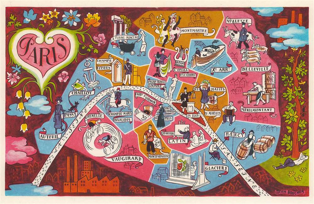
This is a c. 1949 Lucien Boucher pictorial map of Paris, France. Pictorial vignettes illustrate Paris's most famous neighborhoods, including Saint-Germain-des-Prés, Champs-Elysées, Belleville, Menilmontant, Le Marais, and the Quartier Latin. Moulin Rouge showgirls can-can in Montmartre and a tourist admires the Venus de Milo in the Louvre. A canal boat plies the waters of the Canal Saint Martin and a military officer appears on horseback in Champ-de-Mars-Invalides. The Seine curves through Paris and the city is surrounded by a beautiful pictorial border.
Publication History and Census
This map was created by Lucien Boucher and published c. 1949 in Doré Ogrizek's Paris tel qu'on l'aime. Separate examples of the map are rarely seen on the market, but the book appears from time to time. The book is well represented in institutional collections.Cartographer
Lucien Boucher (1889 - 1971) was French cartoonist, artist, writer, and illustrator. Boucher was born in Chartres in 1889 and graduated from the École de Céramique de Sèvres. His work as a cartoonist appeared in the humorous weekly Le Rire. Starting in the 1920s he produced numerous pictorial posters inspired by the commercial promise of surrealism. Among them were a series of surrealistic planispheric and celestial maps drawn to illustrate the transportation networks of Air France. More by this mapmaker...
Source
Ogrizek, D., Paris tel qu'on l'aime, (Paris: Editions Ode) 1949.
Condition
Very good. Light wear along original centerfold. Miniscule areas of loss along centerfold where once bound into volume. French text on verso.