1942 SERP Tourist Map of Paris during German Occupation
Paris-serp-1942-2$500.00

Title
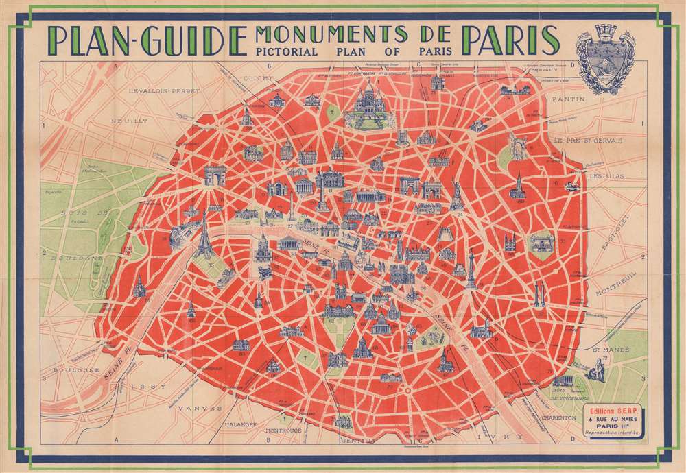
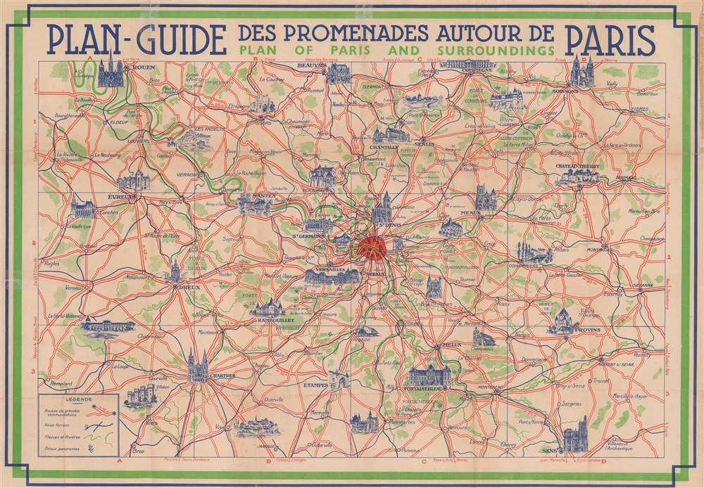
Plan-Guide Monuments de Paris. Pictorial Plan of Paris. / Plan-Guide des Promenades Autour de Paris. Plan of Paris and Surroundings.
1942 (undated) 16 x 22.5 in (40.64 x 57.15 cm)
1942 (undated) 16 x 22.5 in (40.64 x 57.15 cm)
Description
A striking art deco style c. 1942 map of Paris issued during the World War II German occupation of Paris. The map is printed on both sides. The recto features a classic map of central Paris highlighted in bright red. Following in the monumental style popular for Paris guides from as early as the late 19th century, the map illustrates important touristic sites in profile - in this case in bright blue. The verso features a map of the greater region around Paris, covering from Rouen to Sens, and from Rémalard to Soissons. Like the city plan, important buildings and chateaux are highlighted in bright blue profile.
German Occupation
Nazi Germany invaded France in May of 1940. The French were quickly overrun, and Paris was captured. The British urged the French to fight street-to-street, but the French, not desiring to see their beautiful city in ruins, surrendered. The government went into exile and the Nazi's took over completely, instituting their particular brand of horror on the City of Lights. Paris was liberated along with the rest of France in August of 1944. We are not sure why a tourist map of Paris was issued during the occupation when tourism reached an all time low.Publication History and Census
The map was issued by Éditions Greff (S.E.R.P.) Paris and prepared by Fernand Saimond.Condition
Good. Verso repairs to fold separations. Some glue residue on verso, near top right border.
References
OCLC 27084524.