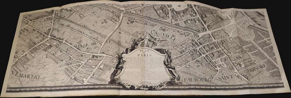
1739 Bretez / Turgot Map of Paris
Paris-turgot-1739-2$21,000.00

Title
Plan de Paris Commence l’Annee 1734.... Leve et Desine par Louis Bretez Grave par Claude Lucas / Et Ecrit par Aubin.
1739 (dated) 96 x 124 in (243.84 x 314.96 cm) 1 : 1800
1739 (dated) 96 x 124 in (243.84 x 314.96 cm) 1 : 1800
Description
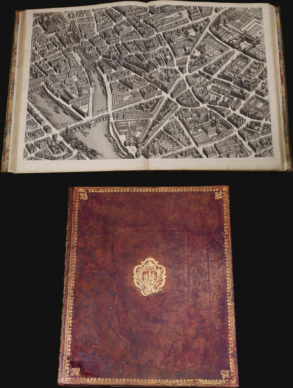
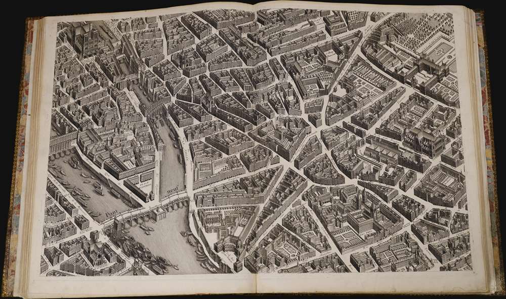
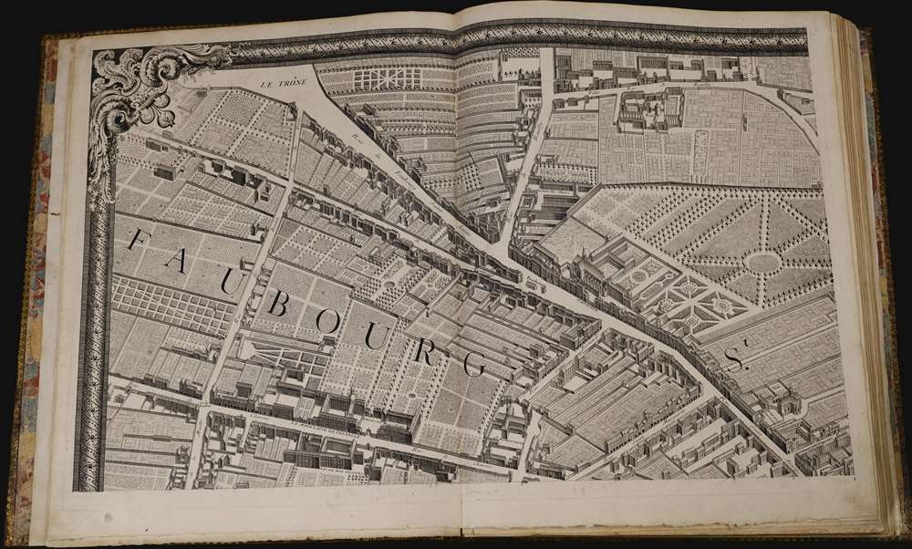
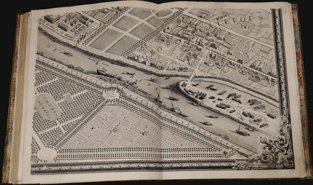
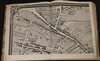
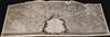
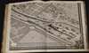
This is Louis Bretez and Michel-Etienne Turgot's monumental 1739 map of Paris, in a beautiful, bound example. Turgot's map of Paris - possibly the most ambitious urban mapping ever undertaken - shows the whole of 18th century Paris, offering an unparalleled view of the city prior to the 19th century redesign by Baron Georges Eugène Haussmann: every structure within the city at the time is here depicted. Turgot, who held the mayor-like office of Prevôt des Marchands de Paris , commissioned Louis Bretez and Claude Lucas to produce this map. Oriented to the east on an axonometric projection, this map is best understood as an aerial view in which every building, window, tree, shadow, and park are shown from an equidistant aerial perspective. In order to produce the thousands of sketches and surveys required to complete this map, Bretez was issued a permit to enter every building in Paris. It took the team nearly five years of exhaustive sketching and surveying to assemble this masterpiece.
A Monumental Achievement
With unprecedented access to the properties of Paris and an official mandate, Bretez achieved outstanding detail and accuracy. The buildings of Paris are presented as one would have seen them at the time. The Louvre, the Tuileries Garden, Notre Dame Cathedral, and the Champs Élysées can all be easily recognized. The Bastille, the flashpoint of the French Revolution which would start 58 years later, is depicted as well.Publication History
The Turgot map, as it is commonly known, was first issued in 1734. It consisted of twenty individual sheets that can be assembled into a massive and striking display roughly 10 by 8 feet (316 x 245 centimeters).CartographerS
Louis Bretez (fl. 1700 - 1740) was French born sculptor and painter active in the early 18th century. Bretez was a member of the Academie Royale de Peinture et Sculpture in Paris where he specialized in perspective with regard to architecture. Bretez's greatest achievement was his production, with Claude Lucas, of the monumental Turgot Plan of Paris. This spectacular map, one of history's greatest achievements of urban cartography, occupied Bretez from 1734 to 1739. It depicts Paris from a bird's eye perspective with extraordinary detail to the level of individual buildings and trees. More by this mapmaker...
Michel-Étienne Turgot (1690-1751) a French businessman and civil administrator in the first half of the 18th century. From 1729 to 1740 he held the mayor-like office of Prévôt des Marchands de Paris ("Master of the merchants of Paris") under King Louis XV. Turgot's greatest claim to fame is his commissioning of Louis Bretez to assemble the spectacular Turgot Plan of Paris, one of the greatest feats of urban cartography ever undertaken. Turgot's more famous son, Anne-Robert-Jacques Turgot, attained prominence as a statesman and economist under Louis the XVI. Learn More...
Condition
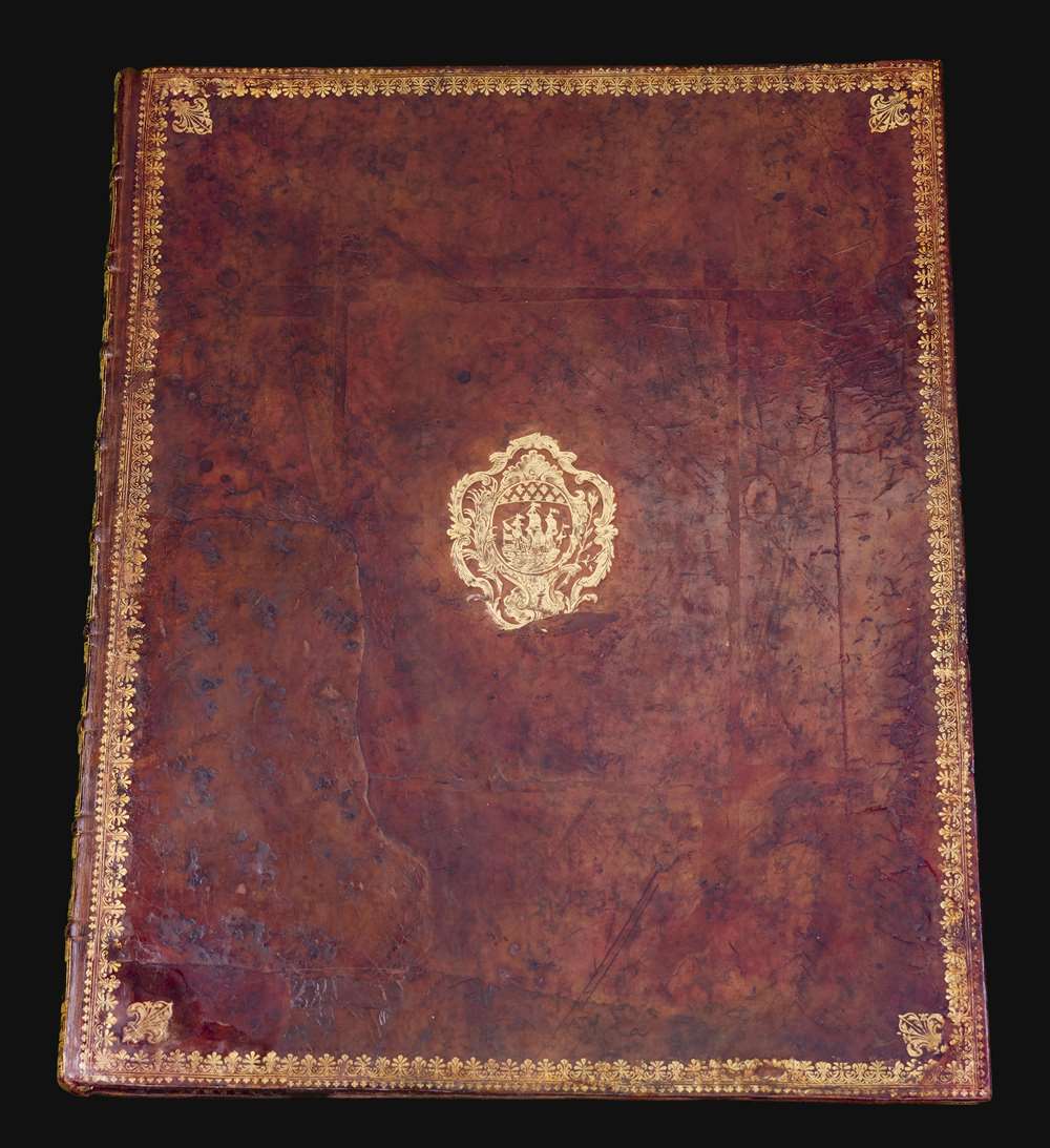
Very good condition. Large folio Bound in calf, gold-tooled on spine; with 21 plates on heavy paper numbered 1-20 (two joined and folding) and one key plate. Minor dampstaining to a few rear pages, isolated to margins, else a beautiful, bright example. (Size given is for entire plan if joined.)
References
OCLC 1294227. Rumsey 10553. Boutier, J, Les Plans de Paris, 219.