This item has been sold, but you can get on the Waitlist to be notified if another example becomes available, or purchase a digital scan.
1924 Leconte Map or Plan of Paris w/Monuments and Map of Versailles
ParisEtSesMonuments-leconte-1925$125.00

Title
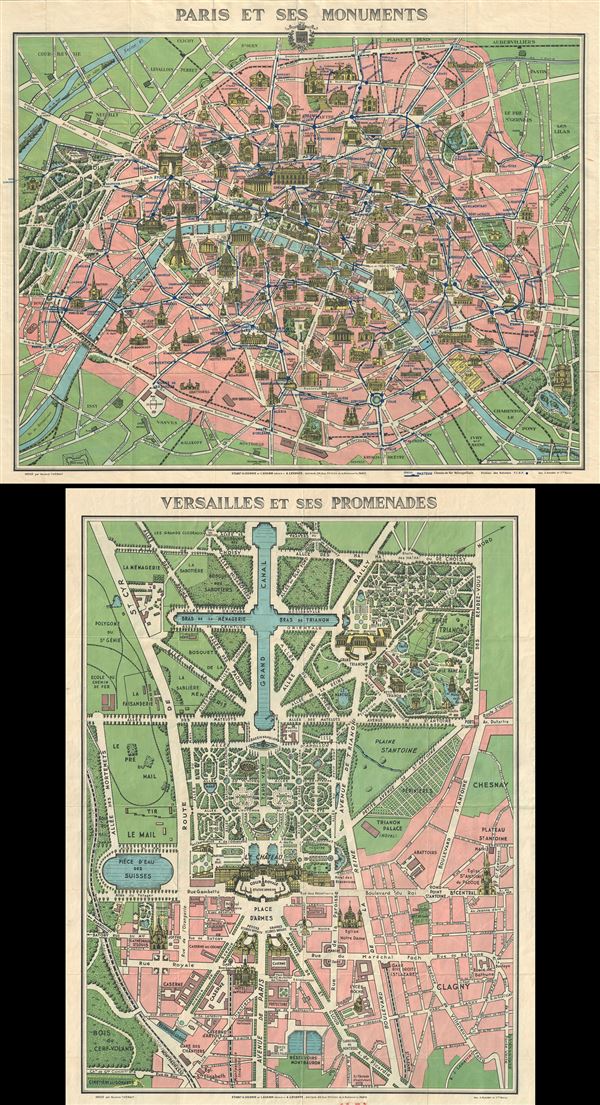
Paris et ses Monuments.
1925 (undated) 22 x 27.5 in (55.88 x 69.85 cm) 1 : 230000
1925 (undated) 22 x 27.5 in (55.88 x 69.85 cm) 1 : 230000
Description
This is an extremely attractive c.1925 tourist pocket map of Paris, France. It covers the old walled city of Paris and the immediate vicinity. Drawn in a lavish art deco style with important buildings shown in profile, including the Eiffel Tower, the Arc de Triomphe, Sacre-Coeur, the Pantheon, and others. Shows both the train and Metro lines throughout the city. This map was issued in various editions from, roughly 1900 to 1937. Most examples, like this one, are undated but we can estimate an approximate date based upon the development of the Metro. This example is also exceptional in that it features a pan of Versailles on the verso. Engraved by Maurice Thiebaut and printed by A. Humblot. Published by A. Leconte and L. Guilmin, of 38 Rue St. Croix de la Bretonnerie, Paris. The image above shows both the front and back of a single sheet.
CartographerS
André Leconte (fl. 1880 - 1930) was a Paris based guidebook and map publisher active in the latter part of the 19th and early 20th centuries. He is one of the publishers of the attractive art nouveau style "Nouveau Paris Monumental" series. Leconte is often associated with L. Guilmin, another Paris based map publisher of the same period. Early in World War II (1939 - 1945) the firm published anti-German propaganda, but briefly shut down operations during the occupation. Leconte's name appears on maps and guidebooks of Paris well after his death (though we can't date this event with any precision) to about 1980. More by this mapmaker...
L. Guilmin (fl. c. 1890 - c. 1933) was a French map and book publisher active in the late 18th and early 19th century. Guilmin has a large corpus of work, but remains personally obscure. His maps begin appearing in the 1890s and continue to appear until the 1930s. He is sometimes associated with A. Leconte and L. Joly, two other prominent Parisian publishers of the period. At various time he had offices at 90 Boulevard Voltaire, 63 Boulevard Voltaire, and 38 Rue Sainte-Croix-de-la-Bretonnerie. Learn More...
Condition
Very good. Minor wear along original fold lines. Map of Versailles on verso.