This item has been sold, but you can get on the Waitlist to be notified if another example becomes available, or purchase a digital scan.
1958 U.S. Air Force Aeronautical Map of Northern Malaysia (Malay) w/ Penang
PenangIsland-usaf-1958$50.00

Title
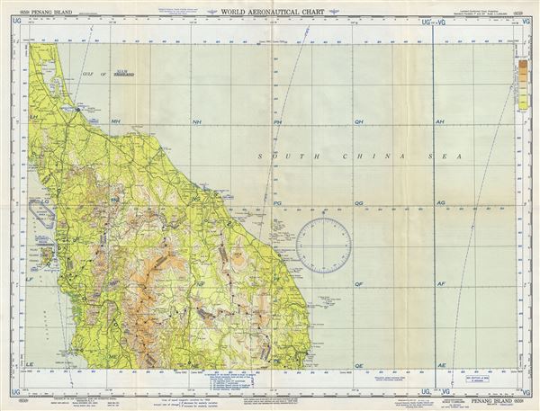
Penang Island Malaya-Thailand.
1958 (dated) 22 x 29 in (55.88 x 73.66 cm) 1 : 1000000
1958 (dated) 22 x 29 in (55.88 x 73.66 cm) 1 : 1000000
Description
This is a scarce 1958 U. S. Air Force aeronautical chart or map of northern Malaysia and southern Thailand on the Malay Peninsula. Focusing on Penang Island, it covers from Thale Luang in Thailand south to Pulau Pangkor in Malaysia. The chart notes danger areas, roads, cities, rivers, lakes, islands, topography and other data essential to the air pilot. Verso features legends and a world aeronautical chart index. This chart was published by the USAF Aeronautical Chart and Information Service, Washington 25, DC, and issued as chart no. 859. First issued in 1945, this is the seventh edition revised to March 1958.
Condition
Very good. Minor wear and toning along original fold lines. Minor spotting.