This item has been sold, but you can get on the Waitlist to be notified if another example becomes available, or purchase a digital scan.
1925 Reading Railway Map of New Jersey and Pennsylvania
PennsylvaniaNewJersey-readingrailway-1925$325.00

Title
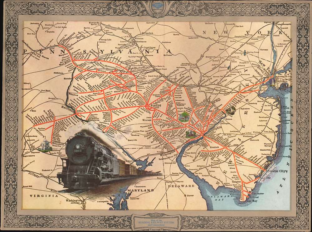
Map of the Reading Railway System and Connections.
1925 (undated) 11.5 x 15.5 in (29.21 x 39.37 cm) 1 : 1300000
1925 (undated) 11.5 x 15.5 in (29.21 x 39.37 cm) 1 : 1300000
Description
This is a c. 1925 Reading Railroad promotional tourist map of Pennsylvania and New Jersey highlighting the Reading Railroad's network. The map was issued to promote the Locomotive 2009, then the largest and fastest locomotive ever constructed and key to the Reading Railroad's high-speed service.
A Closer Look
Coverage embraces from Poughkeepsie, New York, and Towanda, PA, south as far as the Delaware Bay and Washington DC, thus encompassing the primary operations area of the Reading Railroad, a major conduit of Pennsylvania anthracite coal during the Industrial Revolution. The Reading's network is highlighted in red, with stops labeled. The map was likely created to promote railway tourism, as large type marks tourist destinations such as Atlantic City, New York, and Philadelphia, with a spur line to Gettysburg. Vignettes illustrating the Statue of Liberty and Independence Hall brighten the piece, but 'Locomotive 2009' is the focal point. 2009 blasts its way toward the viewer on the bottom right of the page, promoting the Reading's newest and fastest service.The Reading Railroad
The Reading Company, known as the Reading Railroad and branded as Reading Lines, operated in Pennsylvania and the surrounding region from 1924 until 1976. The Reading Company succeeded the Philadelphia and Reading Railroad, founded in 1833. Most of the Reading's cargo was anthracite from Pennsylvania's coal region, but they did offer some short-haul passenger services. The Reading Company filed for bankruptcy in 1971 after years of dwindling profits due to the rise of the interstate road system and the cheap cost of truck shipping. Today, it is immortalized as one of Monopoly's four railroads.Dating the Map
The Locomotive 2009 allows us to pinpoint this map's publication within a few years. Locomotive 2009 was an I-10-S A locomotive built by the Baldwin Locomotive Works. Baldwin built 20 of these locomotives for the Reading Railroad in 1923. They were the heaviest locomotives ever constructed up to that time, tipping the scale at 314,950 pounds. Based on this information and the fact that railroads usually promoted their newest equipment, as well as the printing style, we have dated the piece to c. 1925.Publication History and Census
This map was created for and published by Reading Lines c. 1925. This is the only known example.Condition
Good. Minor repairs to left and right sides and at top center where old framing caused slight damage.