This item has been sold, but you can get on the Waitlist to be notified if another example becomes available, or purchase a digital scan.
1780 Schley Map of the Kingdoms of Peraea and Bashan
Peraea-schley-1780$150.00

Title
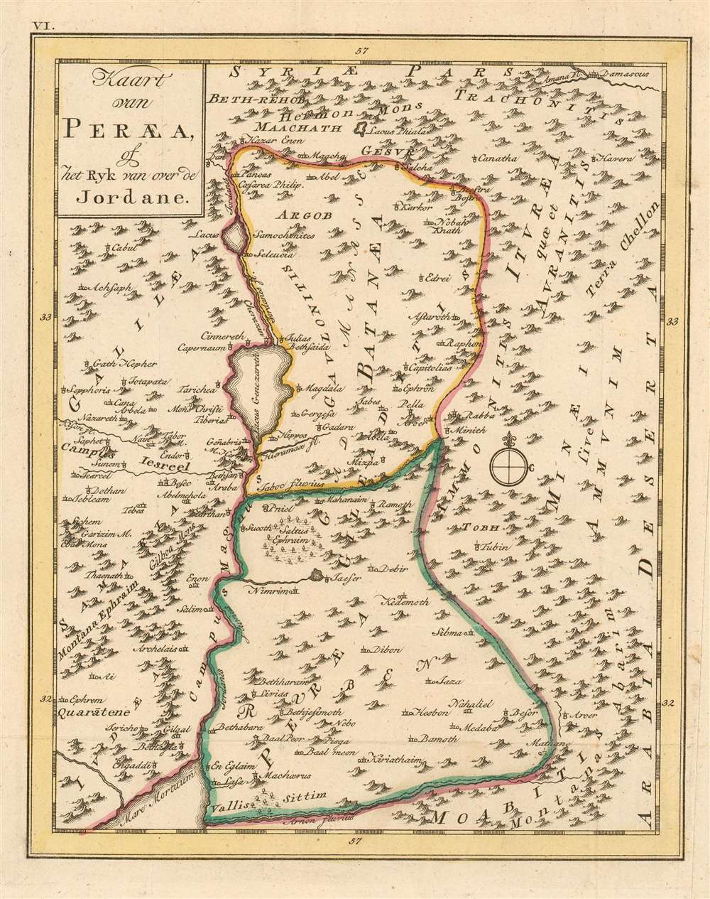
Kaart van Peraea, of het Ryk van over de Jordane.
1780 (undated) 9 x 7 in (22.86 x 17.78 cm)
1780 (undated) 9 x 7 in (22.86 x 17.78 cm)
Description
This rare 1780 map of the Kingdom of Peraea presents the region of modern-day Israel, Jordan and Syria. the map is centered on the course of the River Jordan, from its sources north of the Sea of Galilee to the Dead Sea. The map includes Galilaea and Samaria to the west but focuses on Peraea and Batanaea. These were both the domains of Herod the Great in the first century C.E. The map's topography is based on contemporary cartographic data, but it was not intended to depict the 18th century Near East: rather, the place names are drawn from Biblical sources, reinforced with geographical data of ancient geographers - in particular Pliny the Elder, and Josephus.
Publication History and Census
This map was engraved by Jacob van der Schley for Martinus de Bruyn's Bybelsche huis en zak-Atlas, an atlas of fifteen maps intended to accompany Johan Jacob Schmidt's 1776 Bybelsche Geögraphicus . The atlas was not produced until 1780 and was relegated to a small, solitary edition. Consequently all of the maps of the atlas are rare. OCLC shows only nine examples of the zak-Atlas in institutional collections. No separate copies of this map are listed in OCLC, and we do not see any examples in catalogue or auction records.Cartographer
Jacob Van der Schley (1715 - 1779) was a prominent Amsterdam engraver and draftsman based out of Amsterdam. Schley apprenticed under portrait engraver Bernard Picart, whose style he imitated. He is said to have completed several of Picart's portraits following his master's death. While Schley is primarily known for his work as a portraitist and illustrator, he also has a considerable cartographic corpus. He is known to have worked with Bellin, Hondt, and Provost, among others. More by this mapmaker...
Source
De Bruyn, Martinus Bybelsche huis en zak-AtlasAmsterdam, 1780.
Condition
Very good condition; right margin extended, not affecting printed image. A bold strike with original outline color.
References
Not in OCLC