This item has been sold, but you can get on the Waitlist to be notified if another example becomes available, or purchase a digital scan.
1944 Army Map Service Map of the Philippines During World War II
Philippines-ams-1944$600.00

Title
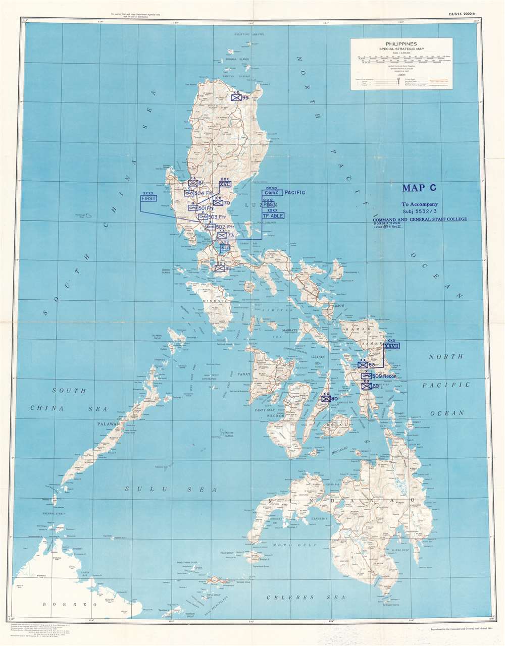
Philippines Special Strategic Map. Map C to Accompany Subj 5532 / 3 Command and General Staff College.
1944 (dated) 35 x 27 in (88.9 x 68.58 cm) 1 : 2000000
1944 (dated) 35 x 27 in (88.9 x 68.58 cm) 1 : 2000000
Description
This is a 1944 Command and General Staff School map of the Philippines. Created during World War II by the Army Map Service, this map was repurposed by the Command and General Staff School likely for use in a class at the Command and General Staff College. Standard military map symbols identify units on Luzon, Leyte, and Cebu. While many of these units, such as the 70th Infantry Division, the 83rd Infantry Division, the 89th Infantry Division, and the 504th Fighter Squadron, saw combat in World War II, all were deployed in the European theater in 1944 and 1945. Task Force Able did serve in the Pacific and was the first unit to enter Tokyo Bay. However, it was not organized until August 1945. Other units, such as the 27th Corps, never existed. This leads us to speculate that this map was used as part of a hypothetical training exercise at the Command and General Staff College. Unfortunately, we have been unable to locate any information concerning the specific course or exercise.
Publication History and Census
This map was first created by the Army Map Service in 1943 before it was repurposed by the Command and General Staff School in 1944. This is the only known surviving example.Cartographer
The Army Map Service (AMS) (1941 - 1968) was the military cartographic agency of the U.S. Department of Defense and part of the U.S. Army Corps of Engineers. The AMS compiled, published, and distributed military topographical maps and other related materials for use by the U.S. Armed Forces. They also prepared maps for space exploration, intelligence reports, and the establishment of world geodetic control networks. Formed during World War II, by the end of the war the Army Map Service had prepared 40,000 maps. 3,000 different maps were created for the Normandy invasion alone. The AMS was instrumental in the Korean War and the Vietnam War, and during all three of these conflicts distributed tens of millions of maps to U.S. servicemen. On September 1, 1968, the AMS was resdesignated the U.S. Army Topographic Command, and continued under this name as an independent organization until January 1, 1972 when it was merged with the new Defense Mapping Agency and renamed the DMA Topographic Center. The Defense Mapping Agency was added to the National Imagery and Mapping Agency on October 1, 1996, which was redesigned the National Geospatial-Intelligence Agency in 2003. More by this mapmaker...
Condition
Very good. Exhibits wear and toning along original fold lines. Verso repairs to fold separations. Blank on verso.