1944 Showa 19 Japanese Map of the Philippines during World War II
PhilippinesManila-kawamata-1944-3$2,400.00


Title
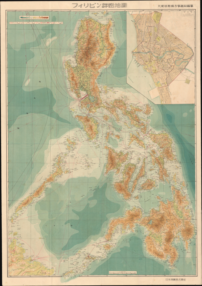
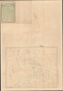
フィリピン詳密地圖 / Detailed Map of the Philippines. / Firipin shomitsu chizu.
1944 (dated) 42 x 28.5 in (106.68 x 72.39 cm) 1 : 1500000
1944 (dated) 42 x 28.5 in (106.68 x 72.39 cm) 1 : 1500000
Description
This is Kawamata Tetsuya's rare 1944 (Showa 19) Japanese large-format map of the Philippines, issued just 5 days after the WWII Philippines Campaign (1944 - 1945) began. The map is an expansion on a similar map issued for the 1942-43 'Greater East Asia Co-Prosperity Sphere' map series, which it stylistically resembles despite being four times the size. (See our listing coprosperityset-showa18-1943 for more detail on this series.) This map was issued to satisfy an increased Japanese need for information and reconnaissance following General Douglas MacArthur's landing at Leyte.
A Closer Look
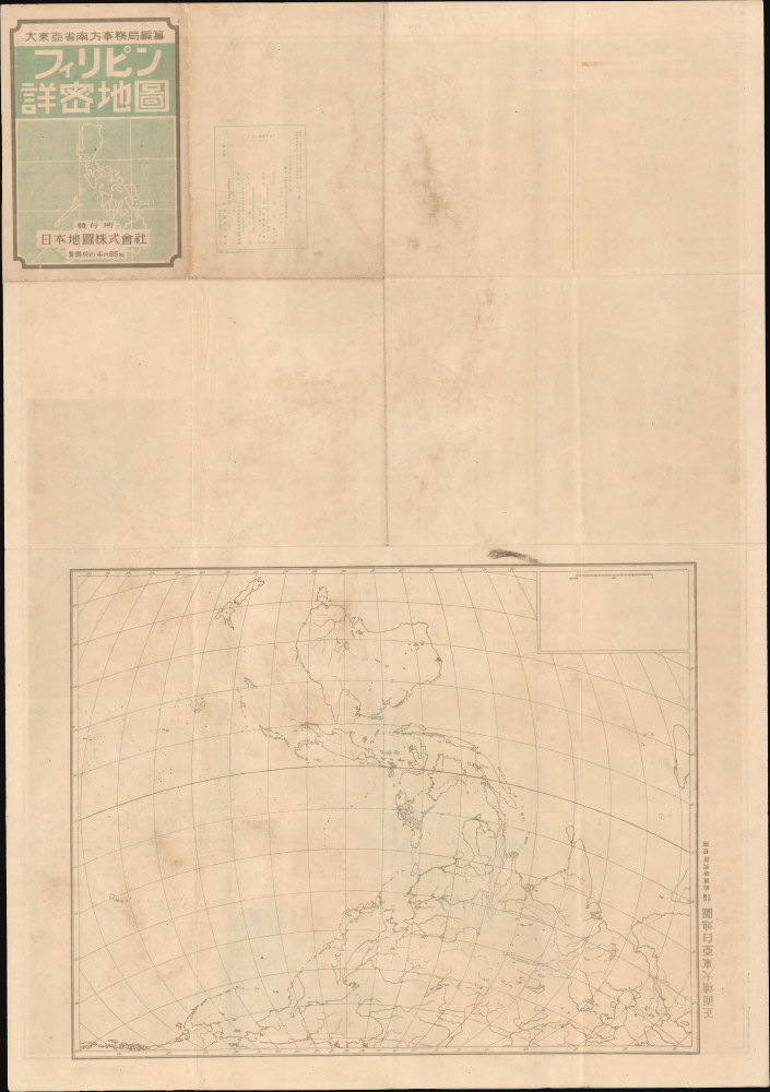
Despite its stylistic similarity to the earlier map series, the present offering is a separate issue. The map features detailed topographic information throughout. It also employs shading to illustrate undersea depths. Most text is in Japanese, but some island names are identified in English, suggesting that the source material for this map may have been British or American. There is a large inset of Manila in the upper right quadrant; the city would be heavily damaged in the course of the Philippines Campaign, leaving it one of the most destroyed cities of the entire war in any theater. The verso includes a large skeleton map of the greater East Asia region (正面積大東亞白地圖), perhaps meant to be filled in on potential later editions of the map or to be utilized by the map's owner.The Philippine Campaign
Launched on October 20, 1944, the Philippine Campaign was a World War II joint American and Filipino military operation intended to liberate the Philippine Islands from occupying Imperial Japanese forces. The Japanese Army overran most of the Philippines during the first half of 1942, retaining it for the subsequent 2 years. American General Douglas MacArthur began the campaign by announcing on Philippine radio 'This is the Voice of Freedom, General MacArthur speaking. People of the Philippines: I have returned.' The campaign progressed rapidly, driving the Japanese out of one island after another. Although by this time the Japanese were clearly losing the war, they gave no sign of capitulation and refused to surrender. During the campaign, Japan suffered nearly half a million casualties, compared to only about 50,000 Americans and an unknown number of Filipino guerrilla fighters, and surviving Japanese troops suffered from widespread hunger and disease. The civilian toll of the campaign was also significant, especially in the brutal battle for Manila in February and early March 1945, when some 100,000 civilians died, largely from atrocities committed by Japanese troops. The campaign continued until Japanese forces in the Philippines were ordered to surrender by Tokyo on August 15, 1945, after the dropping of atomic bombs on Hiroshima and Nagasaki.Publication History and Census
This map was prepared (edited) by Kawamata Tetsuya (川俣鐵也) of the South East Secretariat of Greater East Asia Province (大東亜省南方事務局), printed by Miura Chūzaburō (三浦忠三郎) of the Imperial Publishing Company (帝國出版株式會社), published by the Japan Map Company (日本地圖株式會社), and distributed by the 'Japan Publishing Distribution Control Company, Ltd.' (日本出版配給統制株式會社), a wartime outfit. The map was printed in Tokyo on October 25, 1944 (Showa 19), and released 5 days later, on October 30, 1944. We have only been able to identify two examples in any institutional collection, at the National Diet Library and the Ueda City Public Archives.Condition
Very good. Slight wear along old fold lines.
References
OCLC 935459611.