This item has been sold, but you can get on the Waitlist to be notified if another example becomes available.
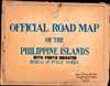
1936 Bureau of Public Works Road Atlas of the Philippines
PhilippinesRoads-publicworksph-1936$1,750.00

Title
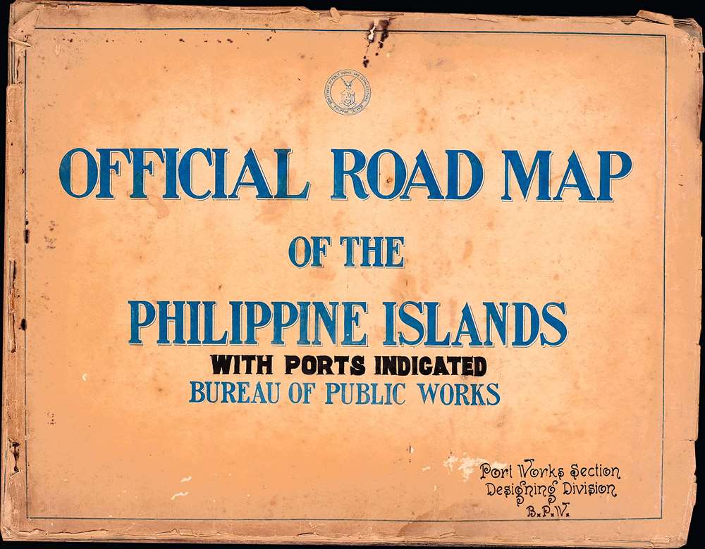
Official Road Map of the Philippine Islands: with Ports Indicated.
1936 (undated) 10 x 13.25 in (25.4 x 33.655 cm) 1 : 930000
1936 (undated) 10 x 13.25 in (25.4 x 33.655 cm) 1 : 930000
Description
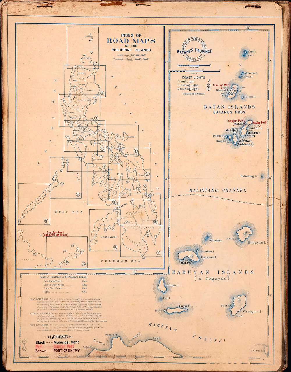
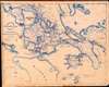
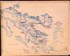
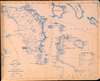
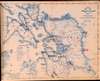
The only known example of a c. 1936 road atlas of the Philippines, produced by the islands' Bureau of Public Works, Manila. It includes 15 maps, plus a title page and an index, covering the entire archipelago in impressive detail.
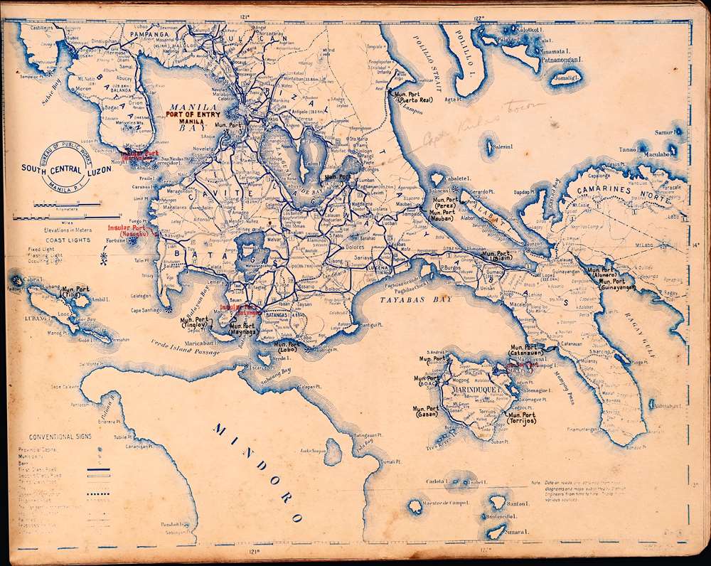
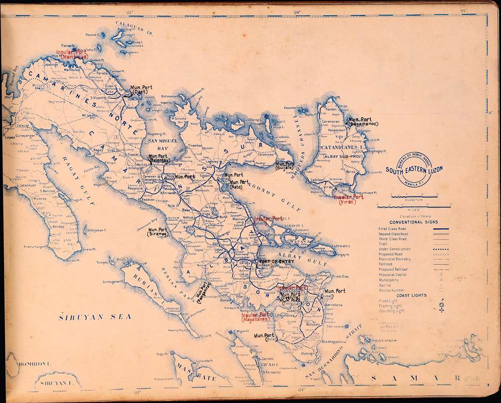
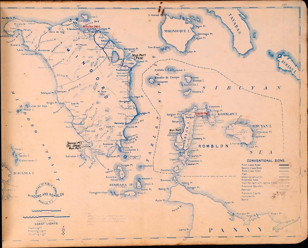
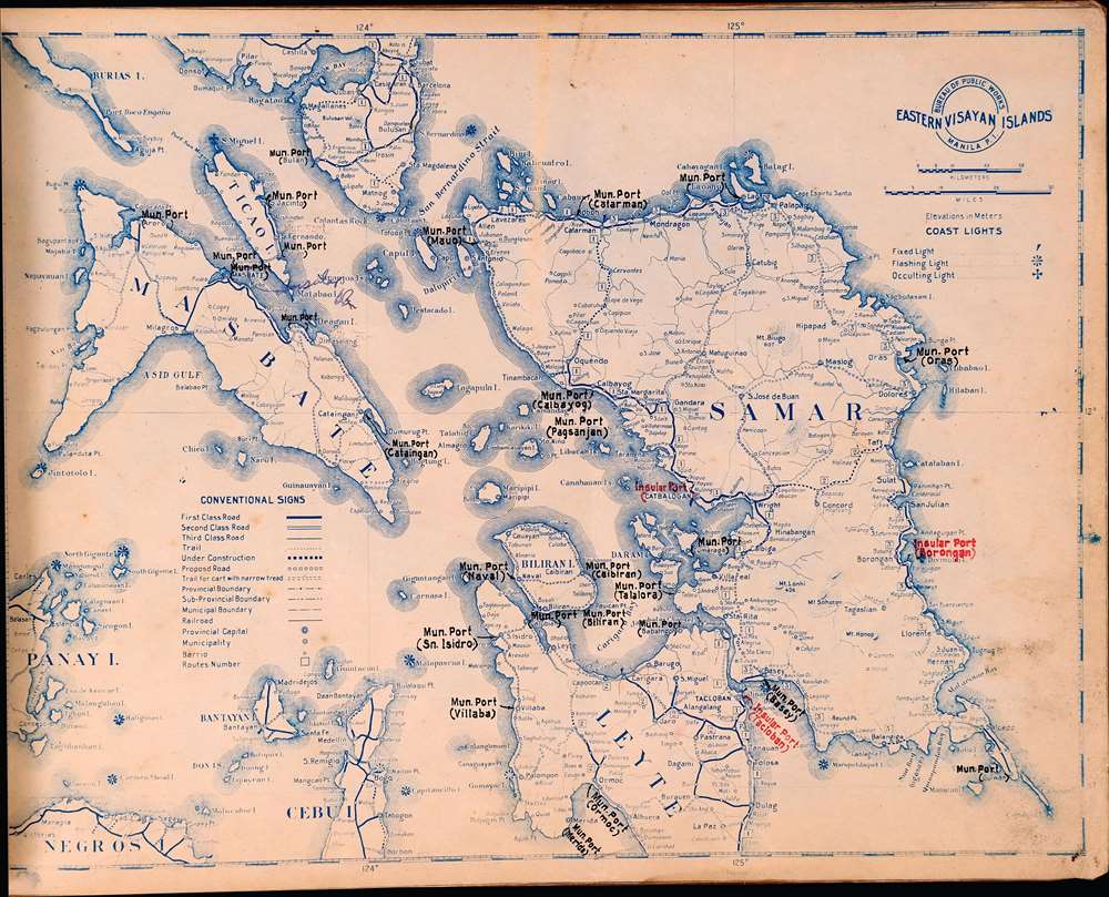
The number of roads under construction and proposed roads (through rugged and often densely forested terrain) hints at the ambitious infrastructure plans of the Filipino government, which had recently acquired Commonwealth status (see below). In addition to road infrastructure, the renovation of ports in the 1930s boosted the Philippines' exports, an important and growing share of the economy, and in some cases strengthened national defenses, an increasing concern in the face of increased Japanese belligerence.
In order of appearance, the maps are:
These measures were both popular and effective, spurring the Philippine GDP to grow steadily despite a weak global economy. Nonetheless, the Second World War sidelined many of Quezon's projects and the man himself died in exile before the war ended. After the war, reconstruction (including totally rebuilding Manila), corruption, and a left-wing peasant insurgency hamstrung the fully independent government of Manual Roxas and its successors.
A Closer Look
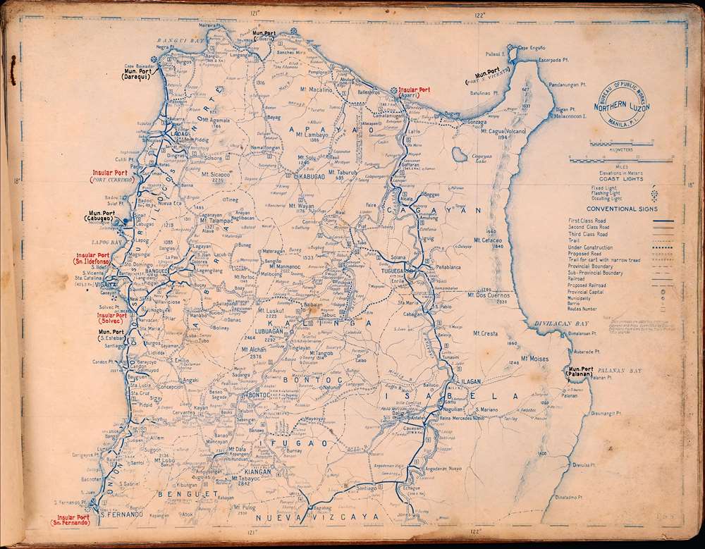
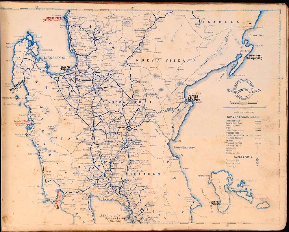
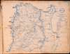
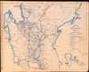
The constituent maps are very detailed, including locations and classes of roads (defined on the index page), roads under construction and proposed roads, cart trails, administrative divisions, ports (insular, municipal, and ports of entry), and lighthouses. On Luzon, distances from major cities to Manila are noted in kilometers.The number of roads under construction and proposed roads (through rugged and often densely forested terrain) hints at the ambitious infrastructure plans of the Filipino government, which had recently acquired Commonwealth status (see below). In addition to road infrastructure, the renovation of ports in the 1930s boosted the Philippines' exports, an important and growing share of the economy, and in some cases strengthened national defenses, an increasing concern in the face of increased Japanese belligerence.
In order of appearance, the maps are:
- Title Page
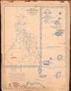
- Map 1: Index page, includes a map of the Batan and Babuyan Islands at right
- Map 2: Northern Luzon
- Map 3: North Central Luzon
- Map 4: South Central Luzon
- Map 5: South Eastern Luzon
- Map 6: Mindoro and Romblon
- Map 7: Eastern Visayan Islands
- Map 8: Eastern Visayan Islands, Part II
- Map 9: Western Visayan Islands
- Map 10: Northern Mindanao
- Map 11: Southern Mindanao
- Map 12: Western Mindanao
- Map 13: Sulu Province
- Map 14: Northern Palawan
- Map 15: Southern Palawan
American Rule and Moves towards Independence
This atlas was produced around the time that the Philippines transitioned from the quasi-colonial Government with an appointed American Governor to a relatively autonomous Commonwealth under Filipino elites. Although society was highly unequal, President Manuel L. Quezon (1878 - 1844) aimed to address inequalities with a range of policies, from land reform to infrastructure development and government involvement in industry.These measures were both popular and effective, spurring the Philippine GDP to grow steadily despite a weak global economy. Nonetheless, the Second World War sidelined many of Quezon's projects and the man himself died in exile before the war ended. After the war, reconstruction (including totally rebuilding Manila), corruption, and a left-wing peasant insurgency hamstrung the fully independent government of Manual Roxas and its successors.
Publication History and Census
This road atlas was produced by the Port Works Section of the Designing Division of the Bureau of Public Works. Although listed twice in the OCLC, no institution is cataloged as holding the atlas and it has no known history on the market. It is undated but is attributed to the Bureau of Public Works, which was established with that name in 1935. However, the cover includes the seal of the Department of Public Works and Communication, the department which housed the Bureau of Public Works until 1935, so this map likely dates from soon after the office's reorganization in tandem with the 1935 Constitution. This atlas has no known history on the market.Cartographer
Bureau of Public Works, Philippines (1867 - present), now the Bureau of Public Works and Highways, originated from an office founded by a royal decree from the King of Spain in 1867. The office shuffled through several administrative reorganizations and for a time was under the management of the U.S. Army Corps of Engineers in the early 20th century. When the Philippines became a Commonwealth in 1935, it branched off from the Department of Public Works and Communication to become the Bureau of Public Works. After the Second World War, the Bureau went through additional reorganization to reach its current form in 1987. More by this mapmaker...
Condition
Average. Foxing on the cover page and most of the maps. Dampstaining at the bottom margin.
References
OCLC 652181910, 419456484.