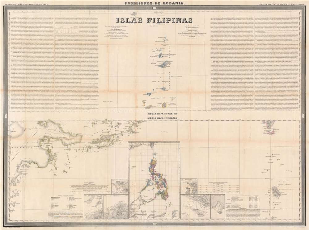
1852 Coello / Morata Wall Map of the Philippines (Three Sheets)
PhilippinesSet-coello-1852$2,200.00

Title
Islas Filipinas Primera Hoja Central. Islas Filipinas Segunda Hoja Central. Posesiones de Oceania. Islas Filipinas. Atlas de España y sus Posesiones de Ultramar.
1852 (undated) 31.5 x 41.5 in (80.01 x 105.41 cm) 1 : 1000000
1852 (undated) 31.5 x 41.5 in (80.01 x 105.41 cm) 1 : 1000000
Description
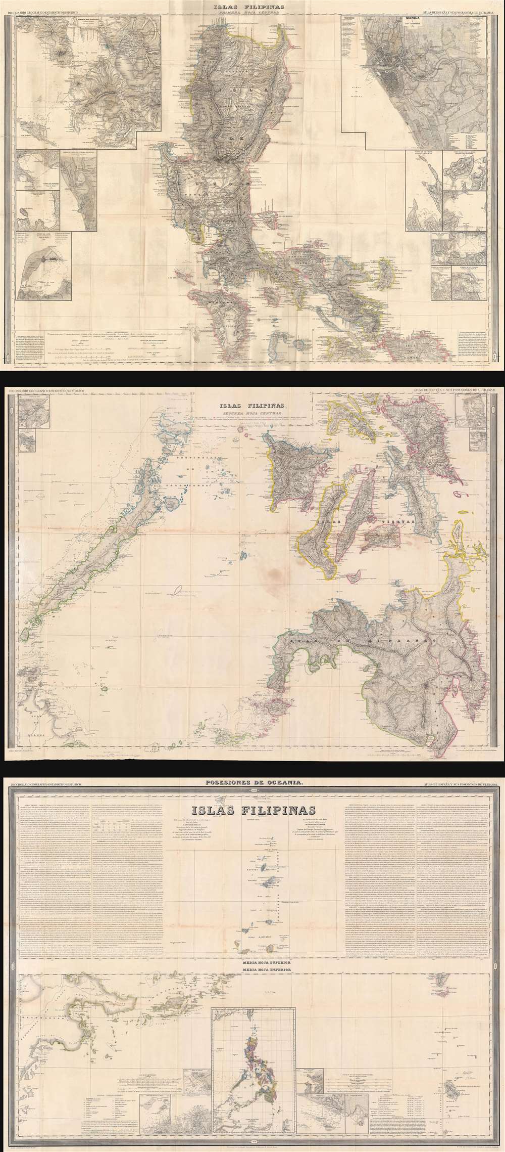
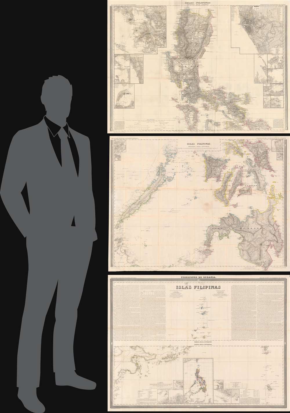
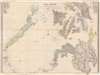
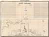
This is Francisco Coello's 1852 map of the Philippine Islands, published on 3 sheets. It is considered the first scientific map of the Philippines. It is the most influential general map of the Philippines to appear in the mid-19th century, used in treaty negotiations for both the Spanish-American War (1898) and the Philippine-American War (1899 - 1902).
A Closer Look
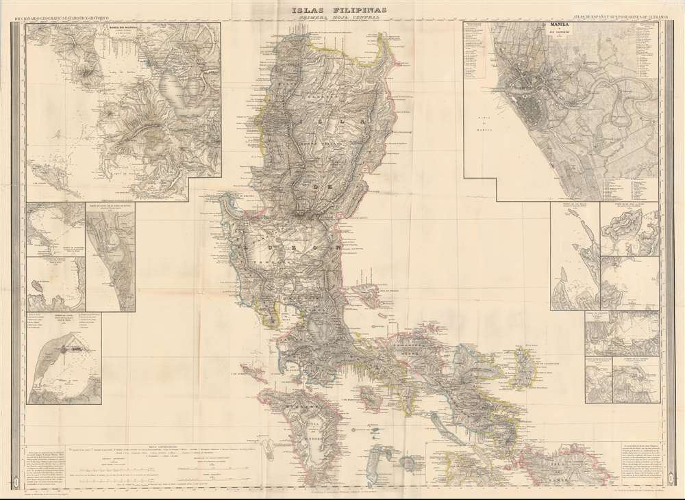
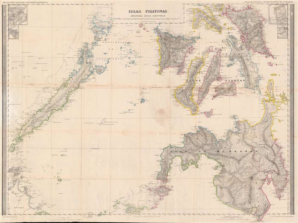
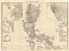
The first sheet covers the archipelago from northern Luzon to southern Mindoro, including all of Luzon and Mindoro, as well as parts of Samar, Masbate, and numerous smaller islands. In addition to the main map, there are 11 insets, including detailed maps of the City of Manila, Manila Bay, Cavite, and Bacoor Bay, among others. The second sheet illustrates the southern portions of the archipelago, including all of Samar, Palawan, Panay, Negros, Cebu, Leyte, and Mindanao. Insets depict the ports of Cebu, Batan, Mandao, and Palapa. The third sheet is divided into two maps. The upper map focuses on the Batanes and Babuyan islands north of Luzon, and the lower map illustrates islands south of Mindanao, including Borneo. Several insets highlight ports and other specific areas within the archipelago, while a relatively large inset situates the Philippines within a regional context. Text on the left and right of the map of Batanes and the Babuyan Islands details the Philippines' climate, religion, industry, and history.A Seminal Piece
This map is the culmination of nearly a century of Spanish survey work in the Philippines. Coello and his partner, geographer Antonio Morata, carefully assembled the various surveys into this composite map based exclusively on scientific survey work. The completed map was unprecedented in size and detail and the foundation for all subsequent mapping of the Philippines until the late 19th century. The map provides the essential cartographic data for several important subsequent maps, including Anselmo Ollero’s Carta Itineraria de la Isla de Luzon (1882) and Ramon Prats’ Islas Filipinas (1887).Publication History and Census
This map was issued as part of Coello's opus, the Atlas de España y sus Posesiones de Ultramar. The Atlas, conceived jointly by Coello and Morata and issued in parts from about 1848 onwards, was a wildly ambitions project consisting of large format separately issued maps of all parts of Spain and her overseas possessions. Due to Coello's death and the disruption of the Spanish-American War, the great work was never completed. Nonetheless, by the time of Coello's death in 1898, some 46 parts were published. This map of the Philippines is one of the first maps Coello issued for the atlas, first appearing in 1849, just one year into the production of the ambitious Atlas de España. We note 8 examples of the complete Philippine set cataloged in OCLC: Princeton University, Yale University, Cornell University, the University of Michigan, the Newberry Library, Stanford University, the Biblioteca AECID, and the National Library of Australia. Rare to the market.CartographerS
Francisco Coello de Portugal y Quesada (1822 - September 30, 1898) was a Spanish cartographer, explorer, and military engineer active in the mid-19th century. Coello was born in Jaen, Spain and joined the military in 1833, enrolling at the Special Army Corps of Engineers Academy of Guadalajara. Upon graduating with honors he joined Corps of Military Engineers where after serving in the First Carlist War, and later in Algeria, he attained the rank of Colonel. Coello later founded the Geographical Society of Madrid and served many years as its president. He was also a corresponding member of the American Geographical Society and a full member of the Real Sociedad Geográfica de España. Coello's greatest work, his monumental Atlas de España y sus posesiones de Ultramar, was truncated by his death in 1898 and consequently never completed. Nevertheless, the work is of historical significance as the first scientifically produced maps of Spain, Cuba, and Porto Rico. More by this mapmaker...
Juan Noguera (fl. c. 1835 – 1870) was a Spanish draftsman and engraver based in Madrid during the middle part of the 19th century. Noguera drafted and engraved maps for Francisco Coello, Direccion de Hidrografia, and others. Juan Noguera should not be confused with Clemente Noguera, who was also a senior line-engraver at the Direccion de Hidrografia. The two engravers may or may not be related. Clemente was significantly older than Juan, and may have been an older relative. Learn More...
Source
Coello, F., Atlas de España y sus posesiones de Ultramar, (Madrid) 1848 - 1868.
Condition
Good. Three sheets. Wear and toning along original fold lines. Verso repairs to fold separations. Some soiling.
References
OCLC 30691977. Phillips (Atlases) #3137. Quirino, Carlos, Philippine Cartography, pp.177-8. PHIMCOS/Metropolitan Museum of Manila, Three Centuries of Philippine Cartography (exhibition catalog), pp.56-7.