
Noguera, Juan

Juan Noguera (fl. c. 1835 – 1870) was a Spanish draftsman and engraver based in Madrid during the middle part of the 19th century. Noguera drafted and engraved maps for Francisco Coello, Direccion de Hidrografia, and others. Juan Noguera should not be confused with Clemente Noguera, who was also a senior line-engraver at the Direccion de Hidrografia. The two engravers may or may not be related. Clemente was significantly older than Juan, and may have been an older relative.
Charting an 1867 Spanish voyage around the Caribbean.
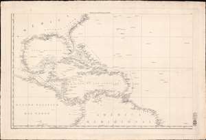
[West Indies, Florida, Gulf of Mexico]
$1,750.00
Acquire
- Digital Map Information
- Suitable for large format printing
- Full resolution TIFF file
- ICC color profile embedded
- Delivered instantly via download link
This is a scarce c. 1838 Direccion Hidrografia nautical chart or maritime map of the West Indies, Florida, the Gulf of Mexico, and the Caribbean. Centered on Hispaniola, the map covers from Cape Hatteras, North Carolina, to the Equator, and from the Pacific coast of Central America to the mouth of the Amazon River. Manuscript notates throughout follow the 1867 voyage of a Spanish ship. (more details)
Most influential map of the Philippines of the 19th century.
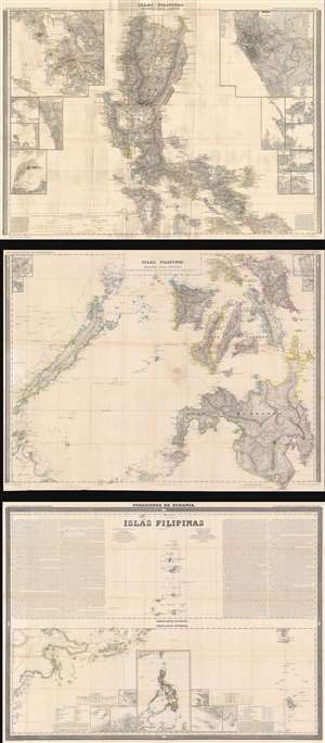
Islas Filipinas Primera Hoja Central. Islas Filipinas Segunda Hoja Central. Posesiones de Oceania. Islas Filipinas. Atlas de España y sus Posesiones de Ultramar.
$2,200.00
Acquire
- Digital Map Information
- Suitable for large format printing
- Full resolution TIFF file
- ICC color profile embedded
- Delivered instantly via download link
This is Francisco Coello's 1852 map of the Philippine Islands, published on 3 sheets. It is considered the first scientific map of the Philippines. It is the most influential general map of the Philippines to appear in the mid-19th century, used in treaty negotiations for both the Spanish-American War (1898) and the Philippine-American War (1899 - 1902). (more details)