1962 Pictorial Map of Big Bend National Park
PictorialBigBend-unknown-1962$300.00

Title
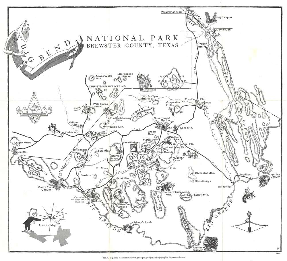
Big Bend National Park Brewster County, Texas. Fig. 4. Big Bend National Park with principal geologic and topographic features and roads.
1962 (dated) 14.25 x 15.25 in (36.195 x 38.735 cm) 1 : 253440
1962 (dated) 14.25 x 15.25 in (36.195 x 38.735 cm) 1 : 253440
Description
This is a 1962 pictorial map of Big Bend National Park in Brewster County, Texas. Topographic and geologic features are illustrated, including the Chisos Mountains, the Sierra del Carmen, and Mariscal Mountain (in the bend in the Rio Grande River that gives the park its name). The creator uses charming vignettes to emphasize other formations, including The Window, the Mule Ear Peaks, Elephant Tusk Mountain, Burro Mesa, and the Christmas Mountains (which feature Santa). Stylized views mark Santa Elena Canyon, Mariscal Canyon, and Boquillas Canyon. An 'inset' in the lower left features a man 'pointing out' the location of Big Bend National Park.
Big Bend National Park
Big Bend National Park opened to visitors on July 1, 1944, and is the largest protected area of Chihuahuan Desert ecology and topography in the United States. Originally established as Texas Canyons State Park in 1933, the United States Congress began the process of acquiring the land from Texas in 1935. Texas deeded the land to the federal government on June 12, 1944. Big Bend National Park is the only national park in the United States to contain an entire mountain range; the Chisos Mountains. The park also contains habitats for hundreds of animal and plant species, as well as 10,000-year-old archaeological sites, dinosaur fossils, and 118 miles of the U.S.-Mexico border along the Rio Grande.Publication History and Census
This map was originally created in 1962 by an unknown artist and published in 1968 by the University of Texas at Austin in Ross A. Maxwell's The Big Bend of the Rio Grande: A Guide to the Rocks, Geologic History, and Settlers of the Area of Big Bend National Park. The guide is well represented in institutional collections, but this is the only known cataloged example of the separate map.Source
Maxwell, R.A., The Big Bend of the Rio Grande: A Guide to the Rocks, Geologic History, and Settlers of the Area of Big Bend National Park (Austin: University of Texas) 1968.
Condition
Very good. Exhibits light wear along original fold lines.
References
OCLC 1136896637.