1976 Lehua Tours Pictorial Road Map of Hawaii
PictorialHawaii-lehuatours-1976$200.00

Title
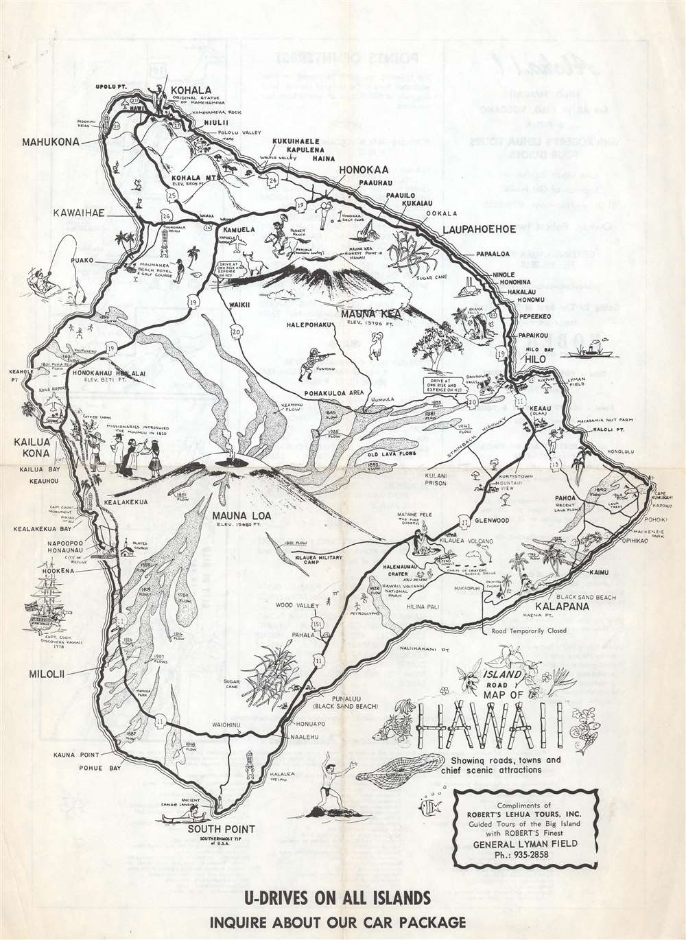
Island Road Map of Hawaii Showing roads, towns and chief scenic attractions.
1976 (undated) 14.25 x 11 in (36.195 x 27.94 cm) 1 : 532224
1976 (undated) 14.25 x 11 in (36.195 x 27.94 cm) 1 : 532224
Description
This is a c. 1976 Robert's Lehua Tours pictorial road map of Hawaii. Depicting the entirety of the Big Island, pictorial illustrations of Mauna Loa and Mauna Kea immediately draw the eye. Historic lava flows spread out from Mauna Loa, dated by year. Apart from the volcanoes, pictorial vignettes illustrate Hawaiian history, agriculture, industry, and tourist activities. References to missionary activities and Captain Cook's visits appear, along with illustrations of Madame Pele the Fire Goddess and the statue of Kamehameha at Kohala. Golf courses, beaches, airports, and hotels are also identified.
Verso Content
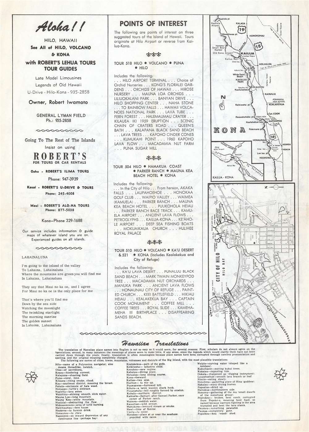
Two small maps are included on the verso. One details Hilo and labels major streets along with some sites around town. The other illustrates the coast of Kona from Keahole Point to Hockena. Advertisements for services provided by Lehua Tours and other related businesses (all owned by Robert N. Iwamoto (1911 - 1984)) occupy the rest of the verso.Publication History and Census
This map was published and distributed compliments of Robert's Lehua Tours c. 1976. We note only one cataloged example, located at the Library of Congress.Condition
Very good. Light wear along original fold lines. Verso repair to a fold separation. Text and maps of Hilo and Kona on verso.
References
OCLC 5707950.