1945 Metsker Map of Pierce County, Washington (Mt. Rainier)
PierceCoWA-metsker-1945$200.00


Title
Metskers Map of Pierce County Washington.
1945 (dated) 26.5 x 38.5 in (67.31 x 97.79 cm) 1 : 126720
1945 (dated) 26.5 x 38.5 in (67.31 x 97.79 cm) 1 : 126720
Description
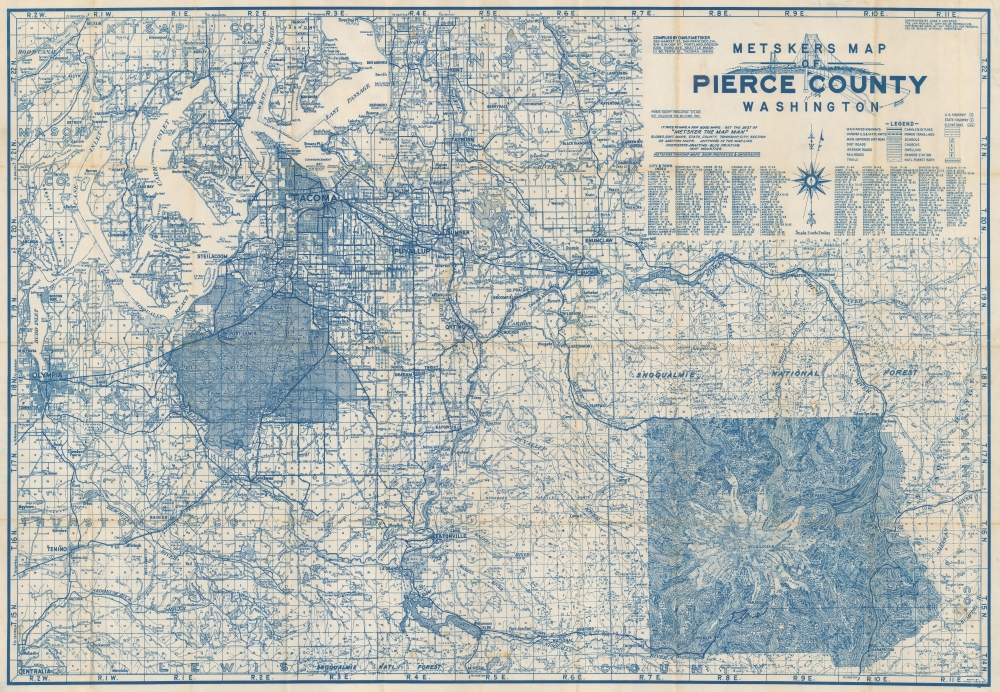
This is a 1945 Charles Metsker map of Pierce County, Washington. The map highlights Mt. Rainier and details its immediate surroundings in the months before the end of World War II (1939 - 1945).
A Closer Look
Coverage embraces Pierce County, Washington, from Olympia east to Yakima County and from Kitsap County and King County south to Lewis County, thus including Tacoma, Fort Lewis, Puyallup, Sumner, Snoqualmie National Forest, and Mt. Rainier. Mt. Rainier is illustrated in striking detail, with glaciers, parks, ridges, and other mountains identified. Camps, cabins, hotels, and towns near Mt. Rainier are also labeled. Major streets and highways are illustrated throughout, along with lakes, rivers, and inlets off Puget Sound. The Tacoma Narrows Bridge adorns the title cartouche. A city and town index is included below the title.Publication History and Census
This map was created and published by Charles F. Metsker of Metsker Maps in 1945. We note 2 cataloged examples in OCLC: the Library of Congress and the University of Washington.Cartographer
Charles Frederick Metsker (December 5, 1881 - October 6, 1966) was an American cartographer and publisher. Born in Douglas County, Kansas, Metsker's family moved to Winlock, Washington, in 1900. Metsker began publishing maps in 1901 in Tacoma, Washington. By the 1920s he was advertising as 'Metsker the Map Man' in Washington and Oregon newspapers. He opened a brick and mortar store in 1950 in Seattle and sold Township maps and atlases and County maps. He married Minnie B. Clevenger (1888 - 19xx) on May 11, 1905, with whom he had two children. They divorced sometime between 1910 and 1920. He married Elizabeth F. Metsker (1899 - 1982) on November 6, 1922, with whom he had a daughter. He retired in 1948 when he turned the business over to his son. He died in McMinnville, Oregon, at the age of 84. Metsker Maps joined forces with the Kroll Map Company, another Seattle-based mapmaker, in 1980. Metsker Maps continues to operate in Seattle to this day, where they can be visited at the Pike Place Market in the Sanitary Market Building. More by this mapmaker...
Condition
Good. Wear and toning along original fold lines. Verso repairs to fold separations and at fold intersections. Slight loss at some fold intersections. Closed tear extending 2 inches into printed area from upper left corner professionally repaired on verso.
References
OCLC 1423501320.