This item has been sold, but you can get on the Waitlist to be notified if another example becomes available.
1973 U.S. Geological Survey Map of Plantation Key, Florida Keys
PlantationKeyQuadrangle-usgs-1973$100.00

Title
Plantation Key Quadrangle.
1973 (dated) 26.25 x 23.25 in (66.675 x 59.055 cm) 1 : 24000
1973 (dated) 26.25 x 23.25 in (66.675 x 59.055 cm) 1 : 24000
Description
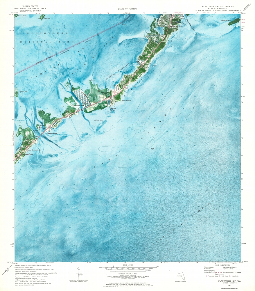
This is a 1973 U.S. Geological Survey map of Plantation Key in the Florida Keys. Coverages embraces from Islamorada to Tavernier Key.
A Closer Look
Churches, a school, a radio tower, a trailer park, and a coast guard station are among the identified locations. Black squares illustrate houses and other buildings. Part of Everglades National Park occupies the upper left corner. A red line traces the Overseas Highway.Plantation Key
Plantation Key, situated in the Upper Florida Keys, is a tropical oasis teeming with a rich diversity of marine life, lush vegetation, and a laid-back island ambiance. As one of the islands in the Village of Islamorada, it offers a perfect blend of recreational and cultural activities, from world-class fishing and diving spots to a plethora of art galleries, local boutiques, and exquisite eateries that showcase the flavors of the Keys. The serene sunsets, pristine waters, and a warm sense of community make Plantation Key a sought-after destination for vacationers and a cherished home for its residents.Publication History and Census
This map was created and published by the United States Geological Survey in 1973. Three examples are cataloged in OCLC and are part of the collections at the Jacksonville Public Library, the Hillsborough County Public Library Cooperative, and Florida International University.Cartographer
The United States Geological Survey (1878 - Present), aka the U.S.G.S., is a scientific agency of the United States government, which was founded in 1879. USGS scientists study the landscape of the United States, its natural resources, and the natural hazards that threaten it. The organization has four major science disciplines: biology, geography, geology, and hydrology. It is a bureau of the United States Department of the Interior and is the department's only scientific agency. More by this mapmaker...
Condition
Very good.
References
OCLC 741752724.