This item has been sold, but you can get on the Waitlist to be notified if another example becomes available, or purchase a digital scan.
1860 Garnier Map of the North and South Poles in Two Hemispheres
PolarHemispheres-garnier-1860$125.00

Title
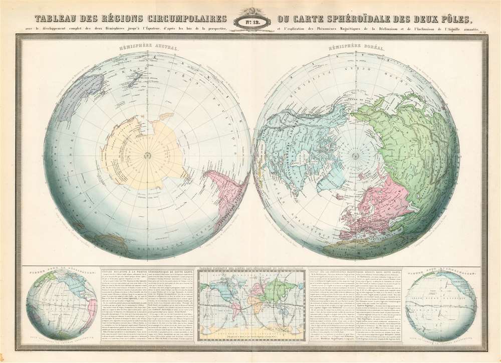
Tableau des régions circumpolaires ou carte sphéroïdal des deux pôles.
1860 (dated) 21.5 x 30 in (54.61 x 76.2 cm) 1 : 42000000
1860 (dated) 21.5 x 30 in (54.61 x 76.2 cm) 1 : 42000000
Description
This is an 1860 F.A. Garnier map of the North and South Poles in two hemispheres. Depicting the Earth as if cut in half along the Equator, both poles are illustrated in detail, and features nearing the Equator are distorted. Numerous locations are identified around the poles, particularly around the still relatively unknown Antarctic continent. Garnier includes a detailed description of the map's geography along the bottom border.
Earth's 'Magnetic Phenomena'
Three maps situated along the bottom border describe what would have been the latest understanding of Earth's magnetic properties. The maps on the left and right detail Earth's declination and inclination. Declination represents the difference between true north and magnetic north (as measured by a compass) and inclination names the angle of a compass needle when the compass is held vertically. The central map details these two phenomena as well as the concept of a magnetic equator.Publication History and Census
This map was created and published by F.A. Garnier in 1860. This piece is well represented in institutional collections.Cartographer
F.A. Garnier (1803 - 1863) was a French cartographer who published the Atlas sphéroidal et universel de géographie in 1862 as his only work. It is said that he spent fifteen years creating the maps for the atlas. More by this mapmaker...
Condition
Very good. Even overall toning. Light wear along original centerfold.
References
Rumsey 5023.012. OCLC 51328604.