1761 Buy de Mornas Celestial Map of the Principal Stars and the Milky Way
PrincipalesEtoiles-buydemornas-1761$350.00

Title
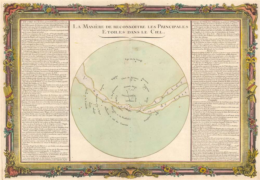
La Manière de Reconnoitre les Principales Etoiles dans le Ciel.
1761 (undated) 14.5 x 21 in (36.83 x 53.34 cm)
1761 (undated) 14.5 x 21 in (36.83 x 53.34 cm)
Description
This is a 1761 Claude Buy de Mornas celestial map of the Milky Way and several easily recognizable stars. A few constellations appear, including Ursa Major, Ursa Minor, and the Pleiades. The North Star (Polaris), Arcturus, Regulus, and Sirius are labeled as well. The Milky Way traverses the sphere in an arc, curving down near the center only to rise again toward the right side. Explanatory text occupies the left and right sides, helping orient the map and offering astronomical facts. The whole is surrounded by a beautiful frame-style border.
Publication History and Census
This map was created and published by Claude Buy de Mornas and Louis-Charles Desnot who jointly published the Atlas Méthodique et Elémentaire de Géographie et d'Histoire in 1761. We note a single separate example cataloged in OCLC, at the Bayerische Staatsbibliothek. The atlas, however, is well represented.CartographerS
Claude Buy de Mornas (17xx - 1783) was a French geography professor. He published the Atlas Méthodique et Elémentaire de Géographie et d'Histoire jointly with Louis-Charles Desnos (1725 - 1805) in 1761. Desnos claimed the plates for the Atlas Méthodique after Buy de Mornas died. More by this mapmaker...
Louis Charles Desnos (1725 - April 18, 1805) was an important 18th century instrument maker, cartographer and globe maker based in Paris, France. Desnos was born in Pont-Sainte-Maxence, Oise, France, the son of a cloth merchant. From April of 1745 he apprenticed at a metal foundry. Desnos married the widow of Nicolas Hardy, sone of the map, globe, and instrument seller Jacques Hardy. Desnos held the coveted position of Royal Globemaker to the King of Denmark, Christian VII, for which he received a stipend of 500 Livres annually. In return Desnos sent the King roughly 200 Livres worth of maps, books and atlases each year. As a publisher, Desnos produced a substantial corpus of work and is often associated with Zannoni and Louis Brion de la Tour (1756-1823). Despite or perhaps because of the sheer quantity of maps Desnos published he acquired a poor reputation among serious cartographic experts, who considered him undiscerning and unscrupulous regarding what he would and would not publish. Desnos consequently had a long history of legal battles with other Parisian cartographers and publishers of the period. It is said that he published everything set before him without regard to accuracy, veracity, or copyright law. Desnos maintained offices on Rue St. Jacques, Paris. Learn More...
Source
Buy de Mornas, C. and L. C. Desnos, Atlas Méthodique et Elémentaire de Géographie et d'Histoire, (Paris: Mornas and Desnos) 1761.
Condition
Very good. Verso repair to centerfold separation.
References
OCLC 163399642.