
Desnos, Louis Charles

Louis Charles Desnos (1725 - April 18, 1805) was an important 18th century instrument maker, cartographer and globe maker based in Paris, France. Desnos was born in Pont-Sainte-Maxence, Oise, France, the son of a cloth merchant. From April of 1745 he apprenticed at a metal foundry. Desnos married the widow of Nicolas Hardy, sone of the map, globe, and instrument seller Jacques Hardy. Desnos held the coveted position of Royal Globemaker to the King of Denmark, Christian VII, for which he received a stipend of 500 Livres annually. In return Desnos sent the King roughly 200 Livres worth of maps, books and atlases each year. As a publisher, Desnos produced a substantial corpus of work and is often associated with Zannoni and Louis Brion de la Tour (1756-1823). Despite or perhaps because of the sheer quantity of maps Desnos published he acquired a poor reputation among serious cartographic experts, who considered him undiscerning and unscrupulous regarding what he would and would not publish. Desnos consequently had a long history of legal battles with other Parisian cartographers and publishers of the period. It is said that he published everything set before him without regard to accuracy, veracity, or copyright law. Desnos maintained offices on Rue St. Jacques, Paris.
The Milky Way, Ursa Major, and the North Star.
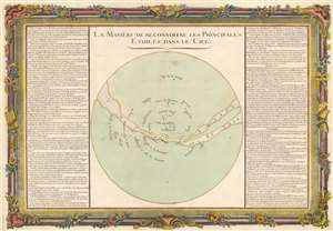
La Manière de Reconnoitre les Principales Etoiles dans le Ciel.
$350.00
Acquire
- Digital Map Information
- Suitable for large format printing
- DPI: 600
- File Size: 51.09 MB
- File Type: ZIP / TIFF
- ICC color profile embedded
- Delivered instantly via download link
This is a 1761 Claude Buy de Mornas celestial map of the Milky Way and several easily recognizable stars. A few constellations appear, including Ursa Major, Ursa Minor, and the Pleiades. The North Star (Polaris), Arcturus, Regulus, and Sirius are labeled as well. The Milky Way traverses the sphere in an arc, curving down near the center only to rise again toward the right side. Explanatory text occupies the left and right sides, helping orient the map and offering astronomical facts. The whole is surrounded by a beautiful frame-style border. (more details)
Seasons and Earth's elliptical orbit around the Sun.
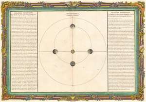
[L'Été est plus long que l'Hyver.]
$275.00
Acquire
- Digital Map Information
- Suitable for large format printing
- DPI: 600
- File Size: 41.86 MB
- File Type: ZIP / TIFF
- ICC color profile embedded
- Delivered instantly via download link
This is a 1761 Claude Buy de Mornas celestial map of the Earth's seasons. Using this orbit diagram, Buy de Mornas explains such concepts as why summer is longer than winter. He illustrates the Earth's elliptical orbit, exchanges how it changes in speed, which causes one part of the orbit (a season) to take longer than the other. He also effectively illustrates how the Earth's tilt with respect to the Sun effects the seasons, although he does not include this detail in the discussion of the seasons to the left of the diagram. To the right, Buy de Mornas discusses heat retention and how the changes daylight certain parts of the Earth receive during different parts of the year results in the temperature changes. (more details)
Spectacular wall map of Paris.
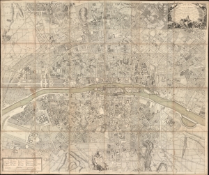
Plan de la Ville et Fauxbourgs de Paris Divise en 20 Quartiers dont la plus grande partie a ete rectifee d'apres differens desseins leve Geometrique, tires du Cabinet de Mr. Cevalier de * * * *... Dedie aux Citoyens de la Capitale Par... Desnos... 1777.
$7,500.00
Acquire
- Digital Map Information
- Suitable for large format printing
- File Size: 265.55 MB
- File Type: ZIP / TIFF
- ICC color profile embedded
- Delivered instantly via download link
This is a spectacular 1777 large-scale map of Paris by Louis-François Deharme, published by Louis Charles Desnos. The map captures Paris during the reign of Louis XV, a period of growing unrest and inter-class resentment that would ultimately culminate in the French Revolution (1789 - 1799). (more details)
Spectacular 18th century wall map published during the American Revolution.
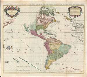
L'Amérique divisée en septentrionale et méridionale subdivisée en ses principales parties. / L'Amérique divisée en ses principales parties sçavoir dans la Septentrionale les Terres Arctiques, le Canada ou Nouvelle France, la Floride, la Nouvelle Espagne et le Nouveau Mexique ; dans la Méridionale la Terre Ferme, le Pérou, le Chili, la Terre Magellanique, le Paraguay, le Brésil. Les isles de Terre Neuve, Antilles, Magellaniques et de Californie.
$9,000.00
Acquire
- Digital Map Information
- Suitable for large format printing
- Full resolution TIFF file
- ICC color profile embedded
- Delivered instantly via download link
A spectacular 1782 wall map of North America and South America issued at the height of the American Revolutionary War, by Louis Charles Desnos, after Alexis-Hubert Jaillot. The map captures French ambitions to reclaim its American territories in the wake of the American Revolution. It also features the wealth of cartographic speculation of the era, including an unexplored Pacific Northwest and Arctic. The lower quadrants also reveal vestiges of the 16th century Terre Australis - the mythical southern continent disproven by Cook's first two voyages (His third voyage returned in 1880, but information about its discoveries had not yet been disseminated). (more details)
The early theories of the Solar System.
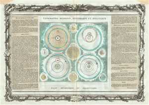
Le Systeme de Ptolomee. Le Systeme de Ticho-Brahe. Le Systeme de Copernic. Le Systeme de Descartes.
$350.00
Acquire
- Digital Map Information
- Suitable for large format printing
- DPI: 300
- File Size: 14.21 MB
- File Type: ZIP / TIFF
- ICC color profile embedded
- Delivered instantly via download link
This is an interesting 1786 map by the French cartographer Louis Brion de la Tour depicting the theories of the Solar System by Ptolemy, Tycho Brahe, Copernicus and Descartes. The chart depicts four models, each consisting of the Sun, the planets and the moon. ... (more details)
Shows the distribution of light on the Earth's surface.
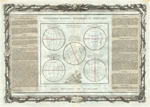
Position Respective des Peuples de la Terre.
$250.00
Acquire
- Digital Map Information
- Suitable for large format printing
- DPI: 300
- File Size: 12.63 MB
- File Type: ZIP / TIFF
- ICC color profile embedded
- Delivered instantly via download link
This is a lovely 1786 map by the French cartographer Louis Brion de la Tour. It depicts the distribution of light on the earth’s surface relative to its position. The chart includes 5 diagrams – Perioeciens, Antociens, Heterosciens, Perisciens and ... (more details)
Beautiful map depicting the Holy Roman Empire's Circle of Austria.
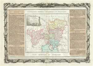
Cercle D'Autriche : divise en toutes ses Provinces, tant Civiles qu'Ecclesiastiques.
$300.00
Acquire
- Digital Map Information
- Suitable for large format printing
- DPI: 300
- File Size: 14.74 MB
- File Type: ZIP / TIFF
- ICC color profile embedded
- Delivered instantly via download link
This is a lovely 1786 map by the French Cartographer Louis Brion de la Tour detailing the counties and duchies of Austria. It covers from Lake Constance eastward to Hungary and south as far as the Adriatic Sea. The Circle of Austria was, as shown here, ... (more details)
18th century map depicting the Imperial Circles of the Holy Roman Empire.
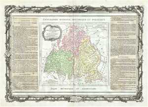
Cercles de Baviere de Franconie et de Souabe.
$250.00
Acquire
- Digital Map Information
- Suitable for large format printing
- DPI: 300
- File Size: 12.48 MB
- File Type: ZIP / TIFF
- ICC color profile embedded
- Delivered instantly via download link
This is a beautifully detailed 1786 map of Bavaria, Swabia and Franconia, Germany by the French Cartographer Louis Brion de la Tour. Renders the entire region in extraordinary detail offering both topographical and political information. The 'circle' ... (more details)
Beautiful map depicting Austrian Netherlands.
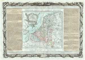
Les Pays Bas Francois, Autrichiens, et Hollandois.
$250.00
Acquire
- Digital Map Information
- Suitable for large format printing
- DPI: 300
- File Size: 13.38 MB
- File Type: ZIP / TIFF
- ICC color profile embedded
- Delivered instantly via download link
This is beautiful map of Belgium and Luxemburg by the French Cartographer Louis Brion de la Tour. It extends from the North Sea south to include Luxembourg. Covers the Austrian Netherlands or Southern Netherlands or Catholic Netherlands which were ... (more details)
Striking map of the Czech Republic.
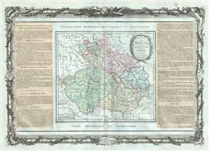
Etats de Boheme, divises en toutes leurs Provinces, tant Civiles qu'Ecclesiastiques.
$250.00
Acquire
- Digital Map Information
- Suitable for large format printing
- DPI: 300
- File Size: 11.75 MB
- File Type: ZIP / TIFF
- ICC color profile embedded
- Delivered instantly via download link
This is an appealing 1786 of Bohemia or modern day Czech Republic by Brion de la Tour and Louis Charles Desnos. It covers all of modern day Czech Republic and parts of Germany and Poland from Frankfurt in Germany to Linz in Austria. Major cities ... (more details)
Beautiful early map of Tuscany and the Papal States.
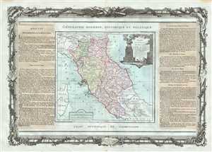
Etats De L'Eglise, De Toscane, Modene Et Luques, avec les Metroples Eclesiastiques et tous leurs Suffragans.
$350.00
Acquire
- Digital Map Information
- Suitable for large format printing
- DPI: 300
- File Size: 13.6 MB
- File Type: ZIP / TIFF
- ICC color profile embedded
- Delivered instantly via download link
This is beautiful example of Desnos and Brion de la Tour’s 1786 map of central Italy. It covers the regions of Tuscany and the Papal States and includes part of the island of Corsica. Extends from Venice south to Naples. The map renders the ... (more details)
Late 18th century map of Denmark.
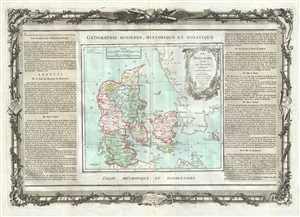
Le Danemark divise par Provinces et Dioceses sous une Metropole.
$275.00
Acquire
- Digital Map Information
- Suitable for large format printing
- DPI: 300
- File Size: 12.11 MB
- File Type: ZIP / TIFF
- ICC color profile embedded
- Delivered instantly via download link
This is a beautiful 1786 map of Denmark by French cartographer Louis Brion de la Tour. It covers all of Jutland and the Island of Zealand, Funen and Lolland. Renders the entire region in extraordinary detail offering both topographical and ... (more details)
Decorative map of the northern part of the African continent.
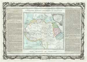
Partie De L'Afrique en deca de l'Equateur, Comprenant L'Egypte, La Barbarie, La Nigritie etc.
$300.00
Acquire
- Digital Map Information
- Suitable for large format printing
- DPI: 300
- File Size: 13.84 MB
- File Type: ZIP / TIFF
- ICC color profile embedded
- Delivered instantly via download link
This is a desirable 1786 map of northern Africa by French cartographer Louis Brion de la Tour. It covers the northern portion of Africa from the Maghreb or Barbary Coast south as far as Gabon. Like most maps of Africa from this period, the ... (more details)
Depicts the counties and provinces of England.
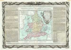
L'Angleterre divisee en 5 grandes Parties, Subdivisee en 52 Comtes.
$300.00
Acquire
- Digital Map Information
- Suitable for large format printing
- DPI: 300
- File Size: 13.56 MB
- File Type: ZIP / TIFF
- ICC color profile embedded
- Delivered instantly via download link
This is a nice 1786 map of England and Wales by the French Cartographer Louis Brion de la Tour. The map extends from Scotland south to the British Channel and depicts the 52 counties and major cities. Several important towns, cities, ... (more details)
Beautiful 18th century map of Europe.
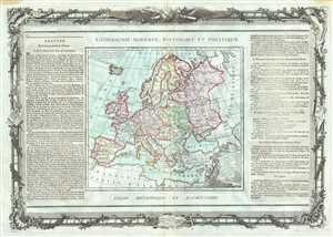
L'Europe Dressee pour l'Etude de la Geographie.
$350.00
Acquire
- Digital Map Information
- Suitable for large format printing
- DPI: 300
- File Size: 14.24 MB
- File Type: ZIP / TIFF
- ICC color profile embedded
- Delivered instantly via download link
This is an attractive 1786 Desnos and Brion map of Europe. Depicts all of Europe including Iceland and parts of North Africa and Asia. Color coded according to territories, notes important towns, cities, rivers, islands and ... (more details)
France under Louis XVI.
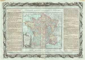
La France, Divisee en ses quarante Gouvernemens Generaux et Militaires, dans leur etendue actuelle et par Provines Ecclesiastiques.
$275.00
Acquire
- Digital Map Information
- Suitable for large format printing
- DPI: 300
- File Size: 13.76 MB
- File Type: ZIP / TIFF
- ICC color profile embedded
- Delivered instantly via download link
This is a lovely 1786 map of France by the French Cartographer Louis Brion de la Tour. It covers the entirety of France from the English Channel to Spain. The map renders the entire region in extraordinary detail offering ... (more details)
Map of France divided into its 40 provinces.
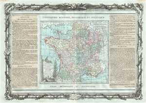
La France, Divisee en ses quarante Gouvernemens Generaux et Militaires, dans leur etendue actuelle et par Provines Ecclesiastiques.
$300.00
Acquire
- Digital Map Information
- Suitable for large format printing
- DPI: 300
- File Size: 14.26 MB
- File Type: ZIP / TIFF
- ICC color profile embedded
- Delivered instantly via download link
This is a lovely 1786 Desnos and Brion map of France divided into provinces. France was organized into provinces until March 4, 1790, when the National Constituent Assembly reorganized the Provinces into Departments. The ... (more details)
Road map of France showing provinces before Napoleon.
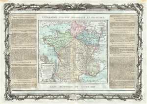
Carte Itineraire et Generale des 18 Feuilles de l'Indicateur De France.
$300.00
Acquire
- Digital Map Information
- Suitable for large format printing
- DPI: 300
- File Size: 12.99 MB
- File Type: ZIP / TIFF
- ICC color profile embedded
- Delivered instantly via download link
This is a lovely 1786 Desnos and Brion map of France showing roads and the 18 administrative divisions. Towns, rivers, and topography is beautifully noted with roads clearly marked. To the left and right of the map are ... (more details)
Late 18th century map of the Emerald Isle.
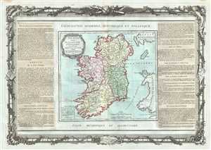
L'Irlande.
$325.00
Acquire
- Digital Map Information
- Suitable for large format printing
- DPI: 300
- File Size: 12.79 MB
- File Type: ZIP / TIFF
- ICC color profile embedded
- Delivered instantly via download link
This is an elegant 1786 map of Ireland by the French Cartographer Louis Brion de la Tour and Louis Charles Desnos. Depicts Ireland in full with color coding dividing the island into its four ancient provinces: Ulster, ... (more details)
Map depicting Italy before its unification.
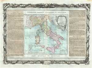
L'Italie Divisee En Tous Ses Etats et assujettie aux observations Astronomiques, Combinees avec les Itineraires tant anciens que moderne.
$350.00
Acquire
- Digital Map Information
- Suitable for large format printing
- DPI: 300
- File Size: 11.54 MB
- File Type: ZIP / TIFF
- ICC color profile embedded
- Delivered instantly via download link
This is an attractive 1786 map of Italy by Desnos and Brion de la Tour. It covers from Switzerland south to include all of Sicily. Sardinia and Corsica are also included. The map renders the entire region in ... (more details)
Beautiful map of one of the oldest and largest wine producing region of France.
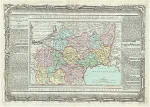
Carte des Departemens du Lot, de l'Aveiron, de la Lozere, de l'Ardeche, du Gers, de la H.te Garonne, du Tarn, de l'Herault, du Gard, des H.tes Pyrenees, de l'Arriege et de l'Aude.
$200.00
Acquire
- Digital Map Information
- Suitable for large format printing
- DPI: 300
- File Size: 15.22 MB
- File Type: ZIP / TIFF
- ICC color profile embedded
- Delivered instantly via download link
This is a decorative 1790 map of the French winemaking regions of Languedoc-Roussillon and Midi-Pyrenees by the French cartographer Louis Brion de la Tour. It covers the departments of Lot, Aveyron, Lozere, ... (more details)
18th century map of central Germany.
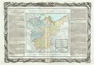
Cercles de Haute et Basse Saxe.
$250.00
Acquire
- Digital Map Information
- Suitable for large format printing
- DPI: 300
- File Size: 11.24 MB
- File Type: ZIP / TIFF
- ICC color profile embedded
- Delivered instantly via download link
This is an attractive 1786 map of Upper Saxony and Lower Saxony, what is now central Germany, by the French Cartographer Louis Brion de la Tour. The map covers from Holstein south to Bohemia and Westphalia ... (more details)
Early map of northeast Italy during the decline of the Republic of Venice.
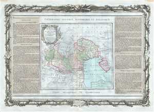
L'Etat De Venise et Le Duche De Mantoue, avec leurs Provinces Ecclesiastiques.
$350.00
Acquire
- Digital Map Information
- Suitable for large format printing
- DPI: 300
- File Size: 13.36 MB
- File Type: ZIP / TIFF
- ICC color profile embedded
- Delivered instantly via download link
This is an attractive 1786 map of northeast Italy by Desnos and Brion de la Tour. It covers from Cadorin south to Romaine and depicts the regions of Venice and Mantua. The map renders the entire region in ... (more details)
Beautiful early map of Scotland.
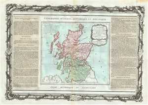
L'Ecosse.
$275.00
Acquire
- Digital Map Information
- Suitable for large format printing
- DPI: 300
- File Size: 12.82 MB
- File Type: ZIP / TIFF
- ICC color profile embedded
- Delivered instantly via download link
This is a lovely 1786 map of Scotland by the French Cartographer Louis Brion de la Tour. Covers All of Scotland including the Shetland, Orkney and Hebrides Islands. Divided by county. This extremely ... (more details)
Notes the legendary Lake Parima.
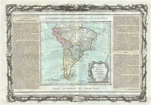
Chili, Paraguay, Breesil, Amazones et Perou.
$275.00
Acquire
- Digital Map Information
- Suitable for large format printing
- DPI: 300
- File Size: 13.05 MB
- File Type: ZIP / TIFF
- ICC color profile embedded
- Delivered instantly via download link
This is an attractive 1786 example of the Brion de la Tour map of South America. It extends from Guyana south to Tierra del Fuego and Cape Horn. The map renders the entire region in extraordinary ... (more details)
Uncommon early mapping of the southern parts of the African continent.
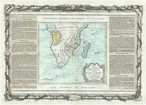
Partie De L'Afrique audela de l'Equateur, Comprenant Le Congo, La Cafrerie etc.
$300.00
Acquire
- Digital Map Information
- Suitable for large format printing
- DPI: 300
- File Size: 12.4 MB
- File Type: ZIP / TIFF
- ICC color profile embedded
- Delivered instantly via download link
This is a lovely example of the 1786 map of the Southern Africa by French cartographer Louis Brion de la Tour. The map covers the entire southern portions of the continent and extends from Good ... (more details)
Early map of southern Italy depicting the Kingdom of Naples and Sicily.
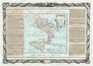
Du Roi Des Deux Siciles avec les Metropoles Ecclesiastiques.
$350.00
Acquire
- Digital Map Information
- Suitable for large format printing
- DPI: 300
- File Size: 13.91 MB
- File Type: ZIP / TIFF
- ICC color profile embedded
- Delivered instantly via download link
This is a lovely 1786 Desnos and Brion de la Tour map of southern Italy. It covers the territories claimed by the Kingdom of Naples, which extended from the Papal States south to include all of ... (more details)
Spain and Portugal during the rule of Charles III.
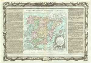
L'Espagne et le Portugal.
$250.00
Acquire
- Digital Map Information
- Suitable for large format printing
- DPI: 300
- File Size: 12.93 MB
- File Type: ZIP / TIFF
- ICC color profile embedded
- Delivered instantly via download link
This is a beautiful 1786 map of Spain and Portugal by the French Cartographer Louis Brion de la Tour. It covers the Iberian Peninsula including the islands of Majorca, Minorca and Ibiza and ... (more details)
Mid 18th century map showing Switzerland divided into cantons.
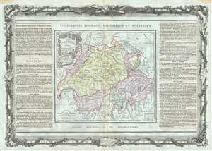
La Suisse divisee en ses Cantons, ses Allies et Sujets.
$250.00
Acquire
- Digital Map Information
- Suitable for large format printing
- DPI: 300
- File Size: 14.23 MB
- File Type: ZIP / TIFF
- ICC color profile embedded
- Delivered instantly via download link
This is a beautiful example of Desnos and Brion de la Tour’s 1786 map of Switzerland. Shows the entirety of Switzerland divided into Cantons. The map beautifully notes important towns, ... (more details)
Depicts the Northeast Passage.
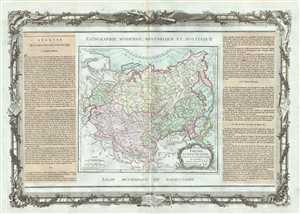
Grande Tartarie Et Isles Du Japon, Suivant les Relations les plus autentiques.
$350.00
Acquire
- Digital Map Information
- Suitable for large format printing
- DPI: 300
- File Size: 12.97 MB
- File Type: ZIP / TIFF
- ICC color profile embedded
- Delivered instantly via download link
This is a beautiful 1786 map of Tartary, Korea and Japan by French cartographer Louis Brion de la Tour. Centered on Chinese Tartary, the map details Korea, Manchuria, Chinese Tartary, ... (more details)
Covers the mountainous Alsace wine region.
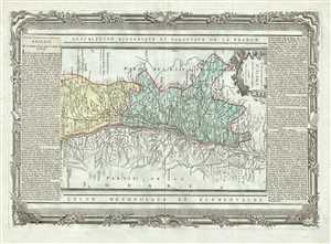
Gouvernement d'Alsace Avec les Grandes Routes.
$200.00
Acquire
- Digital Map Information
- Suitable for large format printing
- DPI: 300
- File Size: 14.86 MB
- File Type: ZIP / TIFF
- ICC color profile embedded
- Delivered instantly via download link
This is a beautiful map of the Alasace region in France by the French cartographer Louis Brion de la Tour. Oriented with north on the right, the map covers the French departments of ... (more details)
Map of France's Maroilles cheese region.
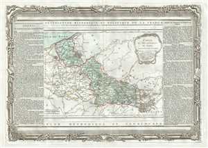
Carte du Departement du Nord.
$200.00
Acquire
- Digital Map Information
- Suitable for large format printing
- DPI: 300
- File Size: 12.72 MB
- File Type: ZIP / TIFF
- ICC color profile embedded
- Delivered instantly via download link
This is an attractive 1790 map of the department of Nord in northern France by the French cartographer Louis Brion de la Tour. It map covers the French departments of Nord in the ... (more details)
Beautiful map of the eastern hemisphere with Australia joined with New Guinea.
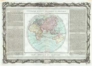
Hemisphere Oriental.
$600.00
Acquire
- Digital Map Information
- Suitable for large format printing
- DPI: 300
- File Size: 14.36 MB
- File Type: ZIP / TIFF
- ICC color profile embedded
- Delivered instantly via download link
This is an impressive map of the Eastern Hemisphere by Desnos and Brion de la Tour dating to 1786. Depicts the Eastern Hemisphere in beautiful detail covering Asia, Europe, ... (more details)
The German Empire divided into its Imperial Circles.
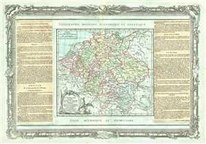
L' Alemagne Divisee en tous ees Cercles.
$250.00
Acquire
- Digital Map Information
- Suitable for large format printing
- DPI: 300
- File Size: 13.42 MB
- File Type: ZIP / TIFF
- ICC color profile embedded
- Delivered instantly via download link
This is a nice 1786 map of the Empire of Germany by the French Cartographer Louis Brion de la Tour. It covers all of modern day Germany, Holland, Belgium, Austria, Czech ... (more details)
Early map of the Mediterranean Islands.
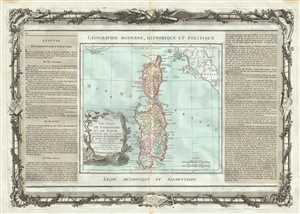
Les Isles de Sardaigne et de Corse.
$300.00
Acquire
- Digital Map Information
- Suitable for large format printing
- DPI: 300
- File Size: 12.87 MB
- File Type: ZIP / TIFF
- ICC color profile embedded
- Delivered instantly via download link
This is a lovely 1786 map of the Mediterranean islands of Corsica and Sardinia by the French Cartographer Louis Brion de la Tour. It covers the two islands in beautiful ... (more details)
The Loire wine region of France.
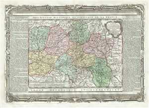
Carte des Departemens de la Mayenne, de la Sarte, d'Eure et Loire, de Maine et Loire, d'Indre et de Loire, du Loir et Cher, et du Loiret.
$200.00
Acquire
- Digital Map Information
- Suitable for large format printing
- DPI: 300
- File Size: 12.88 MB
- File Type: ZIP / TIFF
- ICC color profile embedded
- Delivered instantly via download link
This is a lovely 1790 map of Loire Valley region in France by the French Cartographer Louis Brion de la Tour. Centered on the City of Orleans, the capital of the Loiret ... (more details)
Early map of the Lorraine region of France, known for its cuisine, wines, and unique culture.
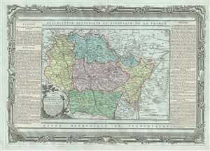
Carte des Departemens de la Meuse, de la Moselle, de la Meurte, des Voges, et du Bas Rhin.
$200.00
Acquire
- Digital Map Information
- Suitable for large format printing
- DPI: 300
- File Size: 15.02 MB
- File Type: ZIP / TIFF
- ICC color profile embedded
- Delivered instantly via download link
This is a beautiful map of the Lorraine region in France by the French cartographer Louis Brion de la Tour. It map covers the French departments of Meuse, Moselle, ... (more details)
The Loire valley region of France.
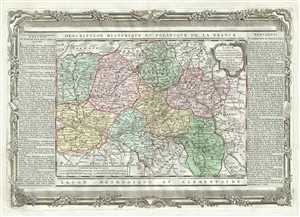
Carte des Departemens de la Mayenne, de la Sarte, de Maine et Loire, d'Indre et de Loire, du Loir et du Cher, du Loiret, de la Vienne, de l'Indre, du Cher et de la Nievre, ainsi que celui des deux Sevre et de la Vendee.
$200.00
Acquire
- Digital Map Information
- Suitable for large format printing
- DPI: 300
- File Size: 12.72 MB
- File Type: ZIP / TIFF
- ICC color profile embedded
- Delivered instantly via download link
This is a lovely 1790 map of the Pays de la Loire, Center, Poitou-Charentes, and Bourgogne regions of France by the French cartographer Louis Brion de la Tour. It ... (more details)
Decorative map of the Picardy region of northern France.
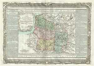
Carte des Departemens du Pas de Calais, de la Somme, de l'Oise et de l'Aisne.
$200.00
Acquire
- Digital Map Information
- Suitable for large format printing
- DPI: 300
- File Size: 11.98 MB
- File Type: ZIP / TIFF
- ICC color profile embedded
- Delivered instantly via download link
This is an attractive 1790 map of the Picardy region in northern France by the French cartographer Louis Brion de la Tour. Covers the French departments of Aisne, ... (more details)
Covers the Rhine region, known for Riesling and sparkling wines.
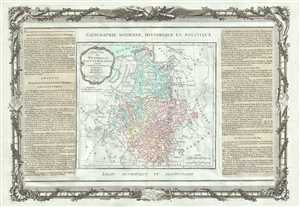
Cercles De Westphalie, Haut et Bas Rhin.
$250.00
Acquire
- Digital Map Information
- Suitable for large format printing
- DPI: 300
- File Size: 12.68 MB
- File Type: ZIP / TIFF
- ICC color profile embedded
- Delivered instantly via download link
A beautifully detailed map of the Upper and Lower Rhine and Westphalia regions of Germany by the French Cartographer Louis Brion de la Tour. The map covers from ... (more details)
Shows the Ptolomaic Spheres.
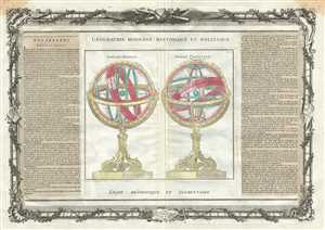
Sphere Droite. Sphere Parallele.
$275.00
Acquire
- Digital Map Information
- Suitable for large format printing
- DPI: 300
- File Size: 14.1 MB
- File Type: ZIP / TIFF
- ICC color profile embedded
- Delivered instantly via download link
This is a decorative chart by French cartographer Louis Brion de la Tour dating to 1786. It depicts two armillary spheres based on the Ptolemaic model. The first ... (more details)
Includes a diagram of a compass rose.
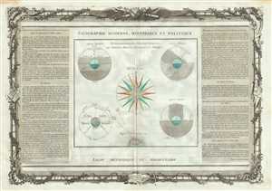
Demonstrations Geometriques, des Spheres Droite, Paralelle, et Oblique.
$250.00
Acquire
- Digital Map Information
- Suitable for large format printing
- DPI: 300
- File Size: 14.26 MB
- File Type: ZIP / TIFF
- ICC color profile embedded
- Delivered instantly via download link
This is a beautiful 1786 chart by French cartographer Louis Brion de la Tour depicting the several geometric diagrams relating to the Earth. The chart present ... (more details)
Geography of the Earth.
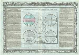
Suite de la Planche precedente.
$250.00
Acquire
- Digital Map Information
- Suitable for large format printing
- DPI: 300
- File Size: 12.98 MB
- File Type: ZIP / TIFF
- ICC color profile embedded
- Delivered instantly via download link
This is a beautiful 1786 chart by the French cartographer Louis Brion de la Tour. Includes five diagrams that depict the Longitude, Latitude, Climate, Zones, ... (more details)
Decorative map of the British Isles.
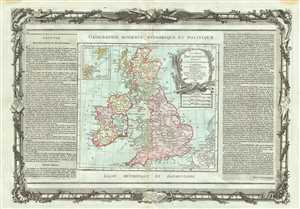
Les Isles Britanniques, Assujetties aux Observations Astronomiques.
$350.00
Acquire
- Digital Map Information
- Suitable for large format printing
- DPI: 300
- File Size: 13.73 MB
- File Type: ZIP / TIFF
- ICC color profile embedded
- Delivered instantly via download link
This is a beautiful 1786 map of the British Isles by the French Cartographer Louis Brion de la Tour. It covers all of England, Scotland, and Ireland, ... (more details)
Map of the French Riviera.
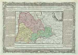
Dauphine, Divise en Trois Departemens.
$200.00
Acquire
- Digital Map Information
- Suitable for large format printing
- DPI: 300
- File Size: 14.02 MB
- File Type: ZIP / TIFF
- ICC color profile embedded
- Delivered instantly via download link
This is a beautiful 1790 map of the Dauphine region of France by the French cartographer Louis Brion de la Tour. It covers part of the Rhone-Alpes ... (more details)
Specuative mapping of Africa.
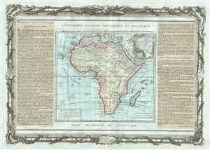
L'Afrique Dressee pour l'etude de la Geographie.
$350.00
Acquire
- Digital Map Information
- Suitable for large format printing
- DPI: 300
- File Size: 13.57 MB
- File Type: ZIP / TIFF
- ICC color profile embedded
- Delivered instantly via download link
This is an attractive example of the 1790 map of Africa by French cartographer Louis Brion de la Tour. The map covers the entire continent of ... (more details)