This item has been sold, but you can get on the Waitlist to be notified if another example becomes available, or purchase a digital scan.
1950 Ureta Martinez Map of Uruguay
RepublicaUruguay-martinez-1950$375.00

Title
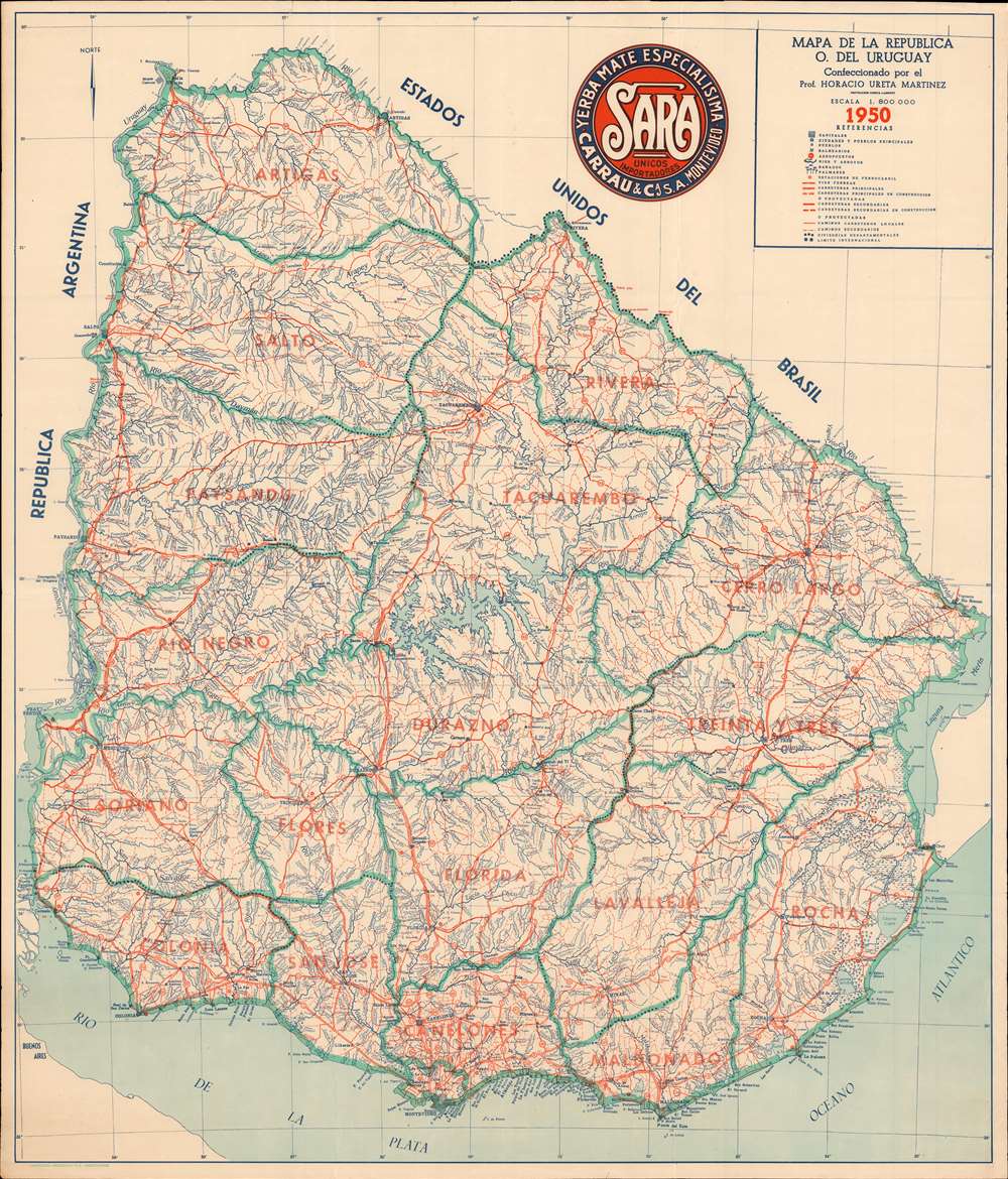
Mapa de la Republica O. del Uruguay.
1950 (dated) 31.5 x 27.25 in (80.01 x 69.215 cm) 1 : 800000
1950 (dated) 31.5 x 27.25 in (80.01 x 69.215 cm) 1 : 800000
Description
This is a 1950 Horacio Urete Martinez map of Uruguay. Teal lines outline Uruguay's departments, and orange block lettering identifies each one. Orange lines also trace Uruguay's railroads, as well as three different road grades: main roads, secondary roads, and local roads. Cities and towns are labeled, with Montevideo situated near the bottom of the map along the Rio de la Plata.
Uruguay in 1950
Uruguay experienced it most prosperous era during the late 1940s and early 1950s, having benefitted from supplying beef, wool, and leather to the Allied armies during World War II and the Korean War. At that time, Uruguay boasted the highest per capita income in Latin America. Uruguay's economic prosperity came to an end in the mid-1950s after the Korean War. This development caused demand for Uruguay's exports to plummet, which led to increased social unrest in the country.Publication History and Census
This map was created and published by Horacio Urete Martinez in 1950 and printed by the Impresora Uruguaya in Montevideo. Two examples are cataloged in OCLC and are part of the institutional collections at the University of Illinois at Urbana Champaign and the University of California Berkeley.Cartographer
Professor Horacio Ureta Martínez (18xx - 19xx) was a private cartographer in Uruguay. Called the 'best private cartographer in Uruguay' by the U.S. Central Intelligence Agency, Ureta Martínez worked on the staff of the Sección de Estadística Agronómica of the Ministerio de Agricultura. His work included compiling maps of departments of Uruguay. He also produced map for propaganda and school use. While working alone, Ureta Martínez produced wall maps, illustrations for geography textbooks, and an atlas. He also produced maps of Uruguay's departments on varying scales, general maps of Uruguay, and a pictorial relief map with political, economic, and climatic insets. In 1950, he joined the cartographic staff of the United Nations Secretariat. More by this mapmaker...
Condition
Very good. Exhibits light wear along original fold lines. Closed tear extending one half inch into printed area from top margin professionally repaired on verso. Blank on verso.
References
OCLC 12067459.