1930 Canadian Government Road Map of Canada and the United States
RoadsCanadaUSA-nris-1930$125.00

Title
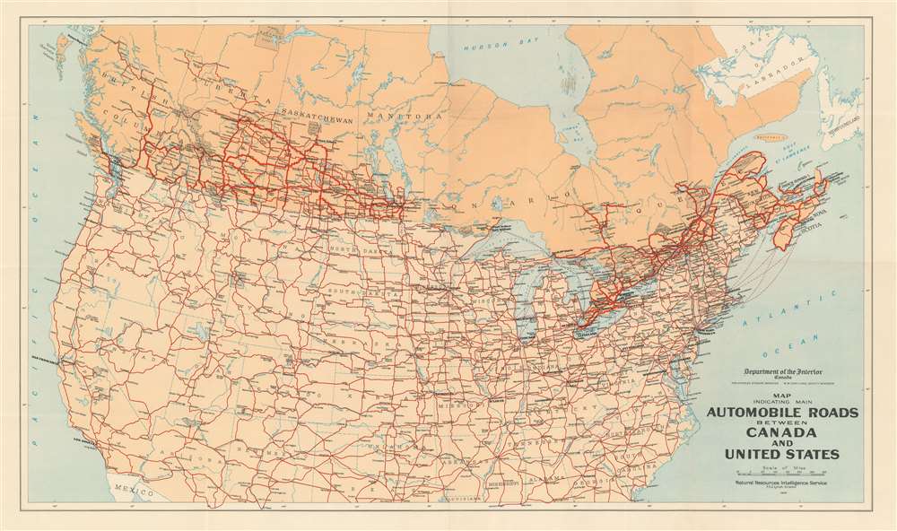
Map Indicating Main Automobile Roads Between Canada and United States.
1930 (dated) 21.5 x 36.5 in (54.61 x 92.71 cm) 1 : 6336000
1930 (dated) 21.5 x 36.5 in (54.61 x 92.71 cm) 1 : 6336000
Description
Published in 1930, this Natural Resources Intelligence Service road map of Canada and the United States highlights the connections between the two countries. Thick red lines trace major and minor highways in both Canada and the United States. Cities and towns are labeled throughout. Gray dotted areas denote national parks in both countries as well, including Yellowstone, the Grand Canyon, Yosemite, Jasper, and Algonquin.
Publication History and Census
This map was created and published by the Natural Resources Intelligence Service in 1930. A year later, in 1931, the Natural Resources Intelligence Service became the National Development Bureau and took charge of promoting tourism in Canada. This change can be seen in the bureau's maps, as they all changed dramatically in character, if not in content. This map is well represented in institutional collections but uncommon on the private market.Condition
Very good. Exhibits light wear along original fold lines. Blank on verso.
References
OCLC 905696207.