This item has been sold, but you can get on the Waitlist to be notified if another example becomes available, or purchase a digital scan.
1910 Reits Bird's-Eye View of Rochester and East Rochester, New York
RochesterDespatch-reits-1910$125.00

Title
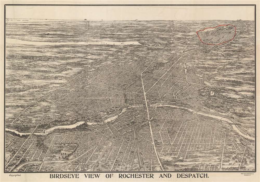
Birdseye View of Rochester and Despatch.
1910 (undated) 23.25 x 33 in (59.055 x 83.82 cm)
1910 (undated) 23.25 x 33 in (59.055 x 83.82 cm)
Description
This is a c. 1910 Reits bird's-eye view of Rochester and East Rochester, New York. Depicting the city from the west, the Genesee River passes through the city in the foreground. Major streets are labeled, and individual buildings are rendered, although only a handful are identified, including the university. Despatch, now known as East Rochester, is circled in red, making it stand out against the rest of the view. The town began as a planned community based around the New York Central Railroad's mainline, which ran through the center of town and is depicted here from the foreground all the way to the horizon. Irondequoit Bay is illustrated, as is Lake Ontario in the background.
Dating This View
The town's name was changed to East Rochester in 1906, which brings the date of this view into question. As this view is undated, we cannot say with certainty when it was published. The Library of Congress has dated this view as c. 1910, and, as we do not have very much additional information to provide, we will follow their date.Publication History and Census
This map was drawn by Reits and published by the Union and Advertiser Company in Rochester, New York c. 1910. The only other known example is part of the collection of the Library of Congress.Condition
Very good. Even overall toning. Light wear along original fold lines. Verso repairs at fold intersections. Light soiling. Blank on verso.
References
LOC G3804.R6A3 1910 .R4. OCLC 436105369.