This item has been sold, but you can get on the Waitlist to be notified if another example becomes available, or purchase a digital scan.
1936 Fowler and Dodge Pictorial Map of Maine
RomanceMaine-fowlerdodge-1936$125.00

Title
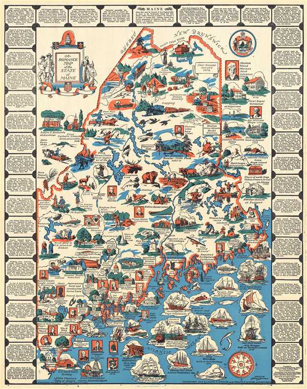
A Romance Map of the State of Maine.
1936 (dated) 23 x 18 in (58.42 x 45.72 cm) 1 : 916000
1936 (dated) 23 x 18 in (58.42 x 45.72 cm) 1 : 916000
Description
This is a 1936 Alice E. Fowler and Grace F. Dodge pictorial map of Maine. The map depicts the state of Maine from New Hampshire to the Atlantic Ocean and from the Piscataqua River to Quebec and New Brunswick, Canada. Highly graphic, A Romance Map of the State of Maine provides a detailed look at the state's history. Each of the vignettes depicts either an historically relevant event, location, or personality. The map is framed by small blocks of text which include information about Maine's statehood, such as its State Motto, State Tree, or explaining the State Seal, or further explaining historical events. The title cartouche is also highly pictorial, surrounded by a Jesuit converting an Indian, the English and French landholders, and a Clipper ship. The State Seal is depicted in the upper right quadrant.
The Romance Map series was very popular in the 1930s, and was begun by Josephine Wilhelm Wickser, with her map A Romance Map of the Niagara Frontier. This map proved to be immensely popular, which started the trend. Wickser went on to consult on several other Romance Maps including this example.
This map was compiled by Alice E. Fowler and Grace F. Dodge and drawn by Mildred Green. It was engraved by August Engraving Company and printed and distributed by The Augusta Press.
Condition
Very good. Blank on verso.
References
OCLC 41755532.