This item has been sold, but you can get on the Waitlist to be notified if another example becomes available, or purchase a digital scan.
1808 Faden and Nantiat Map of Russia in Europe
Russia-faden-1808$375.00

Title
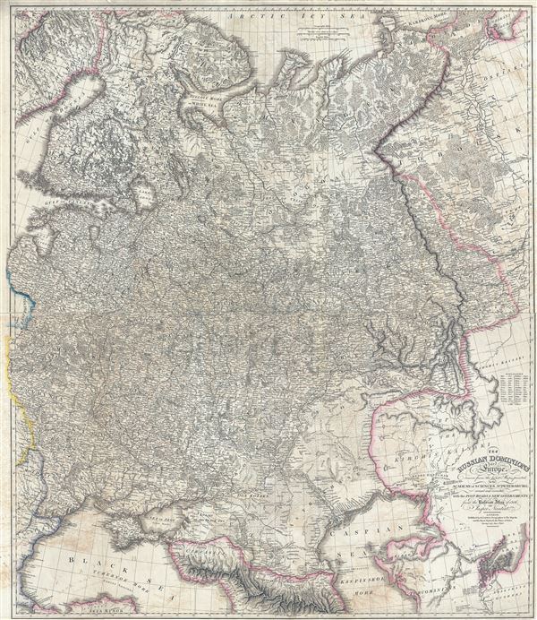
The Russian Dominions in Europe, drawn from the latest Maps, printed by the Academy of Sciences, St. Petersburg; revised and corrected, with the Post Roads & New Governments, from the Russian Atlas of 1806.
1808 (dated) 42.5 x 37 in (107.95 x 93.98 cm) 1 : 3168000
1808 (dated) 42.5 x 37 in (107.95 x 93.98 cm) 1 : 3168000
Description
A remarkable large format map first edition 1808 map of Russia by Jaspar Nantiat and William Faden. This exceptional map covers from the Artic Sea to the Black and Caspian Seas and from East Prussia and Moldova to the Aral Sea and Tobolsk. In addition to Russia, this map also includes, in part or whole, the modern day nations of Belarus, Ukraine, Latvia, Lithuania, Estonia, Poland, Moldova, Georgia, and western Kazakhstan. It includes the European parts of Russia and is presented in extraordinary detail throughout detailing every city and town as well as topography, which is rendered in hachure, and other geographical features.
Russia at this time was ruled by Tzar Alexander I. Napoleon's Empire was at its heights and his disastrous 1812 invasion of Russia was already planned. Russia meanwhile was embroiled in the Finnish War with the Kingdom of Sweden.
Cartographically this map has been based upon maps printed by the Russian Academy of Sciences located in St. Petersburg. Much of the cartographic information included is derived directly from the 'Russian Atlas' published in 1806. The present example has been updated and translated into English by British publisher William Faden for issue in 1808. After Faden's death in 1836, this map's plates were acquired by James Wyld, who issued this map in several later editions.
Cartographer
William Faden (July 11, 1749 - March 21, 1836) was a Scottish cartographer and map publisher of the late 18th century. Faden was born in London. His father, William MacFaden, was a well-known London printer and publisher of The Literary Magazine. During the Jacobite Rebellion (1745 - 1746), MacFaden changed his family name to Faden, to avoid anti-Scottish sentiment. Faden apprenticed under the engraver James Wigley (1700 - 1782), attaining his freedom in 1771 - in the same year that Thomas Jefferys Sr. died. While Thomas Jefferys Sr. was an important and masterful mapmaker, he was a terrible businessman, and his son, Jefferys Jr., had little interest in building on his father's legacy. MacFaden, perhaps recognizing an opportunity, purchased his son a partnership in the Jefferys firm, which subsequently traded as 'Faden and Jefferys'. Jefferys Jr. also inherited Jefferys Sr.'s title, 'Geographer to the King and to the Prince of Wales'. With little interest in cartography or map publishing, Jefferys Jr. increasingly took a back seat to Faden, and by 1776, he had withdrawn from day-to-day management, although he retained his financial stake. The American Revolutionary War (1775 - 1783) proved to be a boom for the young 'Geographer to the King', who leveraged existing materials and unpublished manuscript maps to which he had access via his official appointment to publish a wealth of important maps, both for official use and the curious public - this period of prosperity laid the financial underpinning for Faden, who by 1783, at the end of the war, acquired full ownership of the firm and removed the Jefferys imprint. In 1801, he engraved and published the first maps for the British Ordnance Survey. By 1822, Faden published over 350 maps, atlases, and military plans. He retired in 1823, selling his plates to James Wyld Sr. Faden died in 1836. More by this mapmaker...
Condition
Good. Backed with archival tissue. Two panels, joined. Some offsetting.